- Neyyattinkara
-
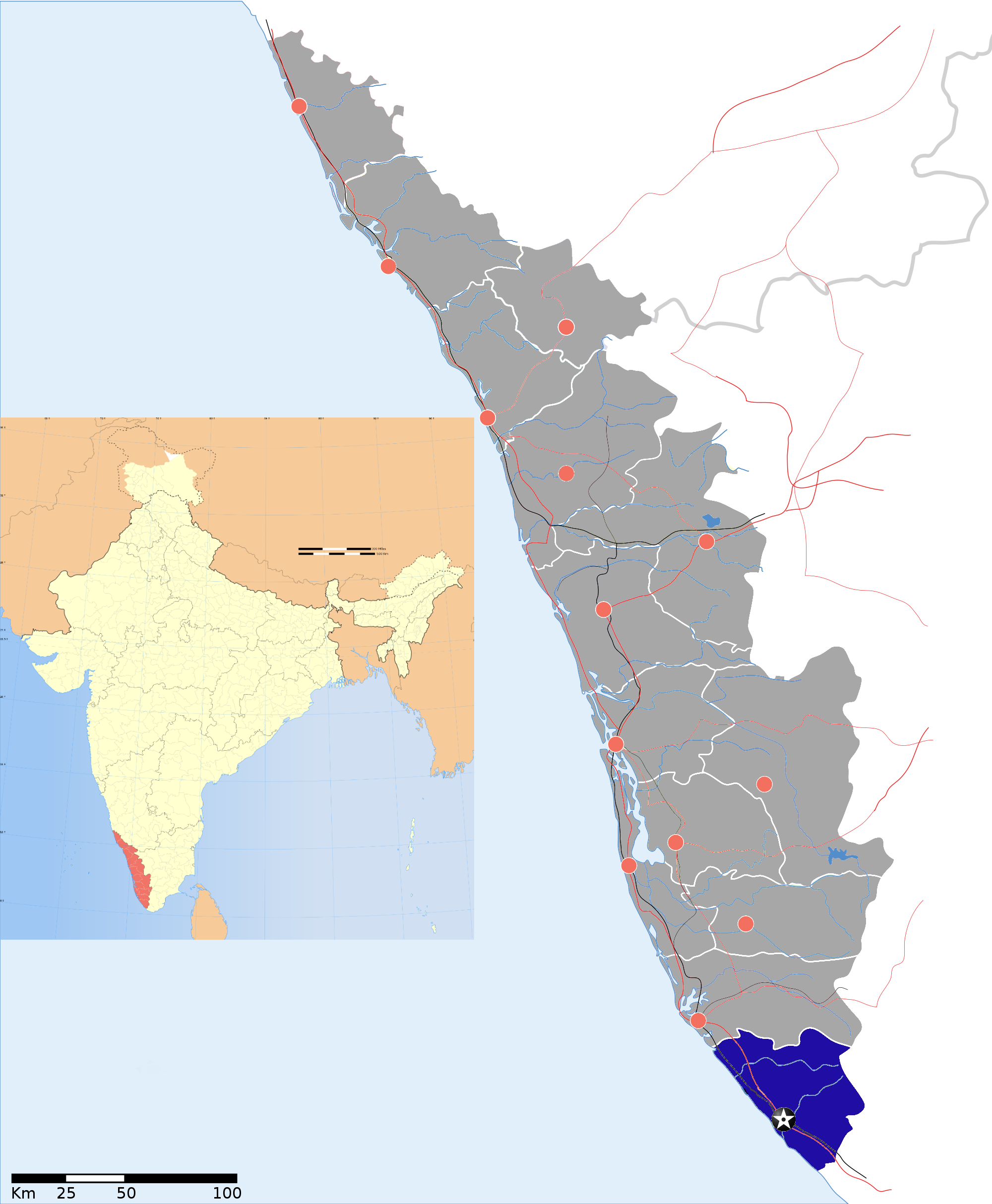
Neyyattinkara (നെയ്യാറ്റിന്കര) — town — Coordinates 8°24′N 77°05′E / 8.4°N 77.08°ECoordinates: 8°24′N 77°05′E / 8.4°N 77.08°E Country India State Kerala District(s) Thiruvananthapuram Population 69,467 (municipality)
858,991 (taluk) (2001[update])Time zone IST (UTC+05:30) Area
• 26 metres (85 ft)
Neyyattinkara is municipality in Thiruvananthapuram district in the Indian state of Kerala. The name Neyyattinkara in Malayalam literally means the shore (kara) of Neyyar River. Neyyar River flows from Agasthyarkoodam , the highest peak (1868m above MSL) in southern end of the Western Ghats. The taluk has a total population of 858,991 with 88.6% classified as rural. Most of the urban population lies within the municipality area which is densely occupied.
The municipality of Neyyattinkara is the major town on the banks of Neyyar River. Neyyattinkara lies 18 km to the south of Thiruvananthapuram city on the National Highway 47 to Kanyakumari. The rapidly growing Thiruvananthapuram city has almost reached its outskirts. Aruvippuram, the holy land of Sree Narayana Guru is an important pilgrim centre near Neyyattinkara. Neyyar Dam is another popular picnic spot near Neyyattinkara at Kallikkadu panchayath of Neyyattinkara Taluk. Neyyattinkara is the birth place of renowned revolutionaries like Swadeshabhimani Ramakrishna Pillai , VeeraRaghavan who fought for Indian independence and against the dictatorial rule of Travancore Diwans. The renowned martyr Veera Veluthampi Dalawa who fought against the British rule in India was born and brought up at Thalakkulam near Neyyattinkara. Neyyattinkara is the land of many uprisings against British rule in India. The brutal crackdown by British military resulted in death of many freedom fighters including Veeraraghavan.
According to the legend it was here the Travancore king Marthanda Varma once hid inside the hollow trunk of a jack fruit tree to escape from his enemies during his war against the 'ettuveetil pillamar' (the eight nair chieftains). According to a legend, the King prayed to Lord Krishna for helping him as he was being surrounded by the enemies. At that time, a mysterious child asked the King to get in a large tree. The jack tree popularly called 'Ammachiplavu' could still be seen preserved in the Shri Krishna Swamy Temple in the heart of the town. This temple was built by Marthanda Varma in the year 1755.
Neyyattinkara and the neighbouring areas has many cottage industries and handloom. The Balaramapuram Handloom Industry is known worldwide for its fine hosiery.
The main large scale manufacturing industry is the Kerala Automobiles Ltd. at Aralummoodu. It is a much sought after brand in the developing ASEAN nations for good quality three-wheelers.[1]
Agasthyarkoodam, the highest peak in southern kerala is located in Neyyattinkara taluk. It is a pilgrim spot and popular trekking place. The mountain got its name from sage Agasthyar who is considered one of the seven Rishis (Saptarishi) of Hindu mythology. A statue of Agasthyar stands on top of the peak where the devotees can render their prayers. The mountain forms a part of the Agasthyarkoodam biosphere reserve which is home to many endemic flora and fauna.
Contents
Geography
Neyyattinkara is located at 8°24′N 77°05′E / 8.4°N 77.08°E.[2] It has an average elevation of 26 metres (85 feet).
The town is situated on the Neyyar River, one of the principal rivers in the district.
List of villages
In addition to the municipality of Neyyattinkara, the taluk contains 28 additional villages.
- Amaravila
- Amboori — part of Perumkadavila block panchayat
- Anavoor
- Athiyannur
- Chenkal
- Kallikkad — part of Perumkadavila block panchayat
- Kanjiramkulam [Panchayath]
- Karode
- Karumkulam [Panchayat]
- Keezharoor
- Kollayil — part of Perumkadavila block panchayat
- Kottukal
- Kulathur
- Kulathummel
- Kunnathukal — part of Perumkadavila block panchayat
- Malayinkeezh
- Manaluvila
- Maranallur
- Mandapathinkadavu
- Ottasekhara Mangalam — part of Perumkadavila block panchayat
- paliyode kunnathukal panchayat 10 km from Neyatinkara
- Pallichal
- Parassala
- Parasuvakal
- Perumkadavila — part of Perumkadavila block panchayat
- Perumpazhuthoor — part of Neyyattinkara Municipality
- Thirupuram
- Vazhichal
- Vellarada — part of Perumkadavila block panchayat
- Vilappil
- Vilavoorkal
- Vizhinjam
- Punnakkad - 4 km far from Balaramapuram
- Balaramapuram
- Pulluvila
History
Cave pictures, probably by Neolithic people, are found in Pandavanpara, located in the North east side of Neyyattinkara to Kattakkada route. The name of this portion of land, before Marthanda Varma became the ruler of Travancore, was 'Thenganad'. The megaliths recently unearthed at Vizhinjam shows a splendorous display of craftsmanship that was prevalent in the region from the Middle Eras.
Demographics
As of 2001[update] India census,[3] Neyyattinkara had a population of 69,435. Males constitute 49% of the population and females 51%. Neyyattinkara has an average literacy rate of 82%, higher than the national average of 59.5%: male literacy is 84%, and female literacy is 80%. In Neyyattinkara, 10% of the population is under 6 years of age.
List of Hospitals
The town has seen an upsurge of many quality medical institutions providing medical care at affordable rates. But the Govt. Hospital still remains the major help-hand for the majority of the working class.
- Neyyattinkara Taluk Hospital-Near railway station
- NIMS Medicity-Aralummoodu
- Rollands Hospital -Pathamkallu
- CSI Medical College - Karakkonam
- Taluk Homoeo Hospital - Cape Road
Educational institutions
- Government Higher Secondary School - Near Govt. Hospital Jn
- Government Girls' Higher Secondary School, Govt. Hospital Road
- Sree Vidyadhiraja Vidya Nilayam Higher Secondary School, Convent Road
- St.Theresa's Convent Girls' Higher Secondary School, Convent Road
- LMS HSS Amaravila - Near AmaravilaChurch
- M.V Higher Secondary School, Arumanoor
- Dr.G.R Public School, Ooruttukaala
- Government High School Perumpazhuthoor - 3 km from Town
- Government Higher Secondary School - Marayamuttom in Perumkadavila Panchayat
- Government Poly Technic, Perumpazhuthoor - 3 km from Town
- Mary Matha College of Engineering & Technology, Paliyode
- Leo XIII Higher Secondary School, Pulluvila
- New Higher Secondary School - Nellimoodu
- Vishwabharathy Public School
- Rachana basha padana kendrum-alummoodu
Politics
Neyyattinkara assembly constituency is part of Trivandrum (Lok Sabha constituency).[4]
See also
- Upper cloth revolt
References
- ^ Kerala Automobiles Ltd
- ^ Falling Rain Genomics, Inc - Neyyattinkara
- ^ "Census of India 2001: Data from the 2001 Census, including cities, villages and towns (Provisional)". Census Commission of India. Archived from the original on 2004-06-16. http://web.archive.org/web/20040616075334/http://www.censusindia.net/results/town.php?stad=A&state5=999. Retrieved 2008-11-01.
- ^ "Assembly Constituencies - Corresponding Districts and Parliamentary Constituencies". Kerala. Election Commission of India. http://archive.eci.gov.in/se2001/background/S11/KL_Dist_PC_AC.pdf. Retrieved 2008-10-21.
Thiruvananthapuram district District HQ: Thiruvananthapuram History 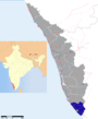
Geography Karamana River · Vamanapuram River · Neyyar River · Varkala Beach · Agastya Mala · Ponmudi · Meenmutty FallsCities and Taluks TaluksCorporationsMunicipalitiesTransport Thiruvananthapuram International Airport · Trivandrum Central · Varkala Sivagiri station · NH 47 · Main Central RoadEducation Buildings Culture Lok Sabha constituencies Thiruvananthapuram · AttingalMunicipalities of Kerala Neyyattinkara · Nedumangad · Attingal · Varkala · Paravoor South · Punalur · Pathanamthitta · Adoor · Thiruvalla · Alappuzha · Kayamkulam · Mavelikkara · Chenganoor · Cherthala · Kottayam · Changanassery · Vaikom · Palai · Thodupuzha · Muvattupuzha · Kothamangalam · Perumbavoor · Angamaly · Aluva · Kalamassery · Thrikkakara · Thrippunithura · Maradu · Eloor · North Paravur · Kodungallur · Chalakkudy · Irinjalakuda · Chavakkad · Guruvayur · Kunnamkulam · Palakkad · Chittur-Thathamangalam · Ottappalam · Shoranur · Malappuram · Ponnani · Tirur · Kottakkal · Perinthalmanna · Nilambur · Manjeri · Koyilandy · Vadakara · Kalpetta · Kannur · Thalassery · Kuthuparamba · Mattannur · Payyannur · Taliparamba · Kasaragod · Nileshwaram · Kanhangad
Categories:- Cities and towns in Thiruvananthapuram district
- Trivandrum railway division


Wikimedia Foundation. 2010.