- Mannarkkad
-
Mannarkkad — town — Coordinates 10°59′N 76°28′E / 10.98°N 76.47°ECoordinates: 10°59′N 76°28′E / 10.98°N 76.47°E Country India State Kerala District(s) Palakkad District Time zone IST (UTC+05:30) Area
• 76 metres (249 ft)
Codes-
• Telephone • ++ 91 (0) 4924 • Vehicle • KL-50
Footnotes- Temperature Range: 22.5°C -35 °C
Mannarkkad (Malayalam: മണ്ണാ൪ക്കാട്), formerly known as Mannarghat is a town in Palakkad district of Kerala State, South India. It is the headquarters of Mannarkkad Taluk, and is one of the largest revenue Taluks in Kerala. It is situated 40 km north-east of the district headquarters Palakkad, on the way to Kozhikkode (NH 213) and in the foothills of the Western Ghats. Silent Valley (a tropical evergreen rain forest with an unbroken evolutionary history of 50 million years) is only 35 km from Mannarkkad.Mannarkkad Taluk, consisting 25 villages, is the first fully computerized Revenue Taluk office, designed as India's first Paperless Government office. All land revenue administrative works are being carried out through on line software called Taluk Suite and Village Suite. Sri A Unnikrishnan is the present Tahsildar of Mannarkkad Taluk.
Mannarkkad has memories of the invasion of Tippu Sultan and Mopila riot. In 1921, hundreds of people lost their lives. The former Ruler/Desavazhi of Mannarkkad is known as 'Mannarkkadu Muppil Nair'. He was a 'Samantha' under 'Valluvakonathiri' of Valluvanadu. The famous novel 'PONNI' written by Malayatoor Ramakrishnan, is based on the 'Adivasis' of Mannarkkadu. The Sandalwood smuggler 'Veerappan' used 'Shiruvani Forests' of Mannarkkadu Muppil Nairs as his shelter.
The population of Mannarkkad is estimated at 150,000+. Mannarkkad has an agri-based economy; main agriculture produce consists of natural rubber, coconut, areca nut, banana, plantain, nutmeg, pepper and rice. But due to inordinate use of chemicals, the natural ecosystem has been adversely affected. But over a decade of control, the town has revived many almost extinct natural species of reptile, butter flies, fresh water fish and other organisms.
70%-80% of the agri-income is earned by 20%-25% of the population. Of the rest, 10% are into trading and the remaining 65% of the total population are below slightly above or below the poverty line.
The town has for ages attracted immigrants from all over and is an amazing community of people who speak multiple languages including Kannada, Telugu, Tulu, Tamil etc. For this reason, you will find shades of a metropolitan city in terms of harmony among multiple cultures in this rather small town. Within Kerala, it had been also one of the first destination (starting from 1914 A.D) for immigrants from southern Kerala seeking their fortune in rubber plantation sector.
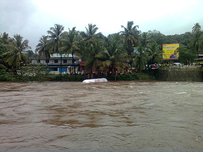
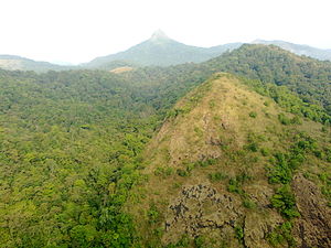
Nestled between two rivers Kunthippuzha and Nellippuzha, Mannarkkad (Mannarghat) valley is famous for its natural beauty. Silent Valley Rain forests and the Attappadi high range add grandeur to the scenery. It is a common destination for trekkers. The hills with a large population of oldest Indian tribes like Mudugar and Irular, recently was in the news relating to unauthorised encroachment and unlawful possession of tribal lands.
Mannarkkad is famous for Mannarkkad Pooram. It is the festival celebrated Kumbha masam of every year. The Adivasis from Attappadi will reach the Udayar Kunnu Temple where the pooram happens to see Devi. Present Mannarkkad M.L.A is Mr N Shamsudhin. The present Tahsildar in charge is Mr A Unnikrishnan.
Contents
Geography
Mannarkkad is located at 10°59′N 76°28′E / 10.98°N 76.47°E[1]. It has an average elevation of 76 m (249 ft).
Notable nearby locations
- Kanjirappuzha Dam & Gardens: 15 km
- Silent Valley National Park: 43 km
- Malampuzha Dam & Gardens: 40 km
- Tippu Sultan's Fort (Palakkad): 43 km
- Meenvallam and Attila Waterfalls: 15 km
- Paathrakkadavu (Mylamapadam): 10 km
- Ahmed kurikkal children's Park,court road, Mannarkkad (0 km)
- Sholayur 40 km
- Siruvani Dam 25 km
- Attappadi Hills and Tribal villages (10 km)
- Vakodan forests To journey and city view of Mannarkkad (4 km)
- vegetable Market, kuthumadom, 500 years old temple,and town views (0 km)
- Mandan Potty water Falls (7 km)
- Changaleeri 5 km
- Mailadikunnu. This is a beautiful place in Mannarkkad (Nattukal,Annanthodi),(15 km from Mannarkkad)
- Nottamala This is a wonderful place in Mannarkkad(town views ) 1km
Transport
Mannarkkad is well connected by road to all other parts of Kerala. NH 213 connecting Kozhikkode and Palakkad passes through the town. The nearest railway stations to the town are Palakkad Jn (32 km), Ottapalam (40 km), Shoranur Jn (44 km), 25 km in Perinthalmanna and 40 km in Manjeri and Nilambur. The nearest airports to the town are Calicut International Airport (60 km), and Coimbatore Airport (62 km). mettupalayam city 55 km, and Ooty 80 KM. Changaleeri is the smallest village & Karakurussi is the biggest village in Mannarkkad Thaluk.
Politics
Mannarkkad assembly constituency is part of Palghat (Lok Sabha constituency).[2]
References
- ^ Falling Rain Genomics, Inc - Mannarkkad
- ^ "Assembly Constituencies - Corresponding Districts and Parliamentary Constituencies". Kerala. Election Commission of India. http://archive.eci.gov.in/se2001/background/S11/KL_Dist_PC_AC.pdf. Retrieved 2008-10-19.
Taluks of Palakkad District , Kerala Alathur • Chittur • Mannarkkad • Ottapalam • Palakkad Cities and towns in Palakkad district Palakkad Alathur · Cherpulassery · Chittur-Thathamangalam · Mannarkkad · Nemmara · Ottapalam · Palakkad · Pattambi · Puthunagaram · Shoranur · Vadakkencherry
Cities and towns
in other districtsAlappuzha · Ernakulam · Idukki · Kannur · Kasaragod · Kollam · Kottayam · Kozhikode · Malappuram · Pathanamthitta · Thiruvananthapuram · Thrissur · Wayanad
Categories:- Cities and towns in Palakkad district
-
Wikimedia Foundation. 2010.


