- Mount Adams (New Hampshire)
-
Mount Adams 
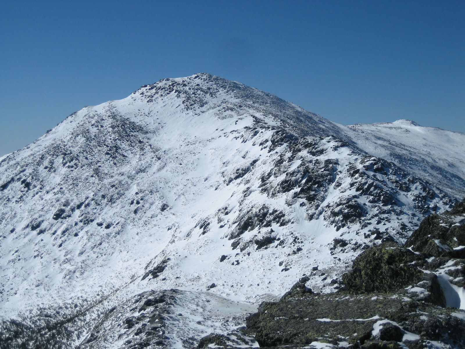
Mount Adams viewed from the summit of Mount MadisonElevation 5,774 ft (1,760 m) Prominence 804 ft (245 m) Listing White Mountain 4000-Footers Location Location Coos County, New Hampshire, USA Range Presidential Range Coordinates 44°19′14″N 71°17′29″W / 44.32056°N 71.29139°WCoordinates: 44°19′14″N 71°17′29″W / 44.32056°N 71.29139°W Topo map USGS Mount Washington Climbing Easiest route Hike Mount Sam Adams Elevation 5,489 ft (1,673 m) < Prominence 80 ft (24 m) Mount Quincy Adams Elevation 5,394 ft (1,644 m) Prominence 60 ft (18 m) Mount Abigail Adams Elevation 5,348 ft (1,630 m) Prominence 40 ft (12 m) Adams 5 Elevation 5,266 ft (1,605 m) Prominence 40 ft (12 m) Mount Adams, elevation 5,774 feet (1,760 m) above sea level, is a mountain in New Hampshire, the second highest peak in the Northeast United States after its nearby neighbor, Mt. Washington. Located in the northern Presidential Range, Mount Adams was named after John Adams, the second president of the United States. It was given this name on July 31, 1820. To the northeast is Mount Madison and to the southwest is Mount Jefferson. From the summit, Mount Washington can be seen directly to the south.
There are two major subsidiary peaks of Mt. Adams: Mount Sam Adams and Mount Quincy Adams, named after John Adams' cousin, Revolutionary leader Samuel Adams, and son, President John Quincy Adams, respectively, and two minor sub-peaks, Abigail Adams (named for John Adams' wife Abigail) and Adams 5. The northern side of the mountain ridge is located in Low and Burbank's Grant, and the end of Durand Ridge, and King Ravine, on the north side of Mount Adams are in the town of Randolph (formerly Durand). The entire south side of the mountain ridge is in Thompson and Meserve's Purchase.
The Appalachian Trail traverses the col between Mount Adams and Mount Sam Adams, on a path called "Gulfside Trail." The Randolph Mountain Club (RMC) maintains the trails and several huts and shelters high on Mount Adams' north side, including "The Perch," "Crag Camp," "The Log Cabin," and "Gray Knob." A large network of hiking and climbing paths lead south to the huts and ridges from several parking areas located on U.S. Highway 2.
See also
- Thomas Starr King
- Four-thousand footers of New Hampshire
- Randolph Mountain Club
References
- The 4000-Footers of the White Mountains: A Guide and History (2001) by Steven D. Smith and Mike Dickerman (ISBN 1-931271-01-1)
- Taylor, Bethany (Fall/Summer 2011). "Abigail Adams Joins the Presidential Range". Appalachia (Appalachian Mountain Club) (Volume 62, No. 2).
External links
- U.S. Geological Survey Geographic Names Information System: Mount Adams
- Mount Washington web page
- Paintings of Mount Adams
- PeakBagger.com: Mount Adams
- summitpost.org: Mount Adams
- AMC: Mount Adams
- hikethewhites.com: Mt Adams
4000-foot mountains of New England Baxter State Park High Peaks Abraham · Crocker · Redington · Saddleback · Saddleback, The Horn · South Crocker · Spaulding · SugarloafBigelow Range Eastern White Mountains Northern ranges Carter-Moriah Range Presidential Range Crawford Notch area Twin Range Pemigewasset Wilderness Sandwich Range Osceola · Osceola (East) · Tripyramid (Middle) · Tripyramid (North) · Passaconaway · Tecumseh · WhitefaceFranconia Range Western White Mountains Green Mountains Categories:- Mountains of New Hampshire
- Landforms of Coos County, New Hampshire
Wikimedia Foundation. 2010.