- Crocker Mountain (Maine)
-
Crocker Mountain
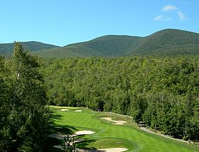
Crocker Mountain (centre) seen from Sugarloaf ski resortElevation 1,289 m (4,229 ft) Prominence 370 m (1,214 ft) Listing New England 4000 footers Location Location Franklin County, Maine, USA Coordinates 45°2.83′N 70°22.97′W / 45.04717°N 70.38283°WCoordinates: 45°2.83′N 70°22.97′W / 45.04717°N 70.38283°W Topo map USGS Black Nubble Crocker Mountain is a 4,228-foot (1,289 m) peak located in Carrabassett Valley, Franklin County, Maine, in the United States. Crocker Mountain is part of the Appalachian Mountains. Crocker Mountain is traversed by the Appalachian Trail (AT), a 2,170-mile (3,500-km) National Scenic Trail from Georgia to Maine. A glacial cirque called "Crocker Cirque" is located between the main summit and the lower summit of South Crocker Mountain. Crocker Cirque contains a small pond and can be reached via the Appalachian Trail.
Brooks on the east side of Crocker Mountain feed the South Branch of the Carrabassett River, which flows into the Kennebec River, and into the Gulf of Maine. The northwest side of Crocker drains into Stoney Brook, thence into Stratton Brook, Flagstaff Lake, and the Dead River, another tributary of the Kennebec. The southwest side of Crocker drains into Nash Stream, thence into the South Branch of the Dead River.
Gallery
See also
External links
- "Crocker Mountain". Geographic Names Information System, U.S. Geological Survey. http://geonames.usgs.gov/pls/gnispublic/f?p=gnispq:3:::NO::P3_FID:564525.
- "Crocker Mountain, Maine". Peakbagger.com. http://www.peakbagger.com/peak.aspx?pid=6837.
- "The Crockers". SummitPost.org. http://www.summitpost.org/page/154994.
4000-foot mountains of New England Baxter State Park High Peaks Abraham · Crocker · Redington · Saddleback · Saddleback, The Horn · South Crocker · Spaulding · SugarloafBigelow Range Eastern White Mountains Northern ranges Carter-Moriah Range Presidential Range Crawford Notch area Twin Range Pemigewasset Wilderness Sandwich Range Osceola · Osceola (East) · Tripyramid (Middle) · Tripyramid (North) · Passaconaway · Tecumseh · WhitefaceFranconia Range Western White Mountains Green Mountains Categories:- Mountains of Franklin County, Maine
- Mountains on the Appalachian Trail
- New England Four-thousand footers
- Maine geography stubs
Wikimedia Foundation. 2010.


