- Mount Moosilauke
-
Mount Moosilauke 
Mt. Moosilauke as seen from Black MountainElevation 1,464 m (4,803 ft) Prominence 894 m (2,933 ft) Listing White Mountain 4000-Footers
#9 New England 50 FinestLocation Location Grafton County, New Hampshire, USA Coordinates 44°01′24.57″N 071°49′52.71″W / 44.0234917°N 71.8313083°WCoordinates: 44°01′24.57″N 071°49′52.71″W / 44.0234917°N 71.8313083°W Topo map USGS Mount Moosilauke Mount Moosilauke is a mountain, 4,802 feet (1,464 m) high, in the southwest White Mountains Region of New Hampshire, United States. It is located within the town of Benton. The Appalachian National Scenic Trail passes over the mountain. Moosilauke is the tenth highest, as well as the most southwestern, of the 4,000 foot summits in the White Mountains.[1] It is one of New England Fifty Finest peaks, a list of summits with the highest topographic prominence.
The Moosilauke Ravine Lodge, which offers food and accommodations to hikers, is situated in the valley on the southeast side of the mountain. The Lodge is owned by Dartmouth College and is run by members of the Dartmouth Outing Club.
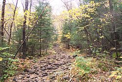
The most commonly climbed route to the summit is the Gorge Brook Trail from Ravine Lodge. One can make a loop by returning via the Carriage Road and Snapper Trail.
The summit of Moosilauke is treeless and offers panoramic views of Franconia Ridge and the Kinsmans to the north, great views into Jobildunc Ravine to the southeast, and the Green Mountains to the west. The first[2] winter high country weather observatory was set up at the top of Mt. Moosilauke in the winter of 1869-1870.[3]
Mount Blue is a small peak to the east of the summit of Moosilauke and about 300 feet (90 m) lower in elevation.
Contents
Name origin
Its name is thought to be derived from a contraction of the Native American words moosi (Bald), and auke (Place).
See also
References
- ^ "The White Mountain Four Thousand Footers List". AMC Four Thousand Footer Club. http://www.amc4000footer.org/wm4.htm. Retrieved June 4, 2009.
- ^ Staff (8 November 1919) "Prof. C. H. Hitchcock Dies" The New York Times
- ^ Waterman, Laura and Waterman, Guy (April 1994) "Charles H. Hitchcock and the Geological Survey of New Hampshire (part 2)" The Granite State Geologist Number 8, page 1
External links
- Mount Moosilauke Homepage
- U.S. Geological Survey Geographic Names Information System: Mount Moosilauke
- PeakBagger.com: Moosilauke
- AMC: Moosilauke
- hikethewhites.com: Moosilauke
- Mt. Moosilauke - FranklinSites.com Hiking Guide
4000-foot mountains of New England Baxter State Park High Peaks Abraham · Crocker · Redington · Saddleback · Saddleback, The Horn · South Crocker · Spaulding · SugarloafBigelow Range Eastern White Mountains Northern ranges Carter-Moriah Range Presidential Range Crawford Notch area Twin Range Pemigewasset Wilderness Sandwich Range Osceola · Osceola (East) · Tripyramid (Middle) · Tripyramid (North) · Passaconaway · Tecumseh · WhitefaceFranconia Range Western White Mountains Green Mountains Categories:- Mountains of New Hampshire
- Landforms of Grafton County, New Hampshire
- Mountains on the Appalachian Trail
- New England Four-thousand footers
Wikimedia Foundation. 2010.

