- Mount Garfield (New Hampshire)
-
Mount Garfield 
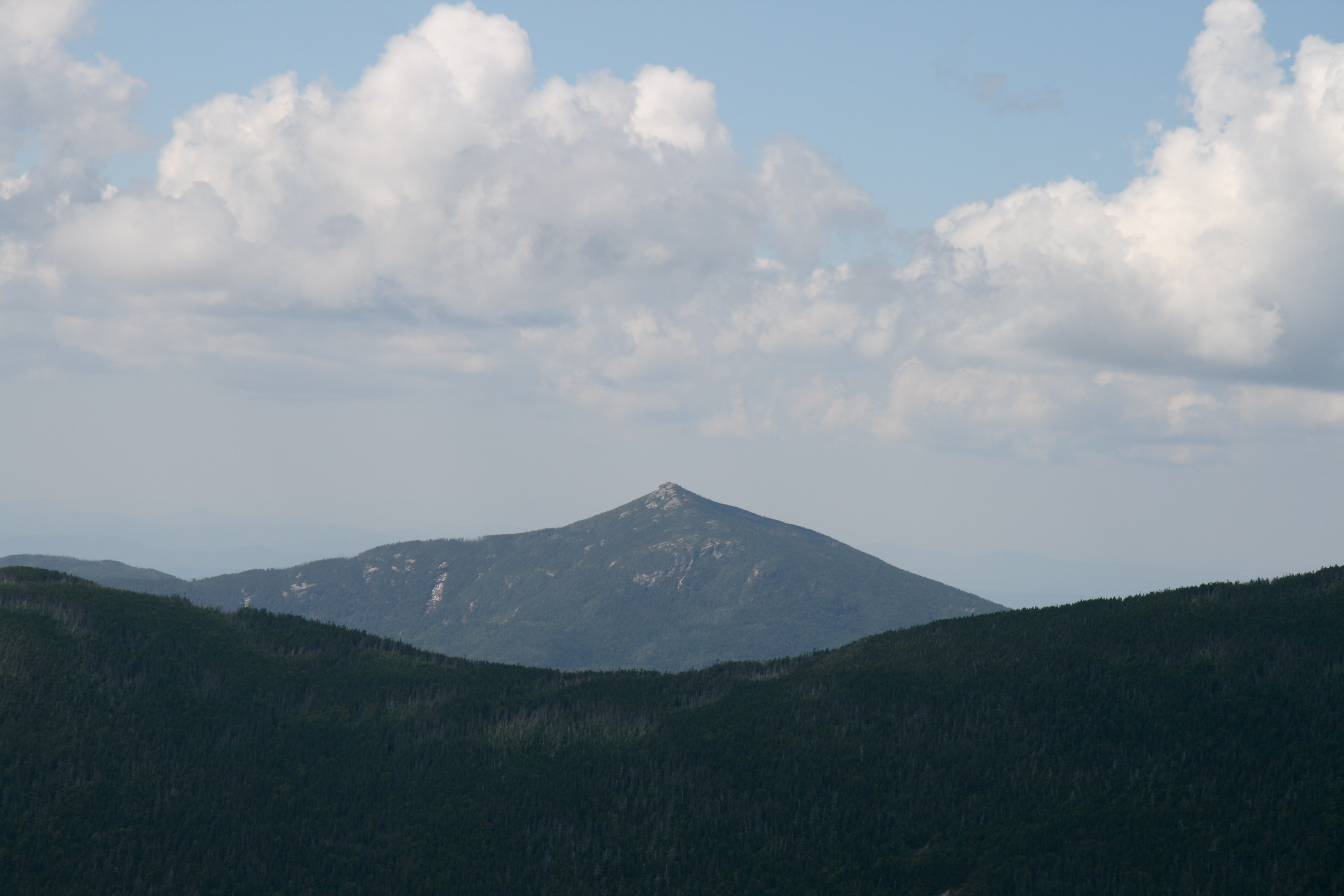
Mt. Garfield as seen from Mt. Guyot, August 2009.Elevation 1,370 m (4,495 ft) Prominence 250 m (820 ft) Listing White Mountain 4000-Footers Location Location Grafton County, New Hampshire, USA Coordinates 44°11.23′N 71°36.65′W / 44.18717°N 71.61083°WCoordinates: 44°11.23′N 71°36.65′W / 44.18717°N 71.61083°W Topo map USGS South Twin Mountain Mount Garfield is a mountain located in Grafton County, New Hampshire. The mountain is part of the White Mountains. Mt. Garfield is flanked to the east by South Twin Mountain, and to the southwest along Garfield Ridge by Mount Lafayette.
The south faces of Garfield drain into the Franconia Branch of the East Branch of the Pemigewasset River, through the Pemigewasset Wilderness, thence into the Pemigewasset and Merrimack rivers, and into the Gulf of Maine at Newburyport, Massachusetts. The north faces of Garfield drain into the north and south branches of the Gale River, thence into the Ammonoosuc and Connecticut rivers, and into Long Island Sound at Old Saybrook, Connecticut.
The Appalachian Trail, a 2,170-mile (3,500-km) National Scenic Trail from Georgia to Maine, runs along the ridge, across the summit of Garfield.
See also
External links
- U.S. Geological Survey Geographic Names Information System: Mount Garfield
- PeakBagger.com: Mount Garfield
- AMC: Mount Garfield
- hikethewhites.com: Mount Garfield
4000-foot mountains of New England Baxter State Park High Peaks Abraham · Crocker · Redington · Saddleback · Saddleback, The Horn · South Crocker · Spaulding · SugarloafBigelow Range Eastern White Mountains Northern ranges Carter-Moriah Range Presidential Range Crawford Notch area Twin Range Pemigewasset Wilderness Sandwich Range Osceola · Osceola (East) · Tripyramid (Middle) · Tripyramid (North) · Passaconaway · Tecumseh · WhitefaceFranconia Range Western White Mountains Green Mountains Categories:- Mountains of New Hampshire
- Landforms of Grafton County, New Hampshire
- New England Four-thousand footers
- Mountains on the Appalachian Trail
- New Hampshire geography stubs
Wikimedia Foundation. 2010.