- Mount Redington
-
Mount Redington 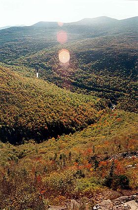
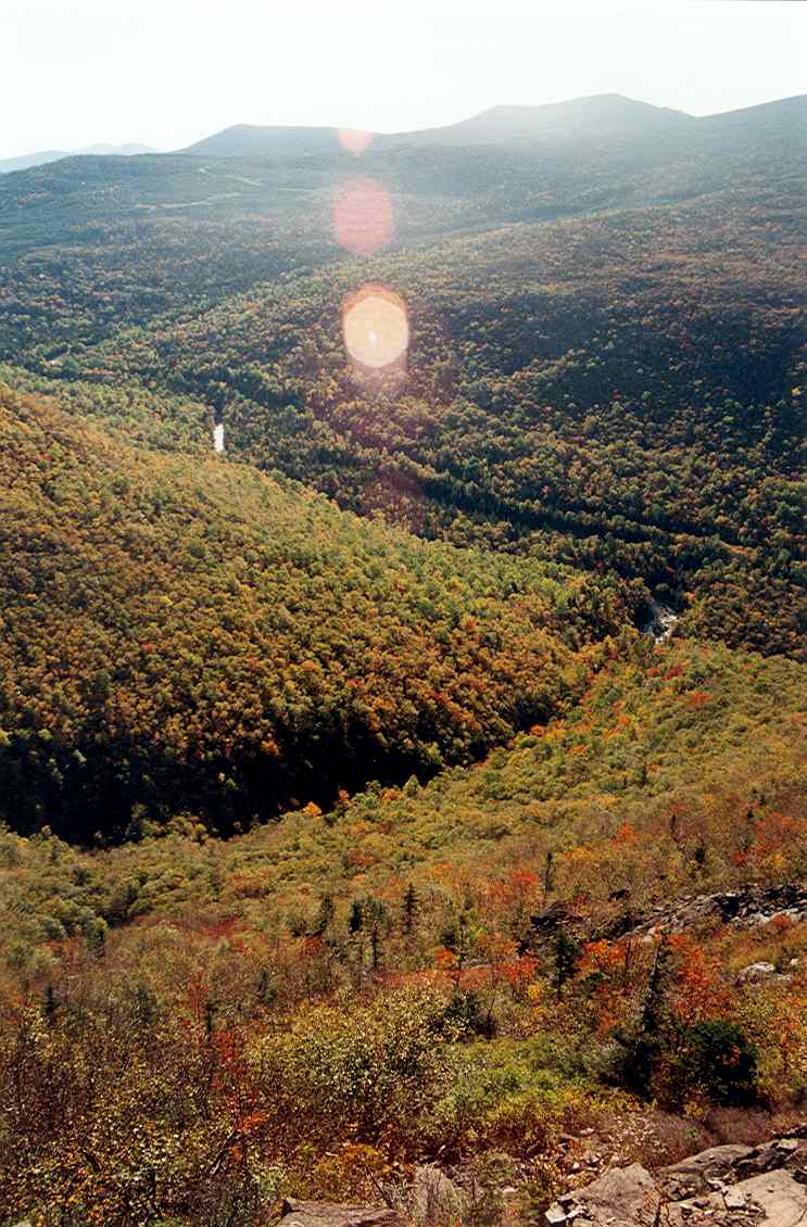
Mount Redington from the AT on SugarloafElevation 4,010 ft (1,222 m) Prominence 460 ft (140 m) Listing New England 4000 footers Location Franklin County, Maine, USA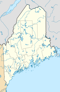
 Mount Redington
Coordinates 45°1.50′N 70°23.32′W / 45.025°N 70.38867°WCoordinates: 45°1.50′N 70°23.32′W / 45.025°N 70.38867°W Topo map USGS Black Nubble Climbing Easiest route herd path Mount Redington is a mountain located in Franklin County, Maine. Redington is flanked to the northeast by South Crocker Mountain and to the west by Black Nubble. Redington stands just northeast of the U.S. Navy Survival Escape and Evasion Training Facility (USSEAETF).
The southeast side of Redington drains into the South Branch of the Carrabassett River, thence into the Kennebec River, and into the Gulf of Maine. The northwest side of Redington drains into Nash Stream, thence into the South Branch of the Dead River, Flagstaff Lake, the Dead River and the Kennebec.
The Appalachian Trail (AT), a 2,170-mile (3,500-km) National Scenic Trail from Georgia to Maine, is routed around Mt. Redington, to instead pass over the summit of Sugarloaf Mountain (4,250 feet / 1,300 metres) — the second highest peak in the state of Maine. The AT runs from Saddleback Junior to the southwest, over Spaulding Mountain and Sugarloaf to the east, and passes about a mile northeast of Redington, at the summit of South Crocker.
Mount Redington and Owl's Head in New Hampshire are the only New England four-thousand footers without a maintained trail to the summit.
Wind farm proposal
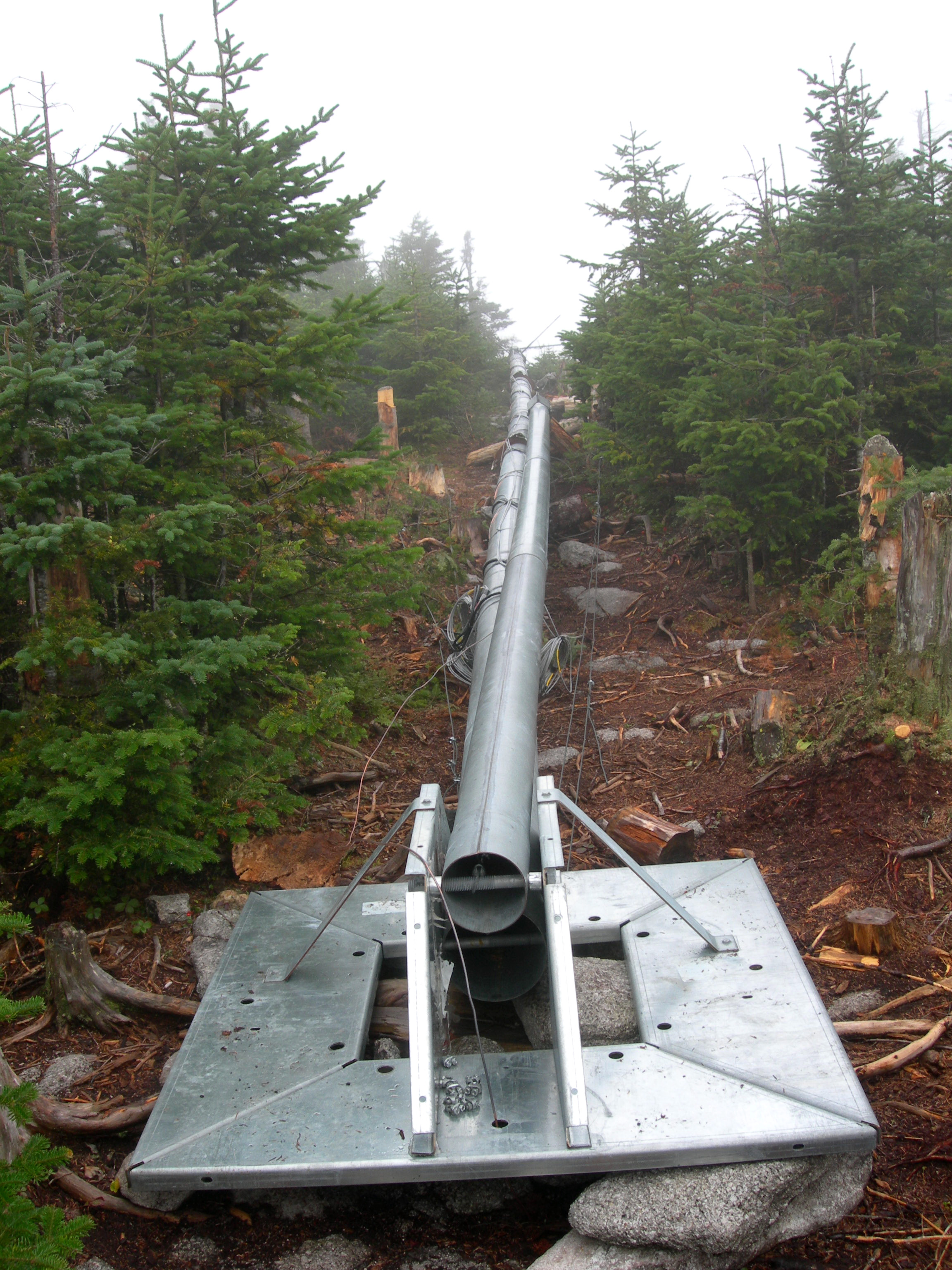
 Tower mast on Redington summit
In 2005, Maine Mountain Power filed an application with the Maine Land Use Regulation Committee (LURC) for a permit to develop a 30-turbine wind farm on Redington and neighboring Black Nubble.[1] After years of contentious debate, the proposal was voted down by the LURC in 2007. The summit of Redington was seen as too ecologically sensitive — a sub-alpine fir habitat providing a home for two rare species, the bog lemming and Bicknell's thrush. Also, the development would have been visible for miles along the AT.[2][3][4] A revised proposal, which would have developed wind power only on Black Nubble, was rejected by the LURC in 2008.[5] As of early 2009, the wind farm project was being planned as the Sugarloaf Community Wind Farm. [6]
Notes
- ^ "Get The Facts". Maine Mountain Power. 2006. http://www.mainemountainpower.com/GetFacts.html. Retrieved 2008-08-28.
- ^ Crowell, Alan (2007-07-11). "Black Nubble wind project supporters line up". Kennebec Journal. http://kennebecjournal.mainetoday.com/news/local/4077881.html. Retrieved 2008-08-28.
- ^ "Maine Mountain Power Redington Wind Farm Application for Development". Maine LURC. http://www.maine.gov/doc/lurc/projects/redington/Click_to_Start.htm. Retrieved 2008-08-28.
- ^ "Redington wind farm a step toward Maine's energy future". Portland Press Herald. 2006-07-29. http://pressherald.mainetoday.com/viewpoints/editorials/060729wind.shtml. Retrieved 2008-08-28.
- ^ "Wind project rulings issued: Panel OKs Kibby, rejects Black Nubble". Morning Sentinel. 2008-01-15. http://morningsentinel.mainetoday.com/news/local/4657191.html. Retrieved 2008-08-28.
- ^ "Board to hear wind farm proposal". Lewiston Sun Journal. 2009-01-03. http://www.sunjournal.com/story/297966-3/Franklin/Board_to_hear_wind_farm_proposal/. Retrieved 2009-05-26.[dead link]
See also
External links
- U.S. Geological Survey Geographic Names Information System: Mt. Redington
- PeakBagger.com: Mt. Redington
4000-foot mountains of New England Baxter State Park High Peaks Abraham · Crocker · Redington · Saddleback · Saddleback, The Horn · South Crocker · Spaulding · SugarloafBigelow Range Eastern White Mountains Northern ranges Carter-Moriah Range Presidential Range Crawford Notch area Twin Range Pemigewasset Wilderness Sandwich Range Osceola · Osceola (East) · Tripyramid (Middle) · Tripyramid (North) · Passaconaway · Tecumseh · WhitefaceFranconia Range Western White Mountains Green Mountains Categories:- Mountains of Franklin County, Maine
- New England Four-thousand footers
- Maine geography stubs

Wikimedia Foundation. 2010.