- Doboj South
-
Doboj South
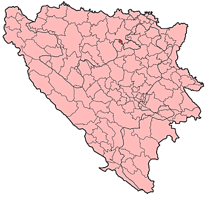
Добој Југ— Municipality — Location of Doboj South within Bosnia and Herzegovina.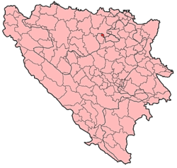
Country  Bosnia and Herzegovina
Entity The Federation Canton Zenica-Doboj Canton Government - Municipality president Džavid Aličić (SDA) Time zone CET (UTC+1) - Summer (DST) CEST (UTC+2) Area code(s) +387 32 Website http://www.dobojjug.ba Doboj South (Doboj Jug / Добој Југ) is a small rural municipality in the Zenica-Doboj Canton of the Federation of Bosnia and Herzegovina.
It borders with Doboj municipality, part of Republika Srpska entity.
Contents
About Doboj South
The municipality Doboj South is a newly formed municipality, established as a direct consequence of war activities in this area. It is not a very large municipality, and covers an area of 80 square kilometers. It spreads around the roads Zenica-Doboj-jug-Doboj and Zenica-Doboj-jug-Usora-Tešanj-Teslić. It nestles between the Bosna and Usora Rivers.
Famous graveyard of tanks located within the Doboj South municipality reminds everyone of the horrors of war and warning never to repeat these atrocities again.
Inhabited places
Municipality consists of the villages of Matuzići and Mravići.
Traffic
The state road M-17, a traffic artery of Bosnia and Herzegovina, runs across most of the municipal area.
Demographics
In 2005, almost all inhabitants of the municipality (100%) were ethnic Bosniaks. [1]
Sport
The local football club, NK Gradina Doboj-Jug, plays in the Regional League in Federation of Bosnia and Herzegovina.
External links
 Categories:
- Cities and towns in the Federation of Bosnia and Herzegovina
- Populated places in Doboj Jug
- Municipalities of Zenica-Doboj Canton
![[1]](http://upload.wikimedia.org/wikipedia/commons/thumb/a/a8/B_2005.GIF/661px-B_2005.GIF)
Wikimedia Foundation. 2010.