- Novi Grad, Bosanska Krajina
-
Нови Град
Bosanski Novi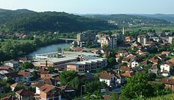 File:Bosanski Novi municipality.svg
Coordinates: 45°02′49″N 16°22′59″E / 45.047°N 16.383°ECoordinates: 45°02′49″N 16°22′59″E / 45.047°N 16.383°E Country  Bosnia and Herzegovina
Entity  Republika Srpska
Telephone code +387 052 Website http://www.opstina-novigrad.com/ Novi Grad (Serbian Cyrillic: Нoви Град) is a town and municipality in northern Republika Srpska entity, Bosnia and Herzegovina. The town is situated on the Una river on the border with Croatia (opposite the town of Dvor). Today, the municipality has a population of about 30,000 people with 8,500 households. In the town itself there is a hospital, post office, a great number of elementary and high schools, cultural center, etc.
Contents
Name
In 1878 Novi Grad was occupied by Austria-Hungary and the town name was changed to Bosanski Novi in 1895. In 1992 the town name was officially re-changed to "Novi Grad". The city is colloquially known simply as "Novi".
Geography
Municipality of Novi Grad is situated in the northwestern part of Bosnia and Herzegovina. It's exact location is 45°53¨ longitude and 45°14 northern latitude.[citation needed] It takes up an area of 470 km2 (180 sq mi). The municipality lies between the rivers of Sana and Una, between the mountains of Grmec and Kozara. The climate is temperamental-continental.
History
The town of Novi Grad was first mentioned in 1280 under the Roman name of Castrum Novum, which literally translated means "new town". In 1895, during the Austro-Hungarian rule, the town was officially named Bosanski Novi. At the end of the last decade of the twentieth century, Novi Grad had 3,300 people with 550 typical Bosnian households. There were wooden bridges across the Una and Sana rivers, which the citizens had to guard against the wild spring and fall floods. For that reason, a symbol of the town was built in 1906-Una quay. In 1872, Novi Grad was the first municipality to have a train station on the new Bosnian railway, which afforded it significant cultural and economic advantages over any other Bosanska Krajina municipalities. The first hospital was established around the same time.
After the Bosnian war, Kostajnica was split form the municipality.
Settlements
• Ahmetovci • Blagaj Japra • Blagaj Rijeka • Blatna • Kostajnica • Novi Grad • Cerovica • Crna Rijeka • Čađavica Donja • Čađavica Gornja • Čađavica Srednja • Ćele • Devetaci • Dobrljin • Donje Vodičevo • Donji Agići • Donji Rakani • Gornja Slabinja • Gornje Vodičevo • Gornji Agići • Gornji Rakani • Grabašnica • Grdanovac • Gumnjani • Hozići • Johovica • Jošava • Kalenderi • Kršlje • Kuljani • Lješljani • Mala Krupska Rujiška • Mala Novska Rujiška • Mala Žuljevica • Maslovare • Matavazi • Mazić • Mrakodol • Mraovo Polje • Petkovac • Petrinja • Pobrđani • Podoška • Poljavnice • Prusci • Radomirovac • Rakovac • Rašće • Ravnice • Rudice • Sokolište • Suhača • Svodna • Tavija • Trgovište • Vedovica • Velika Rujiška • Velika Žuljevica • Vitasavci • Zovik.
Demographics
1991
In the census of 1991, the municipality of Novi Grad had 41,541 residents[1], including:
- 14,083 Bosniaks (33.69%)
- 25,106 Serbs (60.24%) (See: Serbs of Bosnia and Herzegovina)
- 1,531 Yugoslavs (3.73%)
- 402 Croats (0.96%) (See: Croats of Bosnia and Herzegovina)
- 419 others (1.35%)
2006
In 2006, the majority of inhabitants of municipality were ethnic Serbs.
Economy
The largest industries in the town are wood processing, textile manufacturing, mining and electrical industry.
Sport
There are several active sports organizations in the town, such as soccer, handball and basketball clubs.
The local football club is FK Sloboda Novi Grad.
Gallery
-
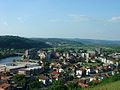
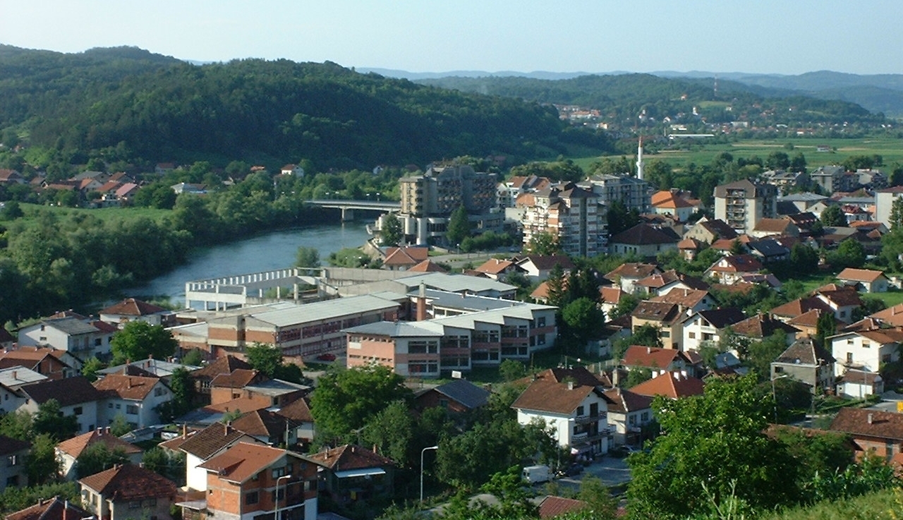
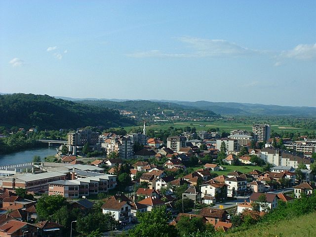
Novi Grad
-
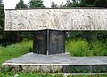
Monument "Majka Partizanka" ("the partisan mother")
-
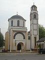
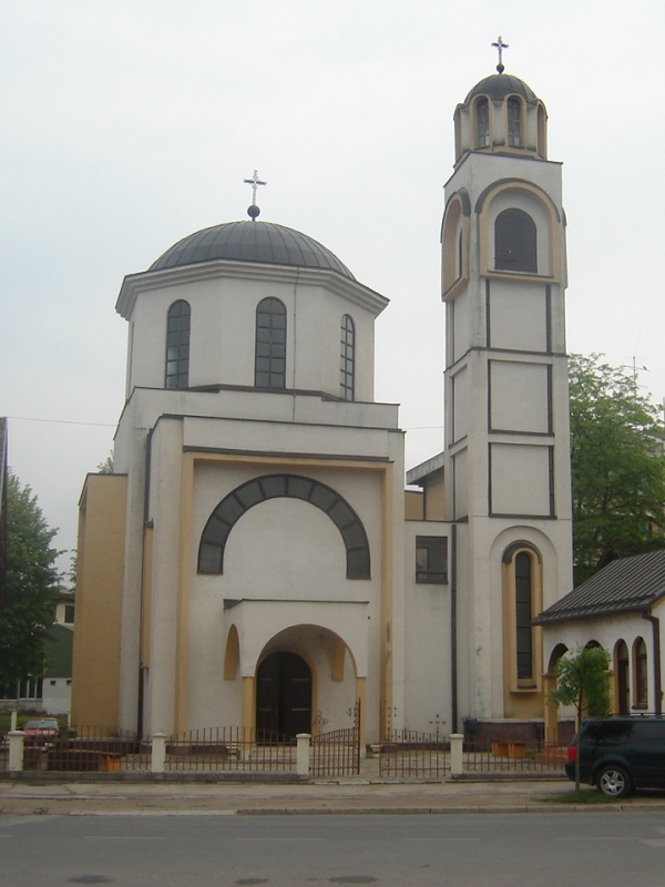
Orthodox Church in Novi Grad
-
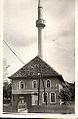
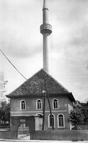
Vidorijska dzamija - one of the oldest buildings in this city
See also
External links
References
Categories:- Populated places in Novi Grad
- Novi Grad
- Bosnia and Herzegovina–Croatia border crossings

Wikimedia Foundation. 2010.