- Rogatica
Infobox Settlement
settlement_type =
subdivision_type = Country
subdivision_name =Bosnia and Herzegovina subdivision_type1 =
subdivision_name1 =
subdivision_type2 =
subdivision_name2 =timezone=CET
utc_offset=+1
timezone_DST = CEST
utc_offset_DST = +2unit_pref=
map_caption =Location of PAGENAME within Bosnia and Herzegovina
latNS=N
longEW=E
population_as_of=1991
native_name = Рогатица
official_name = Rogatica
other_name =
image_shield =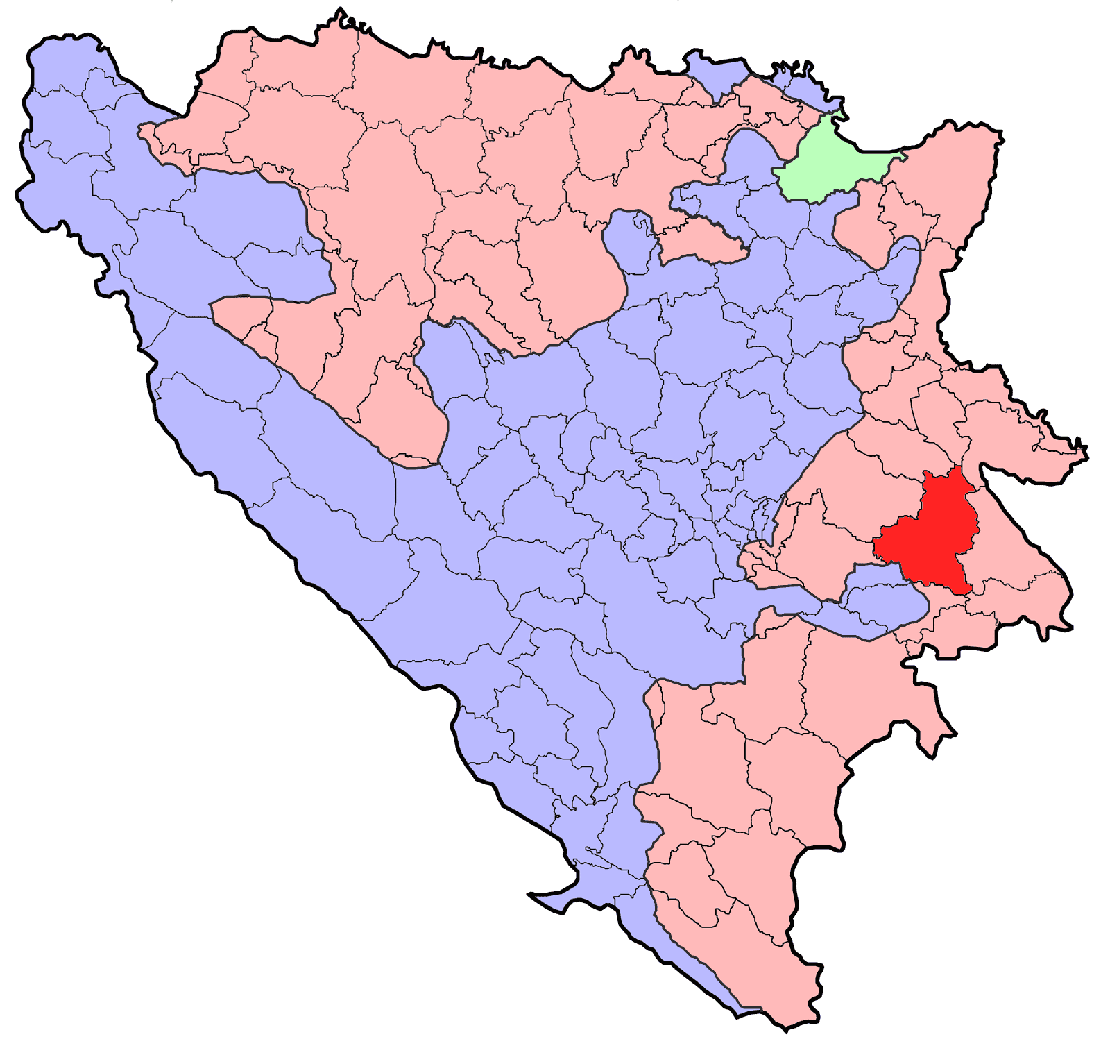
area_total_km2 = 664|population_blank1 = 17000|population_blank1_title=Municipality
population_total = 21,812
|parts_type=Settlements
parts =
latd=43|latm=81
longd=19|longm=00
area_code = 57
website =
footnotes =
|leader_title=Mayor
leader_name = Tomislav Batinić (SDS) [http://www.izbori.ba/documents/Rezultati%20izbora%202004/Utvrdjeni/2004NacelniciRS.pdf]
leader_party =
|Rogatica (
Cyrillic : Рогатица) is a municipality and town in easternRepublika Srpska ,Bosnia and Herzegovina , located 60 kilometres east ofSarajevo ; midway on the road fromGoražde towardsSokolac . The village ofŽepa is located in the Rogatica municipality.Demographics
1971
25.501 total
* Muslims - 15.096 (59,19)
* Serbs - 10.208 (40,02)
* Croats - 45 (0,17)
* Yugoslavs - 62 (0,24)
* Others - 90 (0,38)1991
In the census of 1991, the municipality had 21,812 residents, the ethnic distribution of which were;
*13,169 (60.38%)Muslims by nationality
*3,374 (38.39%)Serbs (See:Serbs of Bosnia and Herzegovina )
*185 (0.85%)Yugoslavs
*18 (0.08%)Croats (See:Croats of Bosnia and Herzegovina )
*66 (0.30%) othersThe town of Rogatica itself had 8,930 inhabitants:
*5,662 (63%) Muslims by nationality
*3,062 (34%) Serbs
*139 (2%) Yugoslavs
*1% othersNote: Most Muslims by nationality today consider themselves
Bosniaks .No census has been conducted since 1991, but estimates put the population at around 18,000, mostly Serbs. [http://www.komorars.ba/a2/index.php/pg/1949.print]
History
In 1992, during the first year of the war all of the Bosnian Muslim (Bosniak) population was expelled from the Rogatica municipality, with the sole exception of
Žepa . In July 1995 the remainder of the Bosniak population was expelled whenŽepa fell to the Serbs. An estimated 1,133 Bosnian Muslims (Bosniaks) were killed between 1992-1995 in Rogatica.ee also
*
Municipalities of Republika Srpska
*List of settlements in Bosnia and Herzegovina External links
* [http://www.rogatica.com/html/index.php Unofficial Rogatica website] bs icon
* [http://hjem.get2net.dk/rogatica/ Another unofficial Rogatica website] bs icon
* [http://www.rogatica.com/Spisak.htm List of people from Rogatica killed in the war] bs icon
Wikimedia Foundation. 2010.