- Banovići
Infobox Settlement
official_name = PAGENAME
settlement_type =
subdivision_type = Country
subdivision_name = BIH
timezone=CET
utc_offset=+1
map_caption =Location of PAGENAME within Bosnia and Herzegovina.
timezone_DST=CEST
utc_offset_DST=+2
latNS=N
longEW=E
leader_title=Municipality president
native_name = Бановићи
other_name =
image_shield = Grb1.jpg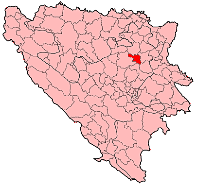
leader_name = Bego Birparić (SDA)|area_total_km2 = 185
population_total = 28918|population_footnotes=
population_as_of=2003 census
population_density_km2 =
latd =
latm=
longd=
longm=
area_code = +387 35
parts =
website = [http://www.opcina-banovici.com.ba opcina-banovici.com.ba]Banovići ("Cyrillic" Бановићи) is a town and
municipality in northwesternBosnia and Herzegovina .Geography
Banovići Municipality is situated on the foothills of Konjuh mountain. Town settlement of Banovići was built on the embankments of Litva river. Its average height above sea-level is 332 meters. The municipality encompasses 185 km2. According the 1991 census, there were 26,507 inhabitants, out of the number there were 72% Bosniaks, 17% of Serbs, 2% of Croats and 9% of the others. According to some estimates in 2000, the population of Banovići is about 29,000, and a considerable number of them are refugees.
History
The oldest settlement known is located on Gradina hill at Tulovići village, dated from Pre-historical period, according to the material culture remainings. There is a system of caves in Pribitkovići village, rich in cave adornments. The origin of the central settlement's name is revealed by a
stećak in Banović selo, which, beside ornaments and the lily flower carved into the stone, also has an inscription written in Bosnian Cyrillic script.There were several necropola of stećaks found, beside Banovići, that used to belong to Dramein county: Straba, Draganja and Treštenica. The county and settlements are mentioned by this name also in Turkish sources. This name of the county was sustained until the 19th century.The intensive development of Banovići begins with construction of the railway Brčko-Banovići in the year 1946. In that year, there were only few houses at Banovići settlement, and in 1961 there were already 4,611 inhabitants. The settlement acquired all features of a modern urban town environment. This is due to exploitation of quality brown coal and construction of a large number of industrial facilities of metal and non-metal industry, as well as construction of a modern traffic road betweenŽivinice andZavidovići . Due to its quality, brown coal from Banovići is well-known all over Europe. The exploitation of brown coal is the basis of further development of Banovići, as well as ofTuzla Canton .Tourism
The Municipality of Banovići has good preconditions for the development of tourism based on hunting on the slopes of Konjuh, as well as for the development of tourism based on fishing in several mountain rivers: the Oskova, the Krabanja, the Zlača and the Studešnica. „Zlača“ mountain motel is one of the best mountain recreation facilities in Tuzla Canton. „Zobik“ mountain house is well known to all those in Bosnia and Herzegovina who like nature. In the village of Pribitkovići there is Borovac, an interesting series of caves rich with cave ornaments.
Demographics
Current population
In 2003 the municipality had a population of 28,918 (95%)
Bosniaks .In 2005, 98% of population of the municipality were ethnic Bosniaks.
Picture Gallery
References
* Official results from the book: Ethnic composition of Bosnia-Herzegovina population, by municipalities and settlements, 1991. census, Zavod za statistiku Bosne i Hercegovine - Bilten no.234, Sarajevo 1991.
* Script about Tuzla Canton, 2001External links
* [http://www.opcina-banovici.com.ba/ Official site]

Wikimedia Foundation. 2010.