- Vogošća
Infobox Settlement
official_name = Vogošća
settlement_type =
subdivision_type = Country
subdivision_name = BIH
timezone=CET
utc_offset=+1
map_caption =Location of Vogošća within Bosnia and Herzegovina.
timezone_DST=CEST
utc_offset_DST=+2
latNS=N
longEW=E|native_name = Вогошћа
image_shield =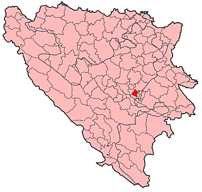
leader_name =Asim Sarajlić (SDA)|area_total_km2 = 72
population_total = 19894|population_footnotes=
population_as_of = 2002 census
population_density_km2 =
pushpin_
pushpin_label_position =
pushpin_map_caption =Location of Vogošća
pushpin_mapsize =
latd = 43
latm= 54
longd= 18
longm= 21
area_code = +387 33
parts = 8
parts_type=Communities
website = http://www.vogosca.baVogošća (
Cyrillic : Вогошћа) is a secondary suburb and municipality ofSarajevo , the capital ofBosnia and Herzegovina , located about 6 kilometers north of the city center and covering some 72 km².Demographics
1971
According to 1971 population census there were 14.402 residents.
*
Serbs - 6.728 (46,71%)
* Muslims - 5.938 (41,23%)
*Croats - 1.186 (8,23%)
*Yugoslavs - 247 (1,71%)
* Others - 303 (2,12%)1991
According to 1991 population census there were 24.647 residents.
* Muslims - 12.499 (50,71%)
* Serbs - 8.813 (35,75%)
* Croats - 1.071 (4,34%)
* Yugoslavs - 1.730 (7,01%)
* Others - 534 (2,19%)The town of Vogošća itself consisted of 10.598 residents.
*
Serbs - 4,698 (44.32%)
*Muslims by nationality - 3,724 (35.13%)
*Yugoslavs - 1,291 (12.18%)
*Croats - 545 (5.14%)
* Others and Unknown - 340 (3.20%)2002
According to government statistics from 2002, Vogošća has 19,894 residents, of which 17,686 are
Bosniaks (88.9%), 1,636 areSerbs (8.2%), 452 areCroats (2.3%), and 120 are classified as others (0.6%). The majority of the Serbian population left Vogošća after the war, largely due to a fear that they were not safe in non-Serbian controlled territory anymore.2005
In 2005, 91% of population of the municipality were ethnic Bosniaks.
History
Vogošća greatly prospered during the 1980s, as part of Sarajevo’s great boom in the latter half of the 20th century. It grew to prominence in large part due to its
automobile manufacturing industry , having deals with German and Swedish companies. By the late 1980s it was the second most industrious and productive municipality informer Yugoslavia .Vogošća was heavily damaged during the exodus of the Serbs who controlled that territory during the war. The Dayton Agreement provided Vogošća to be a part of the
Federation of Bosnia and Herzegovina . Today, Vogošća is rebuilding and its industries are on the rebound thanks to aid and fundsCommunities and neighborhoods in Vogošća
*
Vogošća I
*Vogošća II
*Blagovac
*Hotonj
*Kobilja Glava
*Semizovac
*Svrake
*GoraReferences
* Official results from the book: Ethnic composition of Bosnia-Herzegovina population, by municipalities and settlements, 1991. census, Zavod za statistiku Bosne i Hercegovine - Bilten no.234, Sarajevo 1991.
External links
* http://www.vogosca.ba

Wikimedia Foundation. 2010.