- Kladanj
Infobox Settlement
official_name = Kladanj
settlement_type =
subdivision_type = Country
subdivision_name = BIH
timezone=CET
utc_offset=+1
map_caption =Location of Kladanj within Bosnia and Herzegovina.
timezone_DST=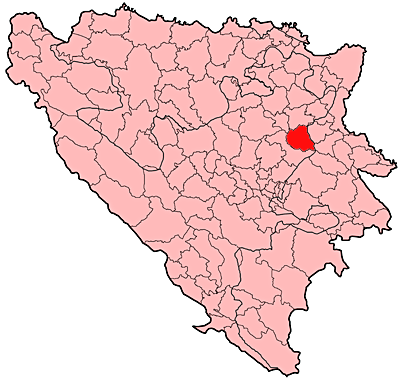
leader_name =Fuad Imamović (ZA BiH)|area_total_km2 =325
population_total = 16000|population_footnotes=
population_as_of= =
population_density_km2 =
pushpin_
pushpin_label_position =
pushpin_map_caption =Location of Kladanj
pushpin_mapsize =
latd = 44
latm= 14
longd= 18
longm= 41
area_code = +387 35
parts =
website =
elevation_m=570Kladanj is a town and municipality in
Tuzla Canton ,Bosnia and Herzegovina . It belongs to theFederation of Bosnia and Herzegovina .Demographics
1971
14.015 total
* Muslims - 9.300 (66,35%)
* Serbs - 4.487 (32,01%)
* Croats - 66 (0,47%)
* Yugoslavs - 63 (0,44%)
* others - 99 (0,73%)1991
16.070 total
* Muslims - Bošnjaci - 11.621 (72,31%)
* Serbs - 3.952 (24,59%)
* Croats - 36 (0,22%)
* Yugoslavs - 277 (1,72%)
* others - 184 (1,16%)2005
In 2005, 99% of population of the municipality were ethnic Bosniaks.
Geography
The land area of the municipality is approximately convert|325|km2|sqmi|abbr=on. The town is 570 meters above sea level.
Economy
The
lumber industry called "Sokolina" is one of the most vital economic contibutors to the municipality.External links
*http://kladanj.17.forumer.com/


Wikimedia Foundation. 2010.