- Olovo
-
Olovo
ОловоLocation of Olovo within Bosnia and Herzegovina.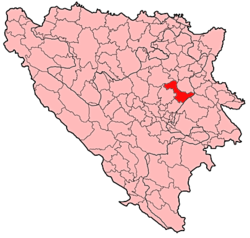
Country  Bosnia and Herzegovina
Government - Municipality president Alija Hadžiabdić (SBiH) area = Population - Total 7,000 Time zone CET (UTC+1) - Summer (DST) CEST (UTC+2) Area code(s) +387 32 Website http://www.olovo.ba Olovo is a town and municipality situated about 50 km (31 mi) northeast of Sarajevo, Bosnia and Herzegovina.
Contents
About Olovo
The town Olovo is on Sarajevo-Tuzla highway and is located 50 km northeast Sarajevo. Olovo is a part of the Zenica-Doboj Canton. Recently, there have been aims to try and have Olovo be a part of the Sarajevo Canton, however as of today, Olovo is still within the Zenica-Doboj Canton [1]. Since the Middle Age there have been well known lead ore deposits, and the town was named after lead (olovo means lead in Bosnian).
Features
It is best known for its occasional bull-fights and for the youth visiting it from nearby villages. An extremely superior characteristic of Olovo is its very effective spa, dating back from the period of Roman reign in the area.
Olovo is also a tryst for resting and changing directions when traveling to cities such as Zenica and Zavidovići.
Demographics
Ethnic Composition Year Serb % Muslims % Croats % Yugoslavs % Others % Total 1961 3,635 32.07% 5,903 52.09% 314 2.77% 1,402 12.37% 11,333 1971 3,601 23,68% 10,546 69,36% 930 6,11% 46 0,30% 80 0,55% 15,203 1981 3,349 20.49% 11,593 70.94% 802 4.91% 508 3.12% 16,341 1991 3,196 18,91% 12,699 75,14% 653 3,86% 282 1,67% 16,901 2005
Given that no recent census has been made, the exact population of Olovo is unknown, but it is thought to be approximately 7,000.
In 2005, 96% of population of the municipality were ethnic Bosniaks.
Inhabited places
Olovo has many small villages in the vicinity, and they are: Čuništa, Solun, Hadre, Bukovdo, Milankovići, Kamensko, Jelaške, Careva Cuprija, Lisci, Gurdici, Dugandzici, Cude, Petrovici, Klis, Kolakovici, Berisalici, Brda, Luke, Lavsici, Ponijerka, Grabovica, Drezelj, Paklanik, Majna, Radacici, Ajvatovici, Miljevici, Rudine, and Ligatići.
External links
- Official website (Bosnian)

Coordinates: 44°07′43″N 18°34′54″E / 44.12861°N 18.58167°E
Categories:- Cities and towns in the Federation of Bosnia and Herzegovina
- Populated places in Olovo
- Municipalities of Zenica-Doboj Canton

Wikimedia Foundation. 2010.