- Busovača
Infobox Settlement
official_name = PAGENAME
settlement_type =
subdivision_type = Country
subdivision_name = BIH
timezone=CET
utc_offset=+1
map_caption =Location of PAGENAME within Bosnia and Herzegovina.
timezone_DST=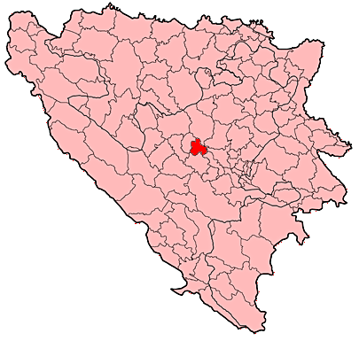
subdivision_type1=Entity
subdivision_name1 =Federation of Bosnia and Herzegovina
subdivision_type2=Canton
subdivision_name2 =Central Bosnia
Canton
area_total_km2 = 158
population_total = 3938|population_footnotes=
population_as_of=991 census
population_density_km2 = 119
pushpin_
pushpin_label_position =
pushpin_map_caption =Location of Busovača
pushpin_mapsize =
latd = 44
latm = 06
longd = 17
longm = 53
area_code = +387 30
leader_name =Nikica Petrović (HDZ)
website =www.sredisnjabosna.com
footnotes =Busovača is a small
town and municipality in the heart ofBosnia and Herzegovina . It is convert|60|km|mi|abbr=on fromSarajevo , convert|21|km|mi|abbr=on fromZenica , and convert|30|km|mi|abbr=on fromTravnik .History
During the Bosnian War, the city saw heavy fighting between the
Bosnian Army and theCroatian Defence Council . Today, Busovača is recovering from the war and with its small economy and infrastructure it is becoming an important crossroad between bigger cities.Demographics
1971
14.428 total
*Croats - 7.646 (52,99%)
*Bosniaks (i.e. Bosnian Muslims) - 5.896 (40,86%)
*Serbs - 735 (5,09%)
* Yugoslavs - 60 (0,41%)
* others - 91 (0,65%)1991
By census of 1991 municipality had the Croat majority, as town itself.
2005
In 2005, population of the municipality of Busovača included 59% Croats and 40% Bosniaks.
References


Wikimedia Foundation. 2010.