Middle LaHave, Nova Scotia

Middle LaHave, Nova Scotia
St. Mark's Place Protects The LaHave
Location of Middle LaHave, Nova Scotia
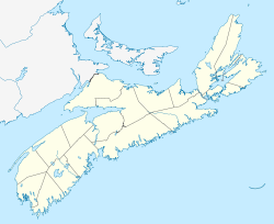
Country Canada
Province Nova Scotia
Municipality Lunenburg Municipality
Elevation 0 m (0 ft)
Highest elevation 119 m (390 ft)
Lowest elevation 0 m (0 ft)
Time zone AST (UTC-4)
 - Summer (DST) ADT (UTC-3)
Canadian Postal code B0J 2W0
Area code(s) 902
Telephone Exchanges 764, 766
NTS Map 021A08
GNBC Code CBFUW
Website http://www.riverport.org


Contents

Middle LaHave

Middle LaHave is part of the Riverport District, a community in the Canadian province of Nova Scotia, in Lunenburg County on the shore of the LaHave River.

Much of the rural infrastructure for Middle LaHave is centered in Riverport, Nova Scotia. This includes Riverport Electric, the first municipal utility incorporated in Nova Scotia, the Riverport & District Fire Department, Riverport & District Community Center, Riverport Community School and Riverport Post Office. Rose Bay General Store offers a wide range of locally based goods and services. The best location for retail goods is Bridgewater, Nova Scotia and exceptional dining is Lunenburg, Nova Scotia.

History

Samuel de Champlain struck settlement claims along the banks of both the North and South shores of the river, including Middle LaHave. Traditionally the Northern side of the LaHave is predominantly on the Lighthouse Route, offering a diverse culture, with both French and English backgrounds. Following the colonization by British and French settlers, German families also immigrated to the South Shore, founding Lunenburg in 1753.

Culture

Their culture and traditions are apparent in the area from the dialect to the architecture. Middle LaHave has a wide variety of inhabitants, including traditional and local families such as Crouse, and Mosher, and more recent additions Durnford and Keeping. The descendants of a famous queen live there still supporting her name. The culture of the LaHave and its founding fathers continues to spread throughout Nova Scotia.

External Links


Coordinates: 44°19′16.4″N 64°24′29.5″W / 44.321222°N 64.408194°W / 44.321222; -64.408194


Wikimedia Foundation. 2010.

Игры ⚽ Поможем написать реферат

Look at other dictionaries:

  • Nova Scotia Route 332 — Route 332 Route information Maintained by Nova Scotia Department of Transportation and Infrastructure Renewal Length: 37 km …   Wikipedia

  • List of Nova Scotia rivers — Nova Scotia s rivers all flow into the Atlantic Ocean through four unique watersheds: the Gulf of Maine, the Northumberland Strait, the Gulf of Saint Lawrence and into the Atlantic Ocean itself.Gulf of MaineThe Gulf of Maine system includes the… …   Wikipedia

  • List of Nova Scotia provincial highways — This is a list of numbered highways in the province of Nova Scotia. Arterial (100 series) highways : See 100 Series Highways * *) * *) *) *) * * * * Highway 102 interchange at Miller Lake * * *Historical Note: Nova Scotia s original arterial… …   Wikipedia

  • List of communities in Nova Scotia — This is a list of communities in the Canadian province of Nova Scotia, as designated by the Union of Nova Scotia Municipalities. Incorporated municipalities in Nova Scotia are either counties, towns or regional municipalities. There are no… …   Wikipedia

  • List of schools in Nova Scotia — Nearly all primary and secondary schools in the province of Nova Scotia are public schools maintained by the provincial government s Department of Education. While providing guidelines, the government divides administration of public education… …   Wikipedia

  • Riverport, Nova Scotia — Infobox Settlement official name = Riverport, Nova Scotia other name = native name = nickname = settlement type = motto = imagesize = 250px image caption = Sunset over Creaser s Cove flag size = image seal size = image shield = shield size = city …   Wikipedia

  • List of communities in Lunenburg County, Nova Scotia — List of communities in Lunenburg County, Nova ScotiaCommunities are ordered by the highway upon which they are located. All routes start with the terminus located near the largest community.Trunk Routes*Trunk 3: Hebbville Bridgewater Dayspring… …   Wikipedia

  • List of National Historic Sites of Canada — This is a complete list of the National Historic Sites of Canada. All such designations are made by the federal Minister of the Environment on the advice of the Historic Sites and Monuments Board of Canada . As of March 2008, there are 935 sites …   Wikipedia

  • Lighthouse Route — The Lighthouse Route is a scenic roadway in the Canadian province of Nova Scotia.It follows the province s South Shore for convert|339|km|mi|abbr=on from Halifax to Yarmouth.List of Highways=Numbered= *Trunk 3 *Highway 103 *Route 309 *Route 329… …   Wikipedia

  • Riverport — Administration Pays  Canada Province …   Wikipédia en Français

Share the article and excerpts

Direct link
Do a right-click on the link above
and select “Copy Link”