- Riverport, Nova Scotia
Infobox Settlement
official_name = Riverport, Nova Scotia
other_name =
native_name =
nickname =
settlement_type =
motto =
imagesize = 250px
image_caption = Sunset over Creaser's Cove
flag_size =
image_
seal_size =
image_shield =
shield_size =
city_logo =
citylogo_size =
mapsize =
map_caption =
mapsize1 =
map_caption1 =
image_dot_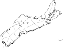
dot_mapsize = 250px
dot_map_caption = Location of the Pagename
dot_x =98 |dot_y =118
pushpin_
pushpin_label_position =
pushpin_map_caption =
pushpin_mapsize =
subdivision_type = Country
subdivision_name =Canada
subdivision_type1 = Province
subdivision_name1 =Nova Scotia
subdivision_type2 = Municipality
subdivision_name2 = Lunenburg Municipality
subdivision_type3 =
subdivision_name3 =
subdivision_type4 =
subdivision_name4 =
government_footnotes =
government_type =
leader_title =
leader_name =
leader_title1 =
leader_name1 =
leader_title2 =
leader_name2 =
leader_title3 =
leader_name3 =
leader_title4 =
leader_name4 =
established_title = Settled
established_date = 1754
established_title2 =
established_date2 =
established_title3 =
established_date3 =
area_magnitude =
unit_pref =
area_footnotes =
area_total_km2 =
area_land_km2 =
area_water_km2 =
area_total_sq_mi =
area_land_sq_mi =
area_water_sq_mi =
area_water_percent =
area_urban_km2 =
area_urban_sq_mi =
area_metro_km2 =
area_metro_sq_mi =
population_as_of =
population_footnotes =
population_note =
population_total =
population_density_km2 =
population_density_sq_mi =
population_metro =
population_density_metro_km2 =
population_density_metro_sq_mi =
population_urban =
population_density_urban_km2 =
population_density_urban_sq_mi =
population_blank1_title =
population_blank1 =
population_density_blank1_km2 =
population_density_blank1_sq_mi =
timezone =AST
utc_offset = -4
timezone_DST = ADT
utc_offset_DST = -3
latd= |latm= |lats= |latNS=
longd= |longm= |longs= |longEW=
elevation_footnotes =
elevation_m = 0
elevation_ft
elevation_min_m = 0
elevation_max_m = 119
postal_code_type = Canadian Postal code
postal_code = B0J 2W0
area_code = 902
blank_name = Telephone Exchanges
blank_info = 764, 766
blank1_name = NTS Map
blank1_info = 021A08
blank2_name = GNBC Code
blank2_info = CBFUW
website = http://www.riverport.org
footnotes =Riverport (formerly Ritcey's Cove) was settled in 1754 at the mouth of the
LaHave River inNova Scotia ,Canada . The waters of the LaHave were first sailed in 1604.History
Like other towns on the South Shore the area was originally founded by the
Foreign Protestants . In the 19th century it was a prosperous fishing and shipbuilding centre.Geography
The village is approximately 105 kilometers from Halifax Regional Municipality, 25 kilometers from Bridgewater and 10 kilometers from Lunenburg.It is located around a cove on the west side of the Kingsburg peninsula surrounded by the communities of Lower LaHave, Rose Bay, Kingsburg, Upper Kingsburg, Bayport, Feltzen South, East LaHave, Middle LaHave, Rose Bay, Lower Rose Bay, Indian Path which is known as Riverport and District. The village of LaHave, West Dublin and Pentz has had many historical ties and sits on the opposite site of the river.
Economy
The district has historically been dependent on the resource sector and used the sea as a trade routes. During the days of prohibition the town was a base for rum running into the United States. The anchor industry for the economy has a Fisheries Products International scallop port. Recently this asset was sold to Ocean Choice International.
In place of this resource dependence the economy has been changing to adapt to modern economic requirements.
Culture
A variety of community events activities take place. The Riverport and District Fire Department has been a center of the community since the great fire of the early 1900's.
The annual Riverport Rum Running Fishing Derby takes place the second week in August.
The Old School house is now the present location of the Community Center where a variety of events are based.
Wikimedia Foundation. 2010.