- Coombe Dingle, Bristol
-
Coordinates: 51°29′43″N 2°38′46″W / 51.4952°N 2.6460°W
Coombe Dingle 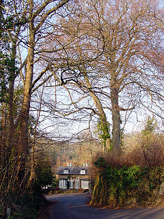
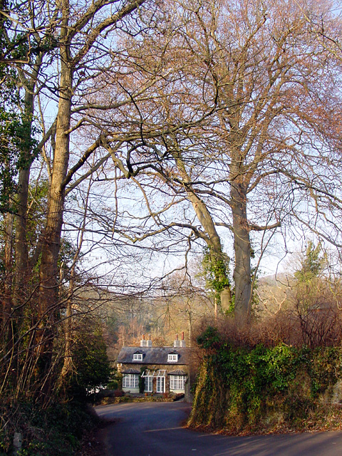
The Dingle, Coombe Dingle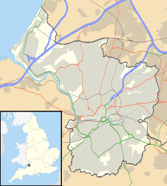
 Coombe Dingle
Coombe Dingle shown within BristolOS grid reference ST552775 Unitary authority Bristol Ceremonial county Bristol Region South West Country England Sovereign state United Kingdom Post town BRISTOL Postcode district BS Dialling code 0117 Police Avon and Somerset Fire Avon Ambulance Great Western EU Parliament South West England UK Parliament Bristol North West List of places: UK • England • Bristol Coombe Dingle is a suburb of Bristol, England, centred near where the Hazel Brook tributary of the River Trym emerges from a limestone gorge bisecting the Blaise Castle Estate to join the main course of the Trym. Historically this area formed part of the parish of Westbury on Trym, Gloucestershire, and is now part of Kingsweston ward of the city of Bristol. South of Coombe Dingle is Sea Mills; to the north is Kingsweston Hill; to the west are Kings Weston House and Shirehampton Park; and to the east, Henbury Golf Club and Westbury on Trym proper.
The inhabited place appears simply as Combe, Coomb or Coombe, meaning 'short bowl-shaped valley', in documents from the 13th century onwards and on early maps. The name applied to Coombe Farm and Coombe House on the eastern side of the confluence of the Hazel Brook and the Trym, not where the modern suburb lies. This area later became noted for its cherry orchards, commemorated in a modern house-name, and a nursery. Strictly speaking, Coombe Dingle was the wooded narrow valley through which the Trym passes south-west of the farm and house to flow southwards through Sea Mills to the River Avon. The name of the narrow valley was borrowed for the new development consisting mostly of private housing built to the west of the Trym in the 1920s and 1930s on an area called Boulton's (or Bowden's) Fields. It was and remains a desirable area to live. Near the western edge is Haig Close, a small development of houses originally built for ex-servicemen in 1929 on land donated from the Kingsweston Estate by Philip Napier Miles, though this is generally said to be in Sea Mills.
Coombe Dingle was once a popular destination for outings from Bristol, and there was a well-known tea-room in the wooded Dingle itself, now a private house. The original winding road passing it, also called The Dingle, has been bypassed by the modern A4162 which is carried across the river on a discreet bridge with a classical-style balustrade. In the Dingle itself, the river drove a flour mill called Coombe Mill.
There is a parade of shops and a pub (The Iron Bridge, formerly The Progress) on Westbury Lane. There used to be, close to the road bridge and near the northern end of Coombe Lane, a "tin" (i.e. corrugated iron) Methodist chapel.[1] It was a small building with plain Gothic-style windows dating from the 1890s, demolished in the mid-1990s and replaced by a house. There are no other places of worship in Coombe Dingle.
Coombe Lane is the home of Bristol University sports complex, which is commonly referred to as Coombe Dingle, though that is not helpful as it is really in Stoke Bishop.
References
- Fisher, Janet, and Derek Fisher (2002) Bygone Bristol: Sneyd Park, Stoke Bishop, Coombe Dingle, Henbury on old postcards. Bristol: Bygone Bristol.
Categories:

Wikimedia Foundation. 2010.