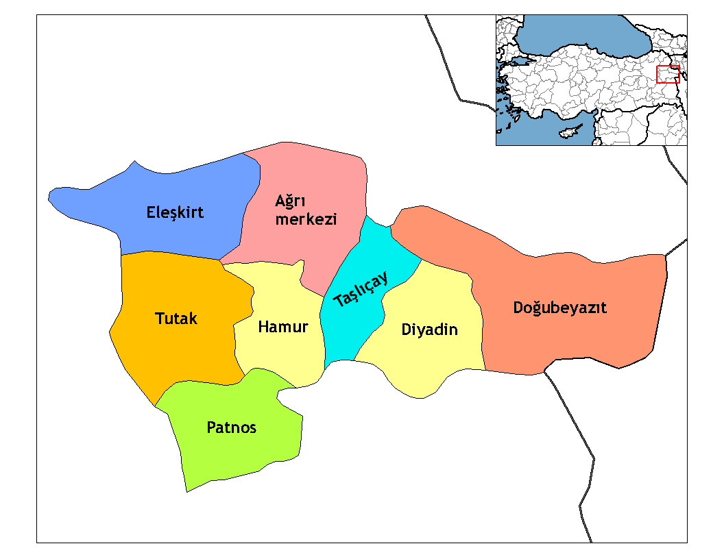
- Doğubeyazıt
-
For other uses, see Beyazid (disambiguation).

Doğubeyazıt(Armenian: Դարոյնք, Դարենից or Պակովան, Latin transliteration: Daroynk‘, Darenic‘ or Pakovan, Kurdish: Bazîd) is a city and district of Ağrı Province of Turkey, and is Turkey's most eastern district, the border crossing to Iran. Elevation 1625 m. Area 2.383 km². Population (2010) 115.354 (up from 73,794 in 1980) of which 69.447 live in the town of Doğubeyazıt, the remainder in the surrounding countryside. The mayor is Canan Korkmaz (BDP).
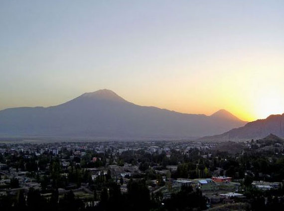
The town of Doğubeyazıt is a settlement with a long history. It lies 15 km southwest of Mount Ararat, 93 km east of the city of Ağrı and 35 km from the Iranian border. The town stands on a plain surrounded by some of Turkey's highest peaks including: Ararat (5,137m), Little Ararat (3,896m), Tendürek Dağı (3,533m), Kaletepe (3,196m) Arıdağı (2,934m) and Göllertepe (2,643m).
The weather on the plain is hot and dry in summer, cold and dry in winter.
Contents
History
- See Ağrı Province for the history of the wider area.
For most of the periods described there Doğubeyazıt was a bigger and more important settlement than the present-day provincial capital Ağrı, not least because this is the Iranian border crossing.
The area has had a rich history since it was settled during the times of the first Armenian Kingdom of Urartu (over 2700 years ago). Before the Ottoman empire the site was referred to by its Armenian name, Daroynk.[1] In the 4th century the Sasanians failed to capture the Armenian stronghold and royal treasury at Daroynk. Princes of the Bagratid dynasty of Armenia resided at Daroynk and rebuilt the fortress.[1] It was subsequently conquered by Persians, Romans, Arabs, and Byzantines all of whom would have used the plain to rest and recoup during their passages across the mountains. Turkish peoples arrived in 1064, but were soon followed by the Mongols and further waves of Turks. The castle of Daroynk was built and rebuilt many times throughout this history, although it is now named after the Turkish warlord Celayırlı Şehzade Bayazıt Han who ordered one of the rebuildings (in 1374). Ultimately, the town was renamed Beyazit itself in the 16th century.
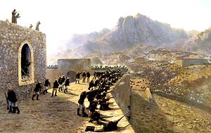
After its conquest by the Ottoman Empire in 1514 the area was ruled by Turkish generals, later including İshakpaşa, who built the palace that still bears his name.
The town saw fighting in the Turko-Persian War of 1821-1822, was attacked by Russia in 1856, and taken by the Russians during the Russo-Turkish War of 1877-1878. When the Russians retreated many of the Armenian population left with them to build New Beyazit (now Gavar at Armenia) on the shore of lake Sevan.
The widely dispersed village of Bayazit was populated by Kurds in 1930, when the Turkish army destroyed it.[1]
Doğubeyazıt was further ravaged during World War I and the Turkish War of Independence and a newer city was built in the 1930s (hence the new Turkish name "Doğubeyazıt" which literally means "East Beyazıt").
Today

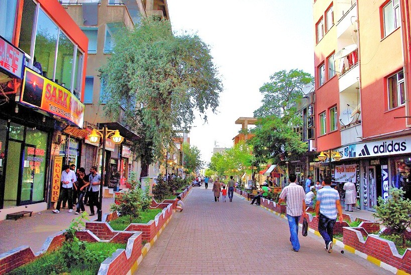
Today Doğubeyazıt is a small town with a predominantly Kurdish population[citation needed] serving an impoverished rural area on a high altitude, dry plain. There is high meadow for grazing on the sides of these mountains while the plain is used for grazing and for growing grains and grasses, mainly as winter foodstuff for livestock. The mountainsides are however insufficiently forested. Life on the mountainside is hard, with people living in mud houses. Apparently rice was grown here in the past and the land had more agricultural potential than today.
However Doğubeyazıt is secure at the moment[when?] and attracts visitors to Mount Ağrı, who usually stop to see the Ishak Pasha Palace and other historical monuments, and others crossing the border to Iran. The economy of the town is boosted by providing food and accommodation (and many internet cafes) for these travellers and in the market in Doğubeyazıt there is a small trade in cheap manufactured goods from Iran and beyond. There is also a strong military presence on the border which also benefits the shops, cafes, billiard halls and restaurants of Doğubeyazıt.
In January 2006, Doğubeyazıt was the centre of a H5N1 bird flu outbreak.[2] Several children died from the disease after playing with chicken carcasses.
The Doğubayazıtspor football club plays in the lower divisions of the Turkish football league. It played in the Turkish Third League for three seasons.
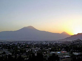 Doğubeyazıt morning
Places of interest
- Mount Ararat - 15 km from Doğubeyazıt, and the best views of the mountain are from here.
- The second-largest meteor crater in the world, just on the Iranian border about 35 km east of the town. (39°21′13″N 43°52′17″E / 39.35354°N 43.87150°E). (although as this is on the (militarised) border it is difficult to visit).
- On a hill to the south of town, there is the Ishak Pasha Palace, completed in 1784.
- The castle and mosque of Old Beyazit, first built by the Urartu but which bear traces of many civilisations.
- The "Noah's Ark National Park" including the "Durupinar" site is up in the hills east of town and south of the main highway.
- Balık Gölü - a lake in a lava bed, 60 km from Doğubeyazıt, near Taşlıçay.
- The Ice Cave - on the side of Little Ararat near the village of Hallaç.
- The ruins of the 900BC Urartu temple and palace on the hill of Giriktepe.
- The ancient Armenian cemetery.[1]
International relations
Twin towns — Sister cities
Doğubeyazıt is twinned with:
 Eilat, Israel
 Podgorica, Montenegro
 Montevideo, Uruguay
 Kitwe, Zambia
- Lusaka, Zambia
 Bulayawo, Zimbabwe
 Kosovska Mitrovica, Serbia
 Gothenburg, Sweden
- Karlstad, Sweden
 Timbuktu, Mali
 Bergen, norway
 Turku, finland
 saarbrücken, germany
 N'djamena, Chad
 esbjerg, denmark
References
- ^ a b c d Bayazit, Iranica Enc., by R. W. Edwards
- ^ Turkey Bird Flu Region Still Wary - BBC article about Doğubeyazıt outbreak
 Doğubeyazıt in Ağrı Province (in the Eastern Anatolia region) of Turkey
Urban districts 
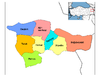
Rural districts RegionsAegean Black Sea Central Anatolia Eastern Anatolia Marmara Mediterranean Southeastern Anatolia Categories:- Districts of Ağrı
- Eastern Anatolia Region
- Doğubeyazıt
- Iran–Turkey border crossings


Wikimedia Foundation. 2010.