- Mount Ararat
-
This article is about the tallest mountain in Turkey. For the biblical toponym, see Mountains of Ararat.
Mount Ararat 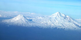
Satellite picture of Mount AraratElevation 5,137 m (16,854 ft)
See Elevation sectionProminence 3,611 m (11,847 ft)
Ranked 48thListing Country high point
UltraLocation Ağrı, Doğubayazıt,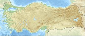
 Mount Ararat
 Turkey[1]
Range Armenian Highland Coordinates 39°42.113′N 44°17.899′E / 39.701883°N 44.298317°ECoordinates: 39°42.113′N 44°17.899′E / 39.701883°N 44.298317°E[2] Geology Type Stratovolcano Last eruption 1840[3] Climbing First ascent 1829
Dr. Friedrich Parrot and
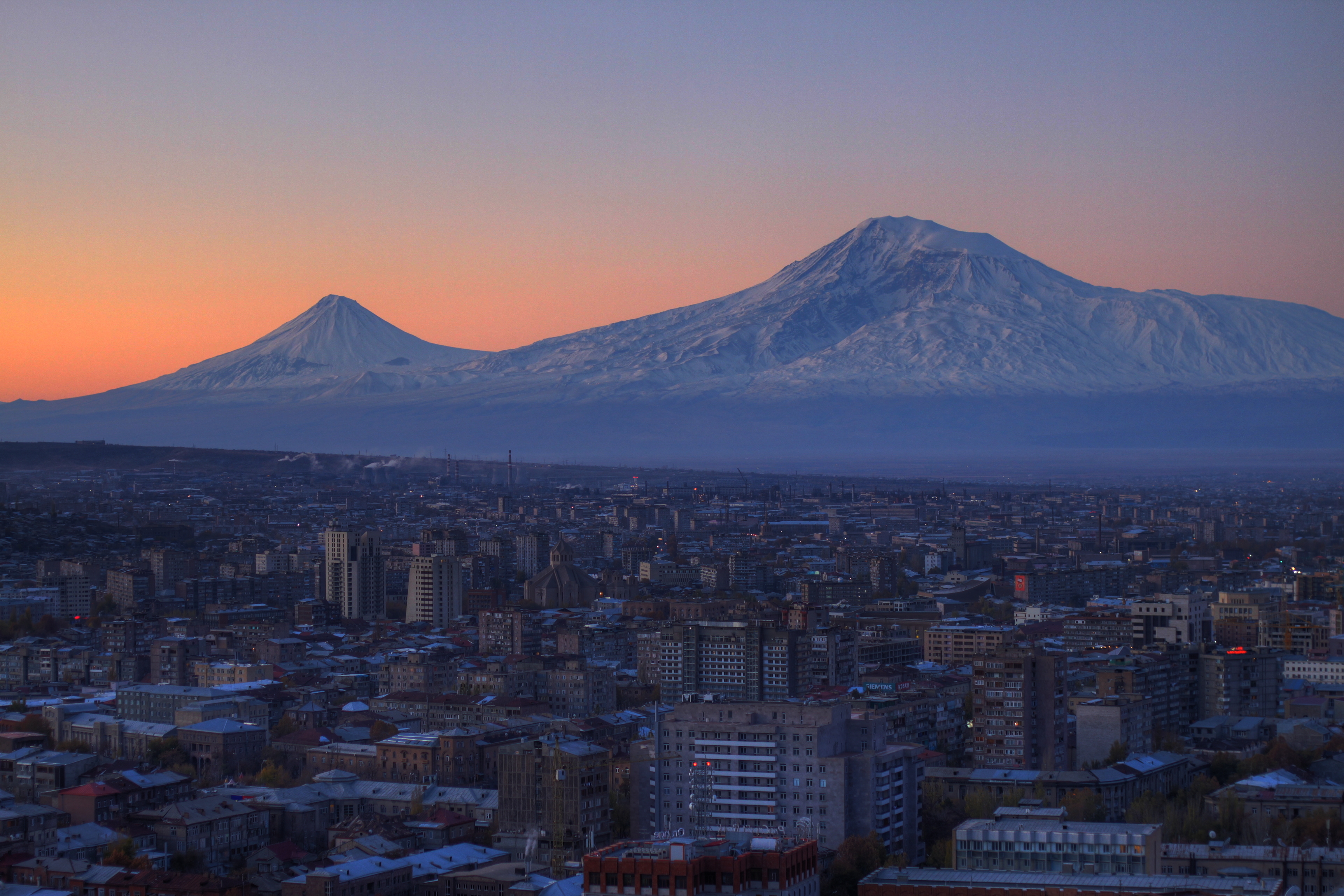
Khachatur Abovian[4]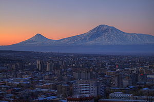 Mt. Ararat in the backdrop of Yerevan, the Armenian capital.
 View of Ararat from Iğdır, Turkey.
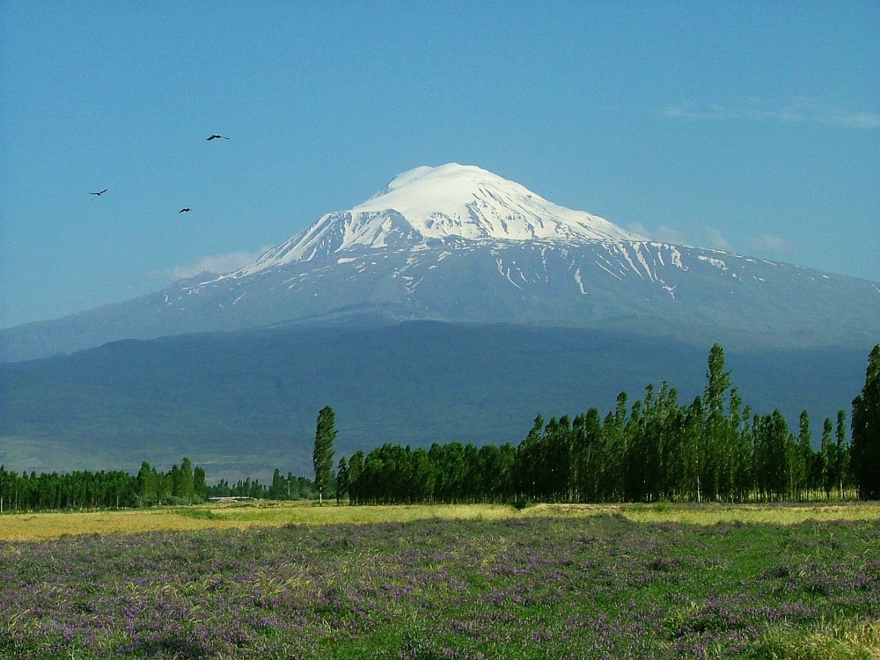
Mount Ararat (see below details on names) is a snow-capped, dormant volcanic cone in Turkey. It has two peaks: Greater Ararat (the tallest peak in Turkey, and the entire Armenian plateau with an elevation of 5,137 m/16,854 ft) and Lesser Ararat (with an elevation of 3,896 m/12,782 ft).
The Ararat massif is about 40 km (25 mi) in diameter. The Iran-Turkey boundary skirts east of Lesser Ararat, the lower peak of the Ararat massif. It was in this area that by the Tehran Convention of 1932 a border change was made in Turkey's favor, permitting her to occupy the eastern flank of the massif.[5]
Mount Ararat in Judeo-Christian tradition is associated with the "Mountains of Ararat" where according to the book of Genesis, Noah's ark came to rest. It also plays a significant role in Armenian nationalism and irredentism.
Contents
Names and etymology
- Ararat - The Bible says that Noah's ark landed on the mountains of Ararat. This does not refer to any specific mountain or peak, but rather a mountain range within the region of Ararat, which was the name of an ancient proto-Armenian kingdom also known as Urartu.[6] Nonetheless, one particular tradition identifies the mountain as Mount Masis, the highest peak in the Armenian Highland, which is therefore called Mount Ararat.[6] (As opposed to the Armenian and European tradition, Semitic tradition identifies the mountain as Judi Dagh located in Turkey near Cizre.)[note 1] According to the medieval Armenian historian Moses of Khoren in his History of Armenia, the plain of Ayrarat (directly north of the mountain) got its name after King Ara the Handsome[7] (the great grandson of Amasya). Here the Assyrian Queen Semiramis is said to have lingered for a few days after the death of Ara.[7] According to Thomson, the mountain is called Ararat (Armenian: Արարատ) corresponding to Ayrarat, the name of the province.[note 2][note 3]
- Ağrı Dağı (Mountain of Ağrı) - The Ottoman Turkish name was Aghur Dagh اغـر طﺎﻍ [note 4] means heavy mountain. Since Ağrı literally means "pain" in Turkic languages such as Azeri and Turkish, the toponym has been popularly rendered as "Painful Mountain". It is almost certainly, however, a borrowing of the Kurdish toponym. Ağrı is also a province in the Eastern Anatolian Region of Turkey, which derived its name from the mountain in 1949.[8] During the Ottoman Empire era the Ağrı village was originally called Karakilise (black church).[9]
- Masis (Armenian: Մասիս) - is the Armenian name for the peak of Ararat, the plural Masikʿ (Armenian: Մասիք) may refer to both peaks.[7] The History of Armenia derives the name from a king Amasya, the great-grandson of the Armenian patriarch Hayk, who is said to have called the mountain Masis after his own name.[7]
- Çiyayê Agirî (Fiery Mountain), Çiyayê Alavhat and Grîdax (Kurdish): This entire tree name referred a volcanic characteristic of Mount Ararat. It is the only name to have a clear, descriptive etymology while also indicating the preservation of folk memory.[9]
- Kuh-e-Nuh (Noah's Mountain): (Persian: کوه نوح, IPA: [ˈkuːhe ˈnuːx], Kuh-e Nuh) , also influenced by the flood story, this time via the Islamic view of Noah.[9]
Geography
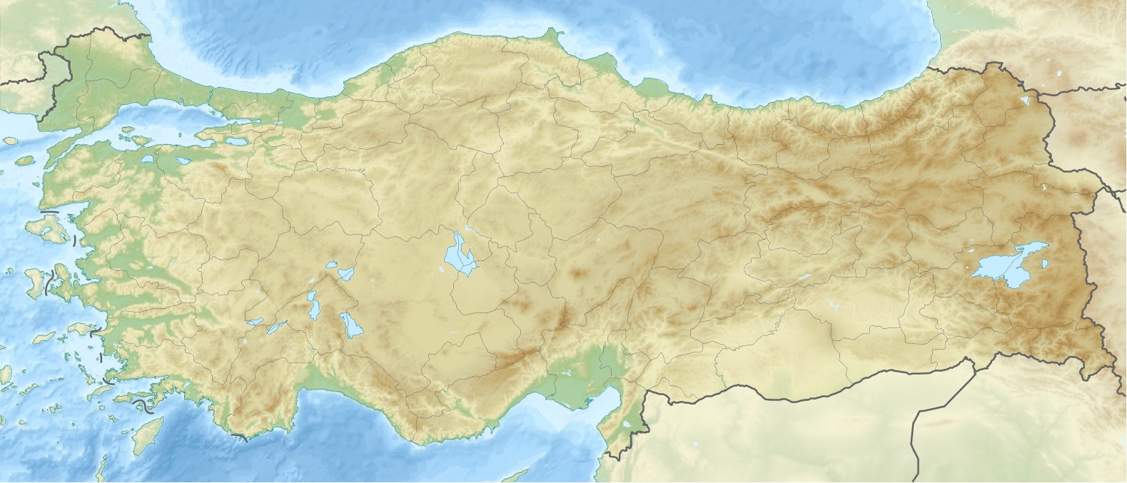
Mount Ararat is located in the Eastern Anatolia Region of Turkey between Doğubayazıt and Iğdır, near the border with Iran, Armenia and Nakhchivan exclave of Azerbaijan, between the Aras and Murat Rivers.[1] Its summit is located some 16 km (10 mi) west of the Iran and 32 km (20 mi) south of the Armenian border. The Ararat plain runs along its northwest to western side.
Geology
Ararat is a stratovolcano, formed of lava flows and pyroclastic ejecta, with no volcanic crater. Above the height of 4,100 m (13,451 ft), the mountain mostly consists of igneous rocks covered by an ice cap.[10] A smaller 3,896 m (12,782 ft) cone, Little Ararat, rises from the same base, southeast of the main peak. The lava plateau stretches out between the two pinnacles. The bases of these two mountains is approximately 1,000 km2 (386 sq mi).[11] The formation of Ararat is hard to retrieve geologically, but the type of vulcanism and the position of the volcano raise the idea that subduction relation vulcanism occurred when the Tethys Ocean closed during the Neogene.[12]
Elevation
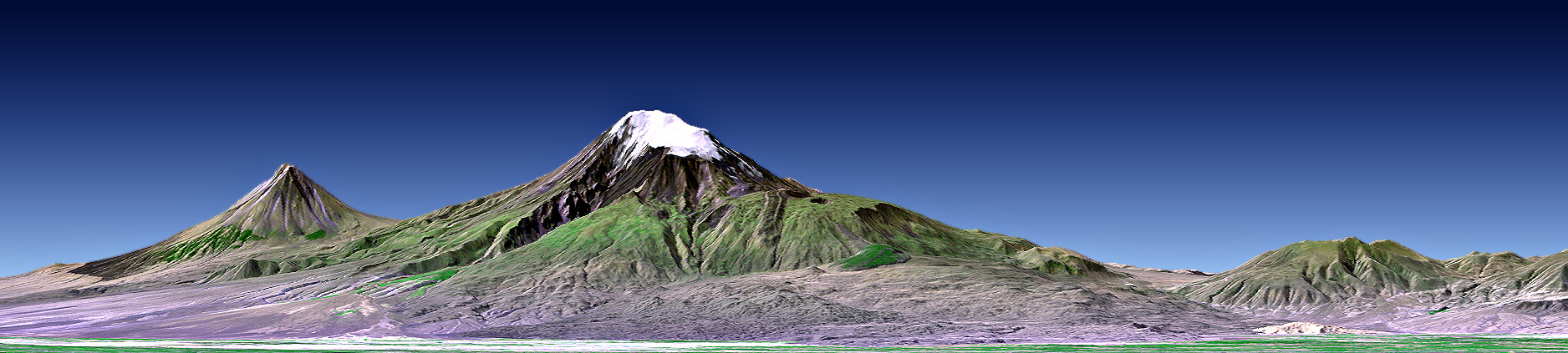
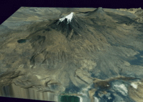 Mont Ararat 3D
An elevation of 5,165 m (16,946 ft) for Mount Ararat is still given by some authorities. However, a number of other sources, such as public domain and verifiable SRTM data[13] and a 2007 GPS measurement show that the alternatively widespread figure of 5,137 m (16,854 ft) is probably more accurate, and that the true elevation may be even lower due to the thick layer of snow-covered ice cap which permanently remains on the top of the mountain. 5,137 m is also supported by numerous topographic maps.[14]
Activity
It is not known when the last eruption of Ararat occurred; there are no historic or recent observations of large-scale activity recorded. It seems that Ararat was active in the 3rd millennium BC; under the pyroclastic flows, artifacts from the early Bronze Age and remains of human bodies have been found.[3]
However, it is known that Ararat was shaken by a large earthquake in July 1840, the effects of which were largest in the neighborhood of the Ahora Gorge (a northeast trending chasm that drops 1,825 metres (5,988 ft) from the top of the mountain). An unstable part of the northern slope collapsed and a chapel, a monastery, and a village were covered by rubble. According to some sources, Ararat erupted then as well, albeit under the ground water level.[3]
Climbing Mount Ararat
First recorded ascent in modern times
Dr. Friedrich Parrot, with the help of Khachatur Abovian, was the first explorer in modern times to reach the summit of Mount Ararat, subsequent to the onset of Russian rule in 1829.[4] Abovian and Parrot crossed the Aras River and headed to the Armenian village of Agori situated on the northern slope of Ararat 4,000 feet above sea level. Following the advice of Harutiun Alamdarian of Tbilisi, they set up a base camp at the Monastery of Saint Jacob some 2,400 feet higher, at an elevation of 6,375 feet. Abovian was one of the last travelers to visit Agori and the monastery before a disastrous earthquake completely buried both in May 1840. Their first attempt to climb the mountain, using the northeastern slope, failed as a result of lack of warm clothing.
Six days later, on the advice of Stepan Khojiants, the village chief of Agori, the ascent was attempted from the northwestern side. After reaching an elevation of 16,028 feet they turned back because they did not reach the summit before sundown. They reached the summit on their third attempt at 3:15 p.m. on October 9, 1829. Abovian dug a hole in the ice and erected a wooden cross facing north. Abovian also picked up a chunk of ice from the summit and carried it down with him in a bottle, considering the water holy. On November 8, Parrot and Abovian climbed up Lesser Ararat. Impressed with Abovian's thirst for knowledge, Parrot arranged for a Russian state scholarship for Abovian to study at the University of Dorpat in 1830. In 1845, the German mineralogist Otto Wilhelm Hermann von Abich climbed Ararat with Abovian. Abovian's third and last ascent to Ararat was with the Englishman Henry Danby Seymour in 1846.
Later ascents
Date Person(s) climbed Comment October 9, 1829 Johann Jacob Friedrich Wilhelm Parrot and Khachatur Abovian First ascent of the summit of Mount Ararat[4] Started from the monastery of St. Jacob (Surb Hakob) and made the ascent by the north-western slope. August 5, 1834 Kozma Spassky-Avtonomov Climbed Ararat from Akori, to prove that the stars could be seen at noon and used ice from the summit to baptize his son[15] August 8–9, 1835 Karl Behrens[15] Imperial Russian Georgraphical Society attested to the expedition. July 29, 1845 Otto Wilhelm Hermann von Abich Armenian guide led him up the southeastern face from Sardar Bulak, a Cossack station with a well, located in the middle of the wide semicircular valley or sloping plain between Greater and Lesser Ararat. Abich I & II Glaciers named after him.[15] Climbed western and eastern summit.[4] They climbed from Sardar Bulak. 1846 Henry Danby Seymour With 2 Armenians and a Cossack officer[15] Climbed from New Akori. August 1–9, 1850 Iosif Khodko (Иосиф Ходько), P.H. Moritz, N. V. Khanikov and many others Ascended from Sardar Bulak. Six days were spent on top of Mt. Ararat[15] June 29, 1856 English Major Robert Stuart With major Alick J. Fraser, Reverend Walter Thursby, James Theobald, John Evans of Darley Abbey. They climbed from Bayazid. August 31, 1876 James Bryce He was alone. And he founded a timber at 3965 m (13,500 ft)[15] He climbed from Sardar Bulak. 1878 G. P. Baker He climbed from Sardar Bulak. 1882 Sivoloboff August 13, 1888 Yevgeniy Markov With Ivan Kovalewski and Mosokevich (young lady)[15] They climbed from Saradar Bulak. 1888 Semenoff 1889 Raphalovich and others He climbed from Sardar Bulak. July 4, 1891 Thomas Gaskell Allen, Jr. and William Lewis Sachtleben [4] First American ascent of the summit of Mount Ararat [4] He climbed from Bayazid. 1893 Postukhoff He climbed from Sardar Bulak. October 1893 H. F. B. Lynch With Rudolph Taugwalder[15] and H. B. Lynch 1897 Herr A. Oswald[15] Eine Besteigung des Ararat, Alpenclub, Berne, 1899–1900, vol. XXXV. pp. 157–183 September 5, 2009 Erik Weihenmayer, Edwin Albert Weihenmayer, Gökmen Önay, Bahar Ganjavi, Behrouz Khabbaz Beheshti, Seyed Hassan Moghimi [16] Erik Weihenmayer is first known blind person to reach the summit of Mount Ararat. Group guided by Gökmen Önay from Turkey. Hassan Moghimi Iran, born without one hand and he is professional cyclist.[16] Climbing routes
The climb is long, but there is a fairly easy route from the south in late summer for climbers who are familiar with the use of axe and crampons. Snow covers the last 400 m (¼ mile) year-round.[citation needed] There are two possible campsites on the mountain, and the glacier begins around 4,800 m (15,750 ft).[citation needed]
Climbing permits and guides
The Turkish government requires a climbing permit and use of a certified Turkish guide. Arrangements can take two months to complete.[citation needed].
 A three dimensional model that shows both peaks.
Association with Noah
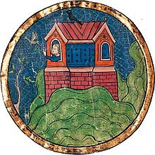 Depiction of Noah's ark landing on the "mountains of Ararat", from the North French Hebrew Miscellany (13th century)Main article: Mountains of AraratFurther information: Searches for Noah's Ark
The name "Ararat" for the peak derives from the tradition linking it with the Biblical Mountains of Ararat where Noah's Ark came to rest after the great flood (Genesis 8:4).
The identification of Mount Ararat with these biblical mountains is ancient, entering Western Christianity with in the 4th century with Jerome's reading of Josephus. The Vulgata renders the Hebrew hārəy Ǎrārāṭ as montes Armeniae.
In eastern tradition (Syriac and Quranic), the biblical mountains are associated with Mount Judi in what is now northwestern Iran. But by the medieval period, the western tradition appears to have eclipsed the earlier association with Mount Judi even in Eastern Christianity, and the Mount Judi tradition is now mostly confined to the Islamic view of Noah.
Political boundaries
Mount Ararat forms a near-quadripoint between Turkey, Armenia, Azerbaijan and Iran. Its summit is located some 16 km (10 mi) west of both the Iranian border and the border of the Nakhchivan exclave of Azerbaijan, and 32 km (20 mi) south of the Armenian border.
The Turkish-Armenian-Azerbaijani and Turkish-Iranian-Azerbaijani tripoints are actually some 8 km apart, separated by a narrow strip of Turkish territory containing the E99 road which enters Nakhchivan at 39°39′19″N 44°48′12″E / 39.6553°N 44.8034°E.
The international boundaries as described have been in effect since the 1991 independence of both Azerbaijan and Armenia, but they have a longer history, having been drawn in 1923 after the conflicts of World War I and the dissolution of the Ottoman Empire that affected the region, in particular the Armenian–Azerbaijani War of 1918 to 1920, and the creation of the Republic of Turkey in the Treaty of Lausanne of 1923 regulating the Partitioning of the Ottoman Empire. From 1923 to 1991, the border between Armenia and Azerbaijan was an internal border within the Soviet Union, between the Armenian SSR and the Nakhichevan SSR, the tripoint between Turkey, Iran and the Soviet Union from 1923 to 1991 corresponding to the current Turkish-Iranian-Azerbaijani tripoint. Prior to World War I, the area had been part of the Ottoman Empire, deriving from the conquests of Suleiman the Magnificent from Safavid Persia in the 1540s to 1550s.
Because of the political instability in Southeast Turkey, Ararat has been a militarized zone for much of the 20th century and was opened for tourism only in 2001. Since 2004, Ararat has been part of a natural reserve.
Significance in Armenian nationalism
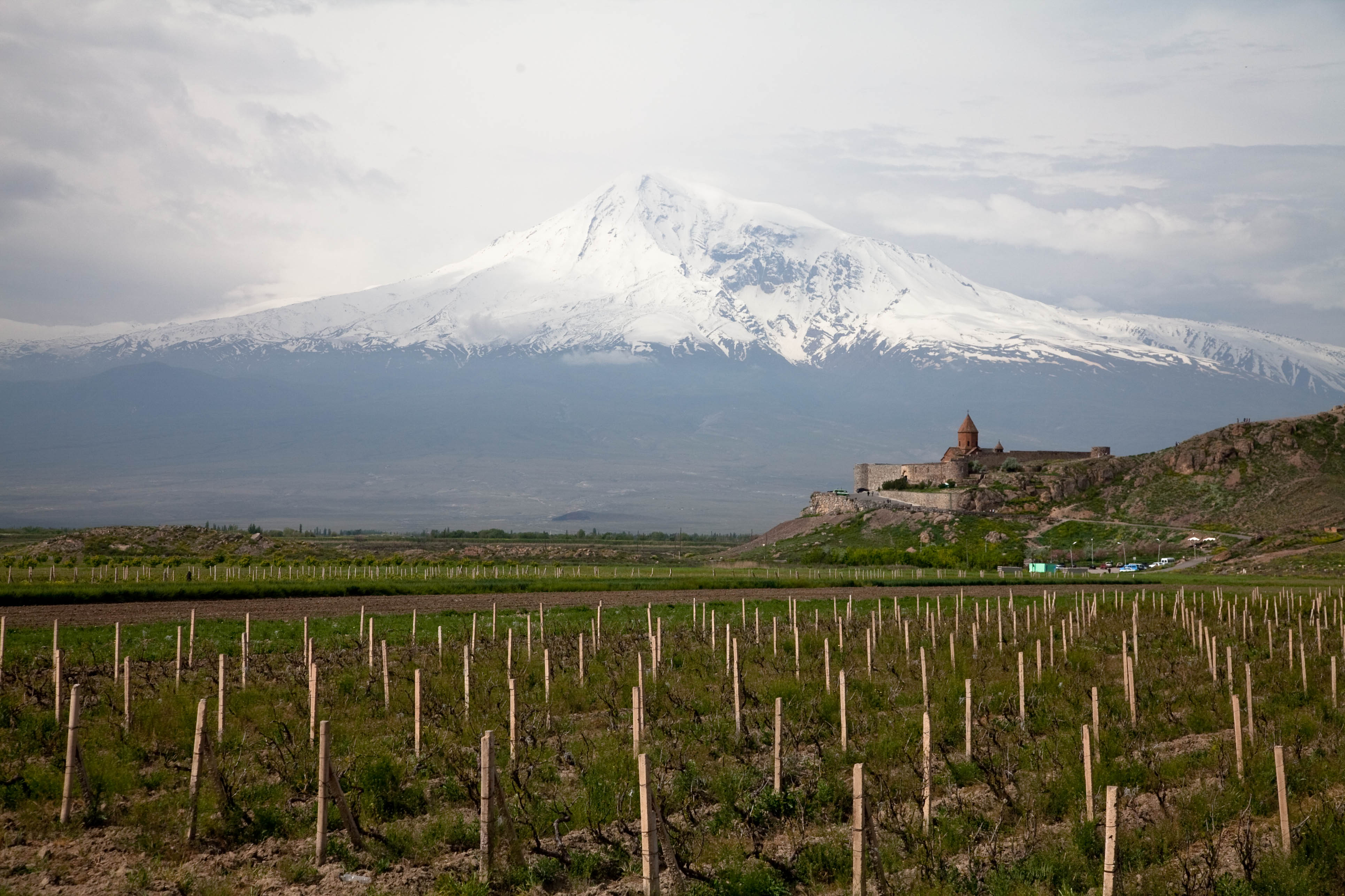
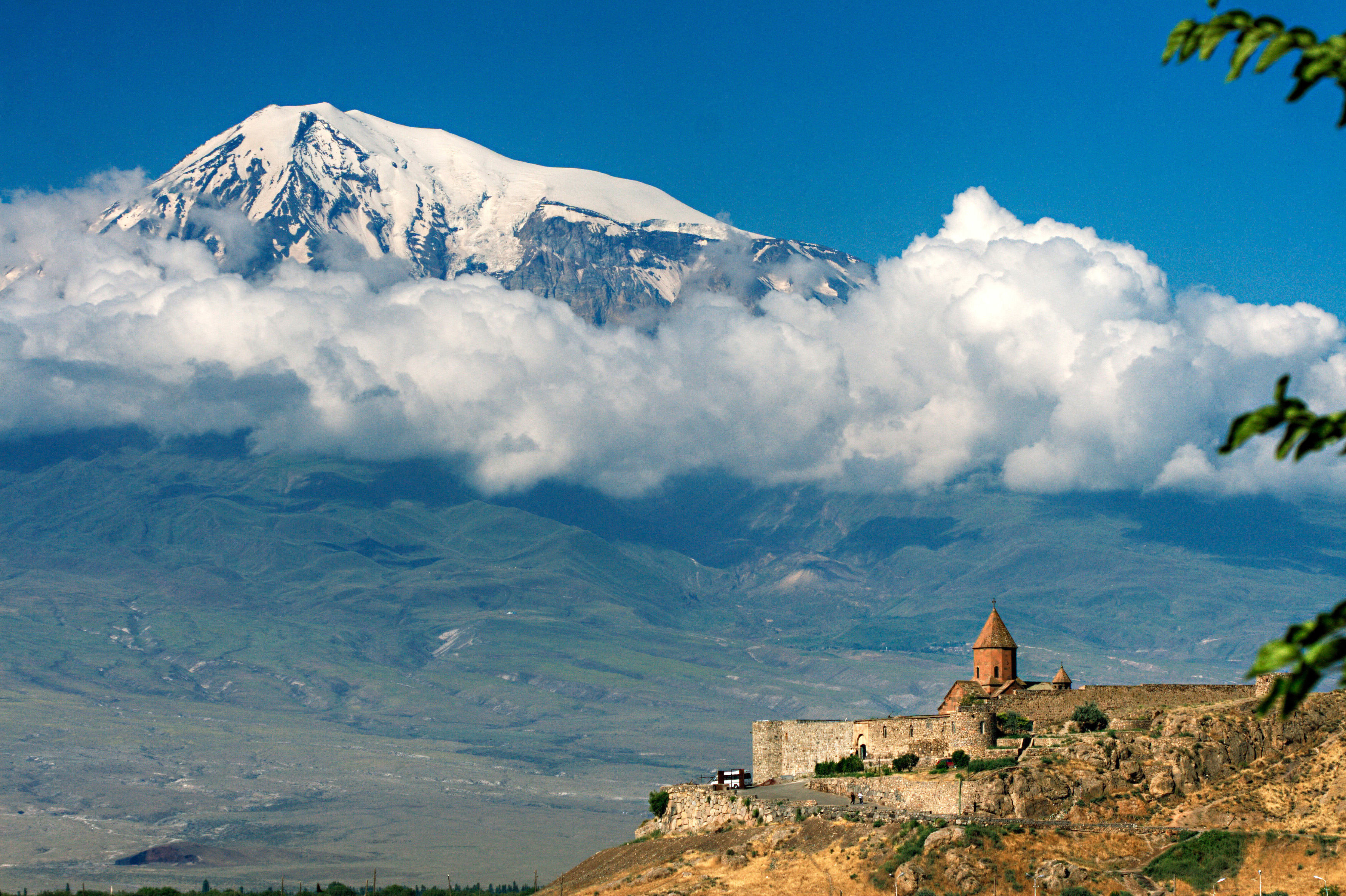
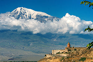 View of Ararat from Khor Virap, Armenia.Main article: Armenian nationalism
Ararat dominates the skyline of Armenia's capital, Yerevan.[17] Mount Ararat has been revered by the Armenians as symbolizing their national identity and their irredentism. Ararat is the national symbol of the 1991 Republic of Armenia, being featured in the center of its coat of arms.[18] In 1937, a coat of arms was adopted. This coat of arms descends from that of the Armenian SSR, which featured Mount Ararat along with the Soviet hammer and sickle and red star behind it.[19] After the dissolution of the Soviet Union, a slightly modified version of the Democratic Republic of Armenia's coat of arms was adopted and has remained in place ever since.[18] The 2002 film Ararat by Armenian-Canadian filmmaker Atom Egoyan features Mt. Ararat prominently in its symbolism.
Mount Ararat was depicted on various Armenian dram banknotes issued in 1993-2001[note 5] and on the reverse of the Turkish 100 lira banknotes of 1972-1986.[note 6]
In Armenian mythology Mt. Ararat is the home of the Gods, much like Mt. Olympus is in Greek Mythology.
See also
- Mountains of Ararat
- 96205 Ararat is an asteroid named in the mountain's honor
- Volcanic Seven Summits
- Searches for Noah's Ark
Notes
- ^ "Against the Armenian (and European) tradition that makes Masis the landing place of Noah, the Semitic tradition associated this landing with the mountain called Judi Dagh (earlier called Ararad or Sararad) located in Kurdistan northeast of Mosul.", Hewsen, p. 15Hewsen 2001
- '^ "Masis: the Armenian name for the mountain south of the Araxes now called Ararat (by confusion with Ayrarat, the name of the province). (The Primary History, Sebeos, p. 10, offers a different etymology, from the personal name Marseak.)". Thomson, footnote on p. 91.Thomson 1978
- ^ Friedrich Murad, Ararat und Masis, Studien zur armenischen Altertumskunde und Litteratur, Heidelberg, 1900. (Frederick Cornwallis Conybeare in a 1901 review states that "To anyone acquainted with Armenia, to speak of Ararat as a mountain is as if you spoke of Wales as such."
- ^ Ağır Dağ in modern Turkish.
- ^ Mount Ararat was depicted in the following Armenian banknotes:
- On the reverse of the 10 dram banknotes issued in 1993 (10 Dram).
- On the reverse of the 50 dram banknotes issued in 1998 (50 Dram).
- On the obverse of the 100 dram banknotes issued in 1993 (100 Dram).
- On the obverse of the 500 dram banknotes issued in 1993 (500 Dram).
- On the reverse of the 50,000 dram banknotes issued in 2001 (50,000 Dram).
- ^ Central Bank of the Republic of Turkey. Banknote Museum: 6. Emission Group - One Hundred Turkish Lira - I. Series, II. Series & III. Series. – Retrieved on 20 April 2009.
References
- ^ a b Republic of Turkey Ministry of culture and tourism
- ^ 2007 GPS survey
- ^ a b c "Ararat". Global Volcanism Program, Smithsonian Institution. http://www.volcano.si.edu/world/volcano.cfm?vnum=0103-04-. Retrieved 2009-01-01.
- ^ a b c d e f Early American Expedition Of Mount Ararat
- ^ IBS No. 28 - Iran (IR) & Turkey (TU) 1964
- ^ a b "Ararat". Jewish Virtual Library. 2008. http://www.jewishvirtuallibrary.org/jsource/judaica/ejud_0002_0002_0_01234.html. Retrieved 27 July 2009.
- ^ a b c d Thomson, p. 90-98.Thomson 1978
- ^ Turkish law 5442 changing place and city name to Turkish
- ^ a b c Mount Ararat Information
- ^ Jamie C. Woodward (2009). The physical geography of the Mediterranean. Oxford University Press US. p. 355. ISBN 9780199268030. http://books.google.com/books?id=ESGTr14RyBgC&pg=PA355. Retrieved 5 June 2011.
- ^ Jr Thomas Gaskell Allen; William Lewis Sachtleben (24 May 2010). Across Asia on a Bicycle (Illustrated Edition). Echo Library. pp. 39–41. ISBN 9781406867824. http://books.google.com/books?id=Ji342XdCN3QC&pg=PA39. Retrieved 5 June 2011.
- ^ Eldridge M. Moores; Rhodes Whitmore Fairbridge (30 November 1997). Encyclopedia of European and Asian regional geology. Springer. p. 132. ISBN 9780412740404. http://books.google.com/books?id=aYRup5mRcGsC&pg=PA132. Retrieved 5 June 2011.
- ^ SRTM data for Mount Ararat
- ^ Detailed topographic maps of Mount Ararat
- ^ a b c d e f g h i Mount Ararat Search Expeditions & Early Ascents
- ^ a b Erik Weihenmayer's Blog
- ^ "Ararat, Mount :: Mount Ararat — Britannica Online Encyclopedia". Britannica.com. http://www.britannica.com/EBchecked/topic-art/32131/15319/Yerevan-Armenia-with-Mount-Ararat-in-the-background. Retrieved 2008-11-11.
- ^ a b "Armenia: Coat of arms". Crwflags.com. http://www.crwflags.com/fotw/Flags/am).html. Retrieved 2008-11-11.
- ^ "Armenia in the Soviet Union". Flagspot.net. http://flagspot.net/flags/su-am.html. Retrieved 2008-11-11.
Bibliography
- ^ Hewsen, Robert H. (2001), Armenia: A Historical Atlas (1st ed.), Chicago, IL: University of Chicago Press, ISBN 0-226-33228-4, http://www.press.uchicago.edu/Misc/Chicago/332284.html
- ^ Moses of Khoren; Thomson, Robert W. (1978). History of the Armenians. Cambridge, Massachusetts: Harvard University Press. ISBN 0-674-39571-9.
External links
Mountains of TurkeyTwo main ranges Mountains Acıgöl • Akdağ • Aktaş • Ağrı (Ararat) • Babadağ • Beşparmak (Latmus) • Davraz • Dilek (Mycale) • Erciyes • Erek • Göllü • Hasan • Honaz • Kaçkar • Kadifekale • Karacadağ • Karadag • Karagöl • Kaz (Ida) • Kula • Küçük Ağrı • Madur • Mahya • Nemrut • Nemrut (volcano) • Nif • Palandöken • Spil • Sultan • Süphan • Şaphane • Tendürek • Topçambaba • Uludağ • Yamanlar • ZurbahanCategories:- Volcanoes of Turkey
- Stratovolcanoes
- Iğdır Province
- Ağrı Province
- National symbols of Armenia
- Places illustrated on Turkish banknotes
- Mythological mountains


Wikimedia Foundation. 2010.