Mount Ararat (Pennsylvania)
- Mount Ararat (Pennsylvania)
-
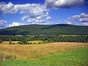
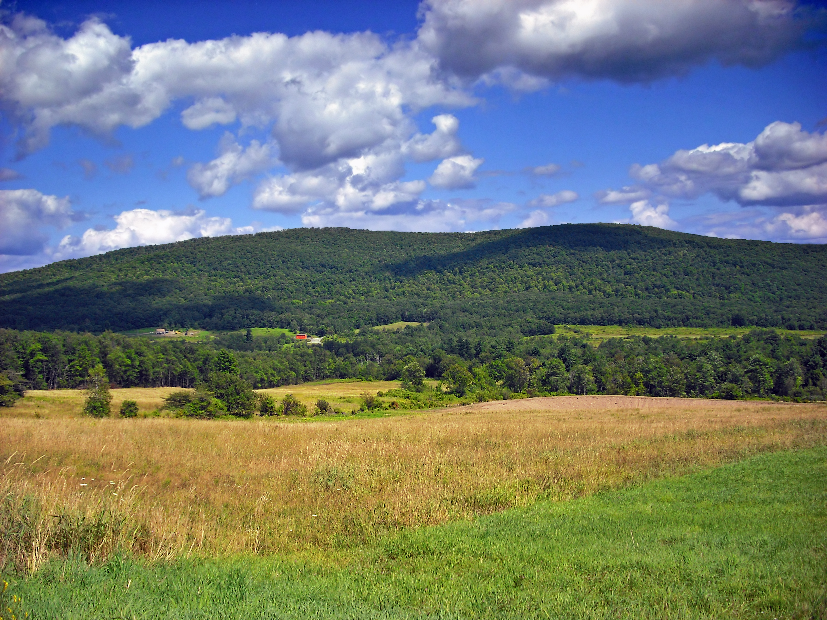
Mount Ararat is the highest point in Wayne County, and one of the higher points in the eastern part of Pennsylvania. Mount Ararat is located in the Glaciated Low Plateaus section of Pennsylvania's geology. This section is characterized with low rolling hills and modest relief. This summit is of low relief but stands as a peak above the countryside.
The west and north sides of Mount Ararat drain into the East Branch of the Lackawanna River, thence into the Susquehanna River, and into Chesapeake Bay. The east side of Ararat drains into the West Branch of the Lackawaxen River, thence into the Delaware River, and into Delaware Bay.
Notes
References
Categories:
- Mountains of Pennsylvania
- Geography of Wayne County, Pennsylvania
- Pennsylvania geography stubs
Wikimedia Foundation.
2010.
Look at other dictionaries:
Ararat — may refer to:*Ararat, a common first name for Armenian males (pronounced Ararad in Western Armenian) *Ararat / Araratian, a common family name for Armenians (pronounced Ararad, Araradian in Western Armenian) *An Anatolian toponym **Mount Ararat… … Wikipedia
List of Pennsylvania locations by per capita income — Pennsylvania locations by per capita income is a list of all incorporated areas and census designated places in Pennsylvania ranked from highest capita income to lowest per capita income. There are many communities not on the list because they… … Wikipedia
Preston Township, Pennsylvania — Geobox Township name = Preston Township native name = other name = other name1 = category = Township image size = image caption = Mount Ararat in Preston Township flag size = symbol = symbol size = nickname = motto = country = United States state … Wikipedia
Wayne County, Pennsylvania — Infobox U.S. County county = Wayne County state = Pennsylvania map size = 225 founded = March 21, 1798 seat = Honesdale | largest city = Honesdale area total sq mi =751 area water sq mi =21 area percentage = 2.84% census yr = 2000 pop = 47722… … Wikipedia
Noah's Ark — Noah s Arc redirects here. For the TV series, see Noah s Arc (TV series). For other uses, see Noah s Ark (disambiguation). An 1846 painting by the American folk painter Edward Hicks, depicting the animals boarding Noah s Ark in pairs. Noah s Ark… … Wikipedia
mountain — mountainless, adj. /mown tn/, n. 1. a natural elevation of the earth s surface rising more or less abruptly to a summit, and attaining an altitude greater than that of a hill, usually greater than 2000 ft. (610 m). 2. a large mass of something… … Universalium
Armenian Soviet Socialist Republic — Армянская Советская Социалистическая Республика Հայկական Սովետական Սոցիալիստական Հանրապետություն … Wikipedia
Mordecai Manuel Noah — Noah s book Travels in England, France, Spain, and the Barbary States, in the Years 1813 14 and 15 Mordecai Manuel Noah (July 14, 1785, Philadelphia, Pennsylvania – May 22, 1851, New York) was an American playwright, diplomat, journalist, and… … Wikipedia
James Irwin — Infobox Astronaut name = James Benson Irwin type = Astronaut nationality = American date birth = March 17, 1930 date death = death date and age|1991|8|8|1930|3|17 place birth = Pittsburgh Pennsylvania place death = Glenwood Springs Colorado… … Wikipedia
Gilgamesh flood myth — The Gilgamesh flood myth is a deluge story in the Epic of Gilgamesh . It was added as Tablet XI to the ten original tablets of the Gilgamesh Epic by an editor who copied or altered parts of the flood story from the Epic of Atrahasis. [ Tigay… … Wikipedia