- Mount Arbel
-
Mount Arbel 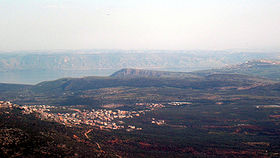
Elevation 181 m (594 ft) above sea level Prominence 380 m (1,247 ft) Location Israel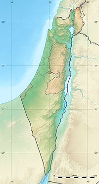
 Mount Arbel
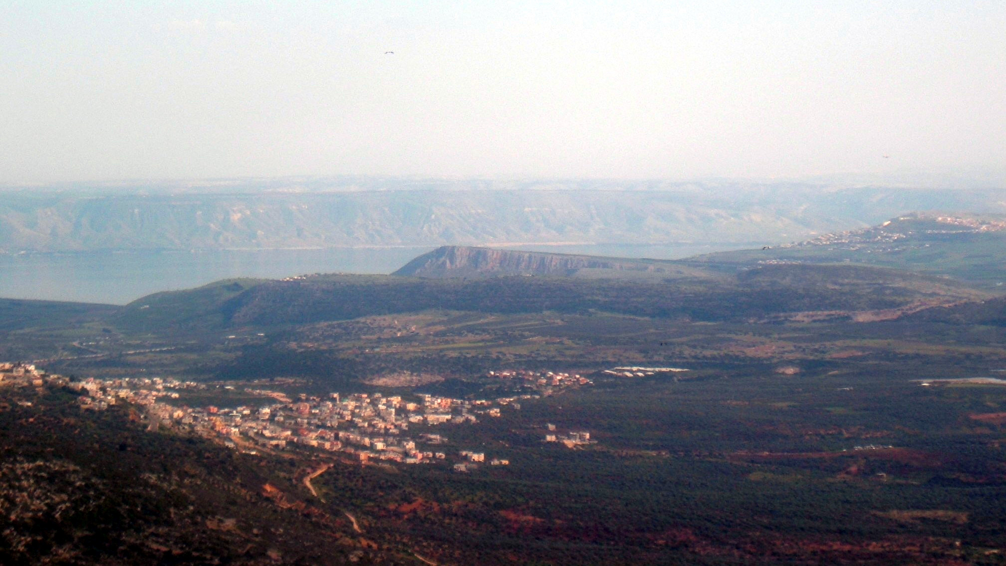
Coordinates 32°49′26″N 35°30′25″E / 32.824°N 35.507°ECoordinates: 32°49′26″N 35°30′25″E / 32.824°N 35.507°E Mount Arbel (Hebrew: הר ארבל, Har Arbel) is a mountain in The Lower Galilee near Tiberias in Israel, with high cliffs, views of Mount Hermon in the Golan Heights, trails to a cave-fortress, and ruins of an ancient synagogue. Mt. Arbel sits across from Mount Nitai; their cliffs were created as a result of the Syrian-African rift and the geological faults that produced the valleys.
There are four villages on the mountain: Kfar Zeitim, Arbel, Kfar Hittim, and Mitzpa. The peak, at 181 metres above sea level (380 metres above the surrounding area), dominates the surroundings (much of the area is below sea level) and from the lookout atop the mountain, almost all of the Galilee into the Golan Heights including Safed, Tiberias and most of the Sea of Galilee, is visible.
Contents
History
Nearby are the ruins of an ancient Jewish settlement with a Synagogue from the fourth century C.E. with extend pews and columns, and dug into the mountain itself are a number of cliff dwellings. The extant cliff dwellings are from the 17th century and were built by the Druze. There are documented Jewish cliff dwellings dating back to the Second temple period, in the area, few standing stones left from synagogues from that period. Josephus writes about the Roman conquest of some of the last Hasmonean rebels who dwelt in the cliffs of Mt Arbel.[citation needed]
Nature reserve and national park
The area was declared a nature reserve in 1967, covering 1400 dunams.[1] The national park (8509 dunams) includes most of Nahal Arbel, that begins near Eilabun and empties into the Sea of Galilee near Migdal. The reserve covers the immediate area around the cliff.[2]
On the south side of the cliff, there is a gradual prolonged climb through agricultural and pasture land while on the other[clarification needed], there is a very steep 400 meters drop. At the top of the steeper Northern side, there are metal handholds driven into the rock because the climb is so steep. Below that are a series of switchbacks that eventually lead to the Bedouin village of Hamaam.
Mt. Arbel, with its 110 metre vertical drop, is the only known mountain in Israel to serve as a base jumping site.[citation needed] A hike to the top of Mount Arbel from the south is included in the Israel National Trail, and an approach from the west is part of the Jesus Trail; the trails converge temporarily at the peak.
Development
In 2008, it was announced that a new golf course resort, designed by Robert Trent Jones, Jr. would be constructed at a cost of $150 million, on land owned by Kfar Hittim on Mount Arbel. The resort which should open in 2011, will cater for between 600-900 people as well as creating 300-400 jobs.[3]
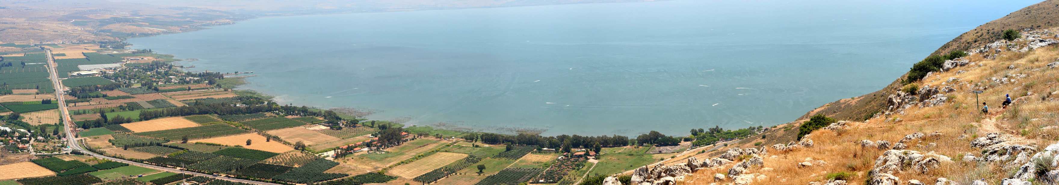
 Panoramic view of the Sea of Galilee from the Mountain
References
- ^ "List of National Parks and Nature Reserves" (in Hebrew). Israel Nature and Parks Authority. http://parks.org.il/sigalit/muchrazim.pdf. Retrieved 2010-10-06.
- ^ (in Hebrew) Nature and Parks Authority brochure, http://parks.org.il/sigalit/DAFDAFOT/arbel.pdf, retrieved 2010-10-06
- ^ "US-Israeli developer brings golf to Israel's historic Mount Arbel". israel21c.org. March 11, 2008. http://www.israel21c.org/bin/en.jsp?enDispWho=Articles%5El2019&enPage=BlankPage&enDisplay=view&enDispWhat=object&enVersion=0&enZone=Culture. Retrieved 2008-03-11.
External links
National parks of Israel Jerusalem District Bayt 'Itab · Canada Park · Castel · City of David National Park1 · Ein Hemed · Judaean Mountains · Tomb of Samuel1North District Achziv · Bar'am National Park · Beit Alfa Synagogue · Beit She'an · Beit She'arim · Belvoir Fortress · Capernaum · Chorazin · Gan HaShlosha · Hamat Gader · Hamat Tiberias · Harod Spring · Hermon National Park1 · Hexagons pool · Horns of Hattin · Hurshat Tal · Hurvat Minia · Kursi1 · Montfort Castle · Mount Arbel · Mount Tabor · Nimrod Fortress1 · Rosh HaNikra · Sde Amudim · Sussita · Tel Hazor · Tel Kedesh · Tel Megiddo · Tzalmon Stream · Tzippori · Yehi'am Fortress · Hula ValleyHaifa District Central District Alexander stream · Arsuf · Hof HaSharon · Mazor Mausoleum · Migdal Afek · Palmachim beach · Rubin Stream · Sidna Ali · Tel Afek · Tel Gezer · Tzur Natan park · Yarkon National ParkSouthern District Ashkelon National Park · Avdat · Besor Stream · Beit Guvrin National Park · Ein Avdat · Ein Gedi · Eshkol Park · Mamshit · Masada · Monument to the Negev Brigade · Nitzana · Semekh caves · Shivta · Tel Arad · Tel Be'er Sheva · Tel Lachish · Tel ZafitJudea and Samaria Area 1 Located in the Israeli-occupied territories  Nature reserves of Israel
Northern District Ein Afek · Akhziv Islands · Alonei Yitzhak · Alonei Abba · Amud Stream · Nahal Ayun · Balfouria · Bitan Aharon · Nahal Betzet · Nahal Dishon · Dor Beach and Ma'agan Michael Islands · Ein Avazim · Ein Elah · Ein Nymphit · Ein Te'oh · Ein Yehuda · Nahal Gamal · Gamla nature reserve† · Snir Stream · Hermon nature reserve† · Nahal Hermon† · Hula Valley · Hurshat Tal · Hurshat Zakum · Kerem Ben Zimra · Nahal Kziv · Mount Arbel · Mount Carmel · Mount Gilboa · Mount Meron · Mount Tabor · Pa'ar Cave · Rosh HaNikra · Shamir-Nahal Rachum · Shimron · Nahal Taninim · Tel Anafa · Nahal Tavor · Tel Dan · Tel Shikmona · Nahal YehiamCentral District Adullam · Ashdod Nitzanim Sand Dune Park · Bnei Zion · Avshalom Cave · Ein Hemed · HaMasrek Reserve · Neot Kedumim · Nahal Poleg · Nahal Sorek · Tel Yitzhak · Te'omim Cave · UdimSouthern District Eilat Region Coral Beach Nature Reserve · Timna valley · Yotvata Hai-Bar† Located in the Israeli-occupied territories Categories:- Mountains of Israel
- National parks of Israel
- Nature reserves in Israel

Wikimedia Foundation. 2010.