- Okara District
-
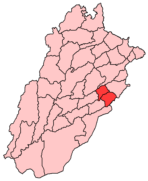
Okara District — District — Location of Okara in Punjab.
Coordinates: 30°48′05″N 73°26′54″E / 30.801380°N 73.448334°ECoordinates: 30°48′05″N 73°26′54″E / 30.801380°N 73.448334°E Country  Pakistan
Province Punjab Capital Lahore Established Government - District Nazim Syed Assad Ali Gilani - District Naib Nazim Population (1998) - Total 2,232,992 Time zone PST (UTC+5) District Council Number of Tehsils 3 Number of Union councils 10 Okara District (Urdu: ضلع اوکاڑہ) is a district of Punjab, Pakistan. The Multan Road connects the district capital, Okara with tLahore 110 km away. Okara began[when?] as a small town about 40 km from the city of Sahiwal. It later[when?] become a city in its own right. According to the 1998 census, the district had a population of 2,232,992 of which 12.84% were urban.[1] The postal code of Okara is 56300.[2]
Contents
History
The city is a relatively new agricultural city. During the period of British rule there was a jungle of Okaan where the city has been built. The word Okara for this district was actually originated from word Okan(A lush green tree with needle like leaves).The tree Okan gave birth to word Okanwali(Land of Okan)which ultimately finalized into Okara.[3] During British rule the area was part of Montgomery District and contained a large saltpeter refinery.[4] At partition one of the two textile mills that Pakistan got was the one at Okara. The mill was known as Sutlej textile mill and belonged to Aditya Birla Group. It was asia's biggest textile mill at that time. In 1982 the city became the headquarters of the newly created Okara District. Okara has had a railway line since 1892.[5]
Agriculture
Okara District is famous for its fertile lands, peaceful natural environment and green fields of potato, tomato, sugarcane, wheat, rice and maize crops. Oranges and Mangoes orchards are famous. The area of district Okara is the gold mine for history seekers, spiritual and curious travellers. One can find archaeological remains of different dynasties of prehistory, Indus civilization, Persians, Sultanates, the Mugal Empire, the Sikh Confederacy and the British Raj.
There is a central ridge, in the centre of Okara District, which marks the old river bed of the Beas, and the boundary b/w the eastern and western half of the district. The ridge descends from Kasur, all the way to Chunian, and then Shergarh in Okara. As you go west of the ridge, into Okara & Renala Khurd, the subsoil water is brackish, therefore the area is dependant on canals for irrigation. However, after you cross the ridge east into Depalpur Tehsil, the subsoil water is sweet and good for agriculture.
Okara District is also famous for the lemon, guava & grapefruit orchards, belonging to the food processing company, Mitchell's Fruit Farms Limited. The orchard runs for about 6 miles, along the LBDC, from Renala Khurd all the way up to the Okara bypass.
Language
Most of the urban people of the district speak the dialects of East Punjab, as a majority of the urban population in and around the major administrative towns of Okara & Renala Khurd have roots in that area, & belong mainly to the Arain & Ranghar clans. However, deviating from the main Lahore-Multan route, the accent starts changing to the Jaangli accent, which is more tinged by Seraiki than the Lahori accent. This has been the original tongue of the people back when irrigation was a distant facility, and most of the people used to rear cattle as the main occupation, along the courses of the rivers Ravi and Satluj. It is spoken by the natives of the Ravi belt (major towns include Gogera, Satghara, Mouza Meerak etc.) belonging to the Joiya Kharal, Baloch, Kathia, Kamiana & Jakhar clans, as well as the Satluj belt around Dipalpur(encompassing major towns such as Shergarh, Hujra Shah Muqeem, Haveli Lakha etc.) belonging to the Wattu, Bodla, Baloch, Bhatti & Jurrera clans.
Livestock
Okara is also famous for its cattle breed known as Sahiwal and a water buffalo breed known as Nili-Ravi. It is very rich in livestock population and production. The Livestock Production Research Institute Bahadar Nagar Farm is a very large Government farm near Okara city. The farm has large number of cows, buffalos, bulls (for reproduction), goats and sheep.
Infrastructure
Okara have all the basic physical and origanizational structures, services and facilities needed and necessary in a city. There are two stadiums of Okara district, in which one of them includes Football ground, Basketball court and Swimming pool for Sports. A new international hockey stadium is being constructed in Renala khurd Tehsil of Okara, which would be completed by 2013. This stadium will develop a strong infrastructure for hockey in the country.
There are also many small and considerable big parks for general public. The three main recreational parks are Ladies Park, Bagh-e-Jinnah and District Park.
Educational institutes include Education University, Cadet College, Govt. College for Boy, two Govt. Colleges for Women. There are also many privately owned colleges and schools, which are nationally recognised, well built, big and their standard of education is also high as comapred nationally.The District Public School and College, Okara (DPSC Okara) is a well known institute in the City , province and also the Country. These institutes include Morden science and computer labs, libraries, playgrounds and canteens.
There are various numerous public & private hospitals and clinics providing the health services. The popular and well equipped hospitals are District Govt. hospital, Shareef surgical hospital and C.M.H Okara Cantt. There is also a Social welfare health society which is being operated under the Govt. of Punjab. Every hospital has more than two ambulances. Located in the village of Rehmpur the Rosary Christian Hospital also provides medical services to Okara and surrounding areas.[6]
The 1122 Rescue Govt. organization is also offering their services in Okara city. There is also a separated Fire station, located in the centre of city, which have several old and also latest fire engines for safety services.
Okara also have a vast Railway station, which contain several platforms, where almost every train going from Islamabad to Karachi makes stop. There are two railway underpasses and one flyover which helps in smooth flow of traffic.
On 31 May 2005, the Ex-President General Pervez Musharraf inaugrated the Okara Bypass (30.786887° 73.459238°), lenegth of 12.7 KM, on GT road (N-5). This project was commenced on 5 September 2003, due to the great demand of the people of the area. It was completed at the cost of 628.17 Million rupees. This interchange proved very helpful in the smooth flow of national highway traffic, particularly between Lahore and Multan and to reduce the national traffic in the city. This bypasss connects the Karachi-Lahore-Peshawar national highway which is the economic lifeline of Pakistan.
Surroundings
Nearby cities are Sahiwal, Pakpattan, Depalpur, Basirpur, Renala Khurd and Haveli Lakha. There is a Famous Shrine of SUFI of Hazrat Sayed Shabeer Husain Shah Ghilani Situated in village "47/2-L (RAJPUTAN)at the tarivling of only 10 Minutes on depalpur road OKARA.. About a distance of 25 km from Depalpur, on Haveli Lakha-Hujra Shah Muqeem road, there is a famous shrine of sufi "Baba Wali Roshan Shah" situated in village "Bunga Saleha". Every year on 27th of Harr(Desi Month), Mela is celebated with great joyous. Another well known shrine near Depalpur is that of Hazrat Syed Daud Bandagi Kirmani, located in the town of Shergarh, which is about 12 miles from Depalpur and 7 miles from Hujra Shah Muqeem.His urs is held in the middle of March, and is attended by thousands from all over Punjab and beyond. In the west of Okara city, the Ravi goes winding along the borders of Faisalabad and Sheikhupura districts.
The Main Towns of the district are:
And some minor towns of the district are:
- Akhtarabad
- Bama Bala
- Bama Kohla
- Basir Pur
- Chuchaq
- Gogera
- Haveli Lakha
- Karmanwala
- Hujra Shah Muqeem
- Jaboka
- Mouza Meerak
- Jandraka
- Lasharian
- Mandi Ahmedabad
- Satghara
- Shergarh
Renala Khurd
Renala Khurd(Urdu: رینالاخورد) is a growing city of Okara District in the north east of the Punjab province of Pakistan. The city is the headquarters of Renala Khurd Tehsil - an administrative subdivision of the district. Its approximate height above sea level is about 570 feet (170 m). It is located at 30°52'60N 73°35'60E[2] and is about 117 km from Lahore and 10 km from the district capital Okara city towards south-west of Lahore on national highway (GT Road) and on Lahore Karachi main railway line. Eastern time zone of Renala Khurd is UTC+5+6DT.
It is mainly known for a famous fruit products company Mitchell's Fruit Farms Limited. It has orchards of guava & citrus running b/w the lower bari doab canal and the Multan Road, for about 8 miles all the way up to Okara bypass. This region is also well known as a major producer of sugarcane & rice. These crops can be cultivated due to abundance of water supplied by the lower bari doab canal & smaller water channels.
At Renala Khurd, one may visit still opertaional, Renala Hydro Power Station, situated on Canal Loar-Bari-Doo-Aab. Its capacity is 1 MW. Sir Ganga Ram (1851–1927), a civil engineer and leading philanthropist of his time, established Renala Hydral Power Station in 1925. In 1873, after a brief Service in Punjab P.W.D, he devoted himself to practical farming. He obtained on lease from the government 50,000 acres (200 km2) of barren, unirrigated land in Montgomery District, and within three years converted that vast desert into smiling fields, irrigated by water lifted by a hydroelectric plant and running through a thousand miles of irrigation channels, all constructed at his own cost. This was the biggest private enterprise of the kind, unknown and unthought of in the country before. Sir Ganga Ram earned millions, most of which he gave to charity. In the words of Sir Malcolm Hailey, the Governor of Punjab at the time, "he won like a hero and gave like a Saint".
A part of Renala Khurd is naturally deprived of the underground sweet water. People in this part rely on canals as the main source of irrigation, as tube -wells, unlike other parts of the district, only pour out salty water which nothing but spoils the land.
Shergarh
Shergarh (literally 'Lion's Den'), is a town located 10 miles away from Renala Khurd on the Hujra Shah Muqeem road, and is a union council of Depalpur Tehsil. It is a very historic town.[7] It was named by the 16th century governor of Multan, Fateh Jang Khan, in honour of the present Afghan ruler of India, Sher Shah Suri. This fact is documented by Abbas Khan Sarauni in his book, Tarikh-e Sher Shah Suri.
It started off as a small police station and was informally known as "Chor Chauki", or "The Police Station". About a decade later, in 1545, a young Syed ascetic named Ibrahim, belonging originally to Kirman of Southern Persia, migrated here from Satghara. After being initiated into the Qadiriyyah order of Sufism, at the hands of Shaikh Hamid Gilani, he established his khanqah in the remote village. At the time, it was sparsely populated, located on the high abandoned bed of the Beas, marking the geographical boundary between the Neeli and the Ganji bars. It was surrounded by jungle from both sides, and was equi-distant from the rivers, Ravi & Satluj. It was also very distant from the main road connecting Lahore to Multan. These factors made the place ideal for a man of his position, as he could worship there in solitude. He spent the remaining thirty years of his life here.It is also documented, that he would sometimes go in the jungle lying between Shergarh and Satghara to meditate, and lose control over his senses. He would stay there for many days until his close friends and relatives would find him deep in the jungle, and bring him back to his home.
Thus, as people started hearing about this holy man, from a small, minor administrative center, Shergarh started gaining spiritual influence. Many people from all over the country, would come to receive spiritual guidance from the holy man. In 1572, a well known historian of Akbar, `Abd al-Qadir Bada'uni, travelled there upon hearing about this fascinating ascetic. He states in his book, Muntakhab-ul Tawarikh (Volume II) that: "Not a day went by in my time there, that I saw less than 50 visitors come to the Shaikh, and recite the Kalimah at his hands". It is believed that the Shaikh converted a total of 35,000 followers to Islam, including 365 disciples to sainthood. He has no books to his credit, and his poetry is only known to his descendants. He even forbade his spiritual succesor, Shah Abul Muali (also his nephew and son-in law) to write anything about him. He was a man who despised worldly power, wealth, fame, materialism & publicity.
The saint passed away in 1575, after which his successor had a beautiful large mausoleum erected for his grave. The pinnacle of its dome was added in 1580. This mausoleum is now the major landmark of Shergarh and can be seen from afar, lying in the heart of the town. It is grand from the outside, yet graceful and charming from the inside with beautiful calligraphy and rare tilework in the 'naqshi' style. The mazar itself also contains 7 or 8 graves of the gaddi nashins, including his son's, Abdullah Naurang Noor and other descendants such as Said Mustafa, Baqa Ali Shah, Syed Abu'l Baqa Muhammad, Pir Nadir Ali Shah, Pir Mohd. Hussain Shah and many others. The compound is also very large and contains the graves of more recent descendants, and others who have been close to the Shaikh and his family. One of the Shaikh's famous descendants who is buried outside is Mohd. Jaffar Shah. He was a prominent hockey player in the Indian olympic team, and won 2 gold medals.
Today, the town is home to 20-25,000 people. The main clans are Syed (Kirmani), Akhund, Baloch, Hans, Joiya, Kharal, Kumhar, Lohar, Machhi, Mirasi, Muslim Shaikh, Nai, Sial, Tarkhan & Wattu. It is well developed and soling is common. All in all, Shergarh is the joining point of roads from six towns, namely Akhtarabad (7 miles away), Chunian (17 miles away), Depalpur (12 miles away), Hujra Shah Muqeem (7 miles away), Renala Khurd (10 miles away), & Wan Radha Ram (11 miles away). The old bed of the Beas is still intact, and agriculture is practiced on both sides.The western side and the town itself is dependant on canals for irrigation, as the sub-soil water is brackish.This side is known as uttar. The eastern, low lying side has sweet subsoil water fit for agriculture, thus tubewells can be used. This side is known as hithar. The main crops cultivated in the region, are rice, maize, potato, cotton & wheat.
The town attracts curious travellers, artists and calligraphers on a year round basis, as well as the usual murids. It is particularly crowded in the month of March, when thousands travel from all over the Punjab & beyond, to attend the annual urs of the Shaikh
There is Mazar-i-Sharif (also known as Darbar[disambiguation needed
 ] mubarik) of Hazrat Sahib, Karmanwaleh, situated on the GT road towards Renala Khurd and Lahore. This Mazar-i-Sharif is commonly known as 'Aastana Alia Hazrat Karmanwala Shareef'. Beside the Mazar-i-Sharif, there is a main Masjid. Both were constructed under the authority and guidance of Hazrat Syed Mohammed Ali Shah Bhukari (RA) Naqshbandi Sahib, in honour of their late Father, Hazrat Syed Mohammed Ismael Shah Bhukari (RA), Naqshbandi sahib, who was affectionately referred to as "Hazrat Sahib, Karmanwaleh".
Date of Urs: The main Urs mubarak is held annually on 27–28 February & 10,11,12 Rabi-Ul-Awal (every year) Salana Khatam Sharif of Ahl-e-bait on 10 Muharram (every year) and also the urs is on 8–9 April and also 9–10 June every year under the supervision of Syed Shaukat Hussain Gilani and Sajjada Nasheen Syed Hassan Mujtaba Gilani.
Date of Wisaal: Syed Muhammad Ismail Shah Bukhari (RA) Naqshbandi sahib, known as Hazrat Sahib Karmanwala - 27 Ramzan 1385 Hijri Syed Usman Ali Shah Bukhari (RA) Naqshbandi sahib - 15 July 1978 Syed Mohammed Ali Shah Bhukari (RA), Naqshbandi sahib, 1st Sajjada Nasheen Hazrat.[8]
Besides Darbar Sharif, there is Hazrat Karmanwala University an Educational project planned by Syed Mir Tayyab Ali Shah Bukhari (RA) Sajjada Nasheen Hazrat Karmanwala Sharif.[9]
Satghara
Satghara is a town and union council of Okara District in the Punjab province of Pakistan.[10] It is located at 30°55'0N 73°31'0E with an altitude of 164 metres (541 feet)[11] and is also the location of the tomb of Baloch folk hero, Mir Chakar Rind. Many of his descendants as well as sub tribes of Balochi descent predominate in the district.
More than half of the town is inhabbited by Syeds. They also have a family graveyard where many great spiritual leaders including Syed Qaim Ali Shah Gilani who was also known as Pir Bodian Wala. He was head of this lineage of the descendents of Abdul Qadir Gilani (Hazrat Ghouse Al Azam) of Baghdad Sharif in Satghara, Syed Ahmed Shah Gilani who was lately known as Pir Bodian Wala was the eldest son, Syed Shams-Ud-Din, Syed Fateh Ali Shah Gilani, Syed Mubarik Ali Shah Gilani, Syed Ahmed Ali Shah Gilani(Chan Pir), Syed Jaffir Hussain Gilani, Syed Ali Bahadur Gilani, Syed Sher Shah Gilani and Syed Khadim Hussain Gilani(Peer Sahib) are lying in peace. Their shrines are built in the graveyard and are visible even from a great distance.
Mounds of brick debris at Satghara mark the site of a forgotten town, the coins found at Satghara prove that it was inhabited in the time of the Kushan dynasty.[12]
The name of this town "Satghara" is commonly believed to drive its name from words (Saat or Seven) (Ghara or pitchers) or seven ghars seven homes. Another sound historical folklore is narrated that some injured soldiers of Alexandar the Great (belonging to ancient town of Stageira of Macedonia) resided their and they named this ancient town as Stageira now corrupted as Satghara.
Akhtarabad
Akhtarabad is one of the towns in Okara district. It is located 25 km away from Okara city on the N-5 National Highway (Multan to Lahore section, also known as G.T road). Its sugar market (shaker mandi) is famous all over Pakistan. Gujjar, Rajput, Arain and Khokhar are main tribes of the area.
Thatta Ghulamka Dheroka
A few kilometres from Okara on the Okara-Faisalabad road there is a village Thatta Ghulamka Dheroka. For going too the village you pass through Gogera—a place where Rai Ahmed Khan Kharral broke famous jail during War of Independence of 1857 and British Extra Assistant Commissioner (Lord) Berkley was defeated and killed by the resilient locals.
The unique claim of the village to international fame is the dolls and toys made by village women that are collectors delight all over the world. Dolls made in the village have travelled to International Dolls Museum in Amsterdam and also have been put on display in the "Theme-park" at EXPO 2000 in Hanover (Germany) as one of the 767 worldwide projects – an example of thinking for 21st century. Earlier, the dolls participated in International Toy Fair in Nuremberg. These dolls show how culture goes beyond simple work of art and becomes collaboration among applied and natural sciences as well as other forces that affect our lives. Mauza Akbar is named after the name Akbar the Great (Mughal). Satghara remained the capital during the period of Baluch leader Mir Chaker Rind.
Administration
 Map of the district's constituent units (national assembly)
The following is a table of the Tehsils & Union Councils of Okara District:
Tehsil Unions Total Unions Depalpur 1/SP WESAWEWALA, AMLI MOTI, AWAN KALAN, BARICT (CHAK BAWA), BASIRPUR-1, BASIRPUR-2, BEHLOL PUR, BHELA GULAB SINGH, BHOMAN SHAH, BHONE MANZEBTA, BHUTA MOHABBAT, BONGA SALEH, CHIPLI PUR, DEPALPUR-1, DEPALPUR-2, DEPALPUR-3, DHULLIANA, FARID PUR SOHAG, GUDDAR MULKANA, HAVELI LAKHA-1, HAVELI LAKHA-2, HAVELI LAKHA-3, HUJRA SHAH MUQEEM-1, HUJRA SHAH MUQEEM-2, HUJRA SHAH MUQEEM-3, JAITH PUR, JHUJH KALAN, KANI PUR, KLAIR KALAN, MAHANT DARSHAN, MANCHARIAN, MANDI AHMADABAD, MAROOF, MAZHAR ABAD, MEHAR SHAH KHAGA, MOHIB ALI UTAR, MUHAMMAD NAGAR, MUSTAFABAD., NAHAL MAHAR, NAMA JINDEKA, PANDAT MANFOOL PUR, PHULLAN TOLI, PIPLI PAHAR, QADIR ABAD, QILA JAVAND SINGH, QILA TARA SINGH, RAJOWAL, RATTA KHANNA, REHMAT WALA, ROHILA TAJEYKA, RUKAN PURA, SHAH NAWAZ KHAN, SHAH YAKKA, SHERGARH, SOBHA RAM 55 Okara AKBAR,BIBI PUR, BURJ JEWAY KHAN, CHAK 12/GD, CHAK 15/1R, CHAK 18/GD, CHAK 24/GD, CHAK 27/4L, CHAK 32/2L, CHAK 32/2R, CHAK 34/GD, CHAK 36-A/4L, CHAK 4/4L, CHAK 40/3R, CHAK 40-A/4L, CHAK 42/3R, CHAK 44/2L, CHAK 45/GD, CHAK 48/3R, CHAK 52/2R, CHAK 53/2L, FATEH PUR, GOGERA-1, JABOKA, JANDRAKA, KOHLA, LASHARI, OKARA-1, OKARA-10, OKARA-11, OKARA-2, OKARA-3, OKARA-4, OKARA-5, OKARA-6, OKARA-7, OKARA-8, OKARA-9, SATGHARA, SHEIKHU SHARIF, TARIQ ABAD 41 Renala Khurd AKHTARABAD, BAZEEDA, CHAK 11/1L, CHAK 13/1L, CHAK 14/1AL, CHAK 18/1L, CHAK 22/1AL, CHAK 23/2L, CHAK 33/1AL, CHAK 4/1AL, CHAK 4/GD, CHAK 5/1RA, CHAK 6/1L, CHAK 7/1R, KAMAN, MOPALKEY, RENALA-1, RENALA-2 18 The district is represented in the Provincial Assembly, by 9 elected MPAs, who represent the following constituencies:
Constituency Member Party PP-186 Javed Allaudin Sajid PPP PP-187 Syed Raza Ali Gilani PML (Q) PP-188 Rubina Shaheen Wattoo PPP PP-189 Ch. Nadeem Abbas Rabera PML(Q) PP-190 Mohd. Ashraf Khan Sohna PML (Q) PP-191 Mian Yawar Zaman PML (N) PP-192 Malik Ali Abbas Khokhar PML (N) PP-193 Moeen Wattoo PML (N) Total 9 The district is also represented in the National Assembly, by 5 elected members who represent the following constituencies:
Constituency Member Party NA-143 Rai Ghulam Mujtaba Kharal PPP NA-144 Sajjad-ul Hassan PPP NA-145 Syed Samsam Ali Bokhari PPP NA-146 Manzoor Wattoo PPP NA-147 Khurram Jahangir Wattoo PPP Total 5 Culture
It is also known for the wide variety of culture reflecting the traditions and customs of the area. Melas (fairs) in the month of 'Saawan' are notable among these traditions where different types of games are played on the drum-beat and shops of sweets and toys etc. are decorated. The population mostly relies on agriculture as their main source of livelihood, although a number of people work in factories and offices as well. Dairy and fruit products are the identical mark of the area.
Castes
There are many Syed clans settled in the district, who have been in the area for a long time, and have a great impact & history in the district. The main Syed families are the Kirmanis of Shergarh, the Gilanis of Hujra Shah Muqeem, Satghara, Shaikhu and Depalpur, & the Mashdis of Mustafabad. All these towns are in Depalpur Tehsil except Satghara Sharif and Shaikhu Sharif, these are in Okara Tehsil. Their ancestors were Sufis, all of whom migrated from Iran,and converted many tribes of the area to Islam. They are revered as saints by the people of the region, and thousands attend the respective shrines daily. The ancestor of the Saadat of Shergarh, Hazrat Daud Bandagi,a renowned follower of the Qadiri Order is revered by millions all around Punjab, and his urs is attended by many in March.
The ancestor of Sadaat Gilani of Depalpur and Satghara, is Muhammad Ghaus Bala Peer, a renowned Shaikh of Ghousiyah Qadiriyyah Order is revered by unaccountable people throughout Pakistan and India. The town of Balakot in Azad Kashmir is named after him. His Urs is on first Naochandi Thursday of every lunar month, it is a miracle of the time. His shrine is near Satghara, about 8 km and 10 to 15 minutes journey on own car or motor bike.
The Syeds also play an important role in the politics of the district. The previous nazim was Syed Sajjad Haider Kirmani, who belonged to the Syed clan of Shergarh, and was a very well known and respected leader of the region who died in May 2009. The current Nazim,Syed Assad Ali Gilani, is also a Syed, from the town of Hujra Shah Muqeem.
The Sial tribe is Also Present in the Area of tehsil Okara. Renala Khurd and Depalpur but in lesser amount.
The Baloch have a long history in the area. Their 15th century folk hero, Mir Chakar Rind, migrated from Sibi, with a large army to this area and made Satghara his capital. Many Baloch can still be found in the District, especially near the Ravi, but also have many villages around Shergarh . They are mainly of Lashari and Rind stock. They are the only people of the region who did not revert to agriculture prior to the development of the irrigation system in the region. They still practice the ancient tradition of rearing cattle along the courses of the rivers as their main source of livelihood.
The Wattu are a Muslim Rajput tribe who reside mostly in the eastern part of Okara District, namely Depalpur Tehsil. They can be found along the Sutlej, & have many villages around towns such as Basir Pur, Haveli Lakha, Hujra Shah Muqeem & Mandi Ahmedabad all the way up to Pakpattan District. Their sub-clans include the Ladhuka, Maneka, Shamadka, Pablika etc. They claim that their pastoral ancestors were converted to Islam, by Baba Farid of Pakpattan
The Joiya, are also a Muslim Rajput tribe of Chandravanshi origin. They too, like the Wattoos live in areas around the Sutlej and can also be found on the other side, in Bahawalnagar District. They are native to Depalpur Tehsil, & can be found around towns such as Hujra Shah Muqeem, Shergarh, Haveli Lakha, Basir Pur etc. They too, like many native clans of the region, had ancestors that were mainly pastoral, but reverted to agriculture after the development of the irrigation system.
- Jakhar
The Jakhar are settled in the district They reside in 8 villages and in Okara city. On the Okara-Faisalabad Rd., the Jakhar Chowk is famous.
- Ranghar
The Ranghars are a Rajput community of considerable influence in the district. Their ancestors were alloted plots of land all over the district, after the partition of Sub-Continent. They were the prime choice of the British for recruitment in the British Army, as they were skilled warriors, and were later awarded the title of Martial Race. Their ancestors migrated from Haryana, Rajputana and East Punjab.They spoke Ranghari. Prior to partition, they started adopting titles such as Rao, Rana etc. Today, they wield significant power in the running of the district's affairs, and have gained substantial landed property through the decades.
The Dogar are settled in the district .Mainly settled in Depalpur Tehsil. They migrated from Ferozpur & Gurdaspur districts.
The Arain are primarily an agricultural caste of Okara district. They are settled all over the district. They are hardworking, honest, and dedicated people. Most of the Arain in this area migrated from East Punjab, from districts like Amritsar, Gurdaspur, Ferozepur etc.They were also rewarded plots of land by the British, upon the development of irrigation in the area.
The Kharal are a tribe of both Rajput & Jatt origin. They are Jaanglis, and speak the Jaangli dialect of Punjabi. Rae Ahmed Nawaz Khan Kharal, a Kharal from Gogera is famous for rebelling against the British, in 1857. The Kharals are native to the region around the Ravi River, majority live around towns like Baman Bala, Chuchak, Gogera, Satghara, Jaboka etc., and can also be found on the other side of the river, in Sheikhupura, Faisalabad & Toba Tek Singh districts. Their ancestors were converted mainly by Baba Farid of Pakpattan, and Daud Bandagi Kirmani of Shergarh. Their subclans include the Rabera's, Jurrera's, Masrera's, Lakhwera's, Sangoka's, Beguka's etc.They were the most powerful and influential pastoral clan of their time.However due to the mass migration of immigrants from East Punjab, and the development of the canal colonies by the British, their power declined and they became absorbed in the agrarian society. The ones of Rajput origin use the prefix 'Rai', whereas many of Jat origin will use another prefix such as 'Chaudhary'.
The Awans, although originating in the Potohar region, can also be found in the district. They live all over, and have many villages in Renala Khurd Tehsil & Depalpur Tehsil
Shrine
The honour of the city, shrine of Hazarat Sufi Manzoor Ahmad Sabri(s a) is situated in muhalla Gazi abad in okara which is serving the humanity by showing real picture of spending life.A project of charity work, free maternity home serving poor women there at Dargha shraif. new project of free education free food and library is under consideration.
Moreover, the shrine of Syed Shabbir Ali Shah has also gained popularity among the people.
See also
- List of Jat Clans of West Punjab
References
- ^ Urban Resource Centre (1998 Census figures)
- ^ Pakistan Post
- ^ Dawn Newspaper
- ^ Punjab - Imperial Gazetteer of India, v. 20, p. 312.
- ^ Dawn Newspaper
- ^ [Interconnections, Bordeaux International Communications Service, March 2009]
- ^ http://sajshirazi.blogspot.com/2009/01/shifting-sher-garh.html=Shifting Sher Garh
- ^ [1]
- ^ [2]
- ^ Tehsils & Unions in the District of Okara – Government of Pakistan
- ^ Location of Satghara – Falling Rain Genomics
- ^ Montgomery District – Imperial Gazetteer of India, v. 17, p. 411.
Divisions of Pakistan Balochistan KP Punjab Bahawalpur · Dera Ghazi Khan · Faisalabad · Gujranwala · Lahore · Multan · Rawalpindi · Sahiwal · SargodhaSindh Categories:
Wikimedia Foundation. 2010.