- Bahawalnagar District
Infobox Pakistan district
district = Bahawalnagar District
area =
population =
pop_year =
density =
caption = Location of Bahawalnagar District (highlighted in red) within Punjab.
region = Punjab
established =
nazim = Mian Mumtaz Ahmad Matiana
naib_nazim =
seats =
tehsils =
languages =Saraiki , Punjabi andUrdu
website =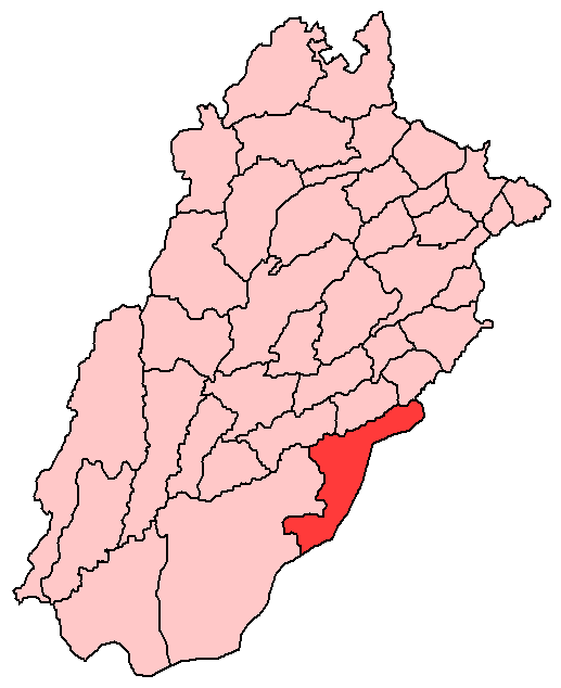
Bahawalnagar District (
Urdu : بہاولنگر) is a district of Punjab province inPakistan . The district is situated on the Indo-Pakistani border, before the partition of the sub-continent, Bahawal Nagar was a part of Bahawalpur state governed by theNawab of Bahawalpur . The town ofBahawalnagar is the capital of the district.History
Bahawalnagar was part of Jona Garh state. Later, it become a part of Bahawalnagar State. After partition, the
Nawab of Bahawalpur had to decide whether the territory should join India or Pakistan. The Nawab of Bahawalpur announced the affiliation with Pakistan because 99% of the population was Muslim. Later on, the whole state became part of the Punjab province. The city is known as Shaher-e-Wafa. The old name of Bahawalnagar was Rojhan Waal".District Boundaries
The boundaries of Bahawalnagar District in the East and South touches Indian territory while, the river
Sutlej flows on its Northern side across which are situated Okara, Pakpattan and Vehari districts.Administration
The District of Bahawalnagar is spread over an area of 8,878 square kilometres comprising five
tehsil s and 118 Union Councils [ [http://www.nrb.gov.pk/lg_election/union.asp?district=5&dn=Bahawalnagar Unions in Bahawalnagar Government of Pakistan] ] :Population
The population of Bahawalnagar, according to the 1998 Census of Pakistan, is 2,061,447 of which 18.80%. [ [http://www.urckarachi.org/Population%20Table-5.htm Population] ] . The sub-Campus of Islamia University is also located here. The classes of MBA had started in the campus. The literacy rate of Bahawalnagar is less than 25%. The unemployment rate is much higher than 25%.".
Industry
Main Towns:Takhat Mehal, Mandi Sadiq Gunj, Faqirwali, Madrisa, Dahranwala, Yateemwala, Qaziwala and Bukhshan Khan, Bala Arain, Fateh Kot and Jenjeranwali, Maharwali.
Main Crops: Sugarcane, Cotton, Wheat, Rice and Mustard Seed
Main Fruits: Citrus, Guavas, Mangoes and Dates
Main Vegetables: Cauliflower, Onion, Turnip, Carrot, Potatoes and Tomatoes
Forest (Area in Acres: 24,195
Major Industries: Cotton Ginning & Pressing, Flour Mills, Marble Industry, Oil Mills, Paper & Paper Board, Rice Mills, Sugar, Tea Blending and Textile Spinning.
The region's problems can be overcome by establishing new industries in the city to alleviate the problem of unemployment. Another problem is ignorance which can be solved by keeping the educational institutions in order. The main problem they have to face is the unavailability of sui gas. Problems and unemployment can be overcome by providing sui gas to them.The roads leading to the district Bahawalnagar are very rough. But nowadays, this city is progressing by leaps and bounds. Students of the city are very intelligent. The need of the day is to provide good transport and roads facility to the district of Punjab which is the largest district of Punjab by area."
Climate & Vegetation
Bahawalnagar has a very hot and dry climate in summer. The maximum temperature touches 52ºC. The climate in winter is very dry and cold. The minimum temperature recorded was 6ºC. Wind and storms are quite common during the summer. The average annual rainfall in the district is 119 mm. The district may be divided into three parts. These are the riverain area, the canal irrigated plain and the desert area. The riverain area of the district lies close to the Satluj river which flows in the North-West along its border with Okara, Pakpattan, Sahiwal and Vehari districts. The land in this area is irrigated by non-perennial canals. During the summer monsoons, the area is generally in-undated by the river water. The canal irrigated area is a plain which has been brought under cultivation by the canals. The main canal which is Sadqia canal irrigate almost all the tehsils except Chishtian. This canal travels in round with the border of Pakistan and India. The desert area of the district is called the
Cholistan . The surface of this desert consists of a succession ofsand dune s, rising in places to a height of 150 metres. It is covered with the vegetation peculiar to the sandy tracts.Bahawalnagar is one of the hottest areas in the country. Typically the temperature reaches 50°C (122°F) in the summer.
References
Wikimedia Foundation. 2010.