- Sheikhupura District
-
Sheikhupura District
Qila Sheikhupura— District — Map of Punjab with Sheikhupura District highlighted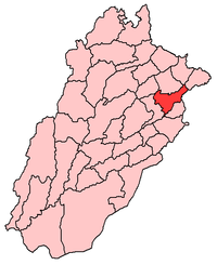
Country  Pakistan
Province Punjab Capital Sheikhupura city Established Government – District Nazim – District Naib Nazim Area – Total 5,312 km2 (2,051 sq mi) Population (1998) – Total 3,321,029 Time zone PST (UTC+5) District Council Number of Tehsils 5 Sheikhupura District (Urdu: ضلع شيخوپورہ) is a district of Punjab province, Pakistan. Sheikhupura is the headquarters of Sheikhupura District. According to the 1998 census of Pakistan, the district had a population of 3,321,029 of which 25.45% were urban.[1]
All the Sikhs That lived in Sheikhupura District before the 1947 partition were from Eastern Punjab. During the colonization of Lower Chenab Bar Which consisted of Present day Faisalabad, Sheikhupura, Nankana Sahib, and Gujranwala Districts in the late 19th century Large number of Sikhs Mainly From eastern Punjab were given land in Bar Area by the British, later Villages Were Built in a Square Colony Shape. Large number of Muslims and some Hindus also Settled in the New Bar Area. Bar Area was a Big Area Which covered from Jhang to Gujranwala Area and was not that Populated it had Forests an Empty land with some Cities and Minor Villages. During the partition The Whole of the Sikh population left for east Punjab.
During the partition of 1947 Shiekhupura District had a Big Sikh Population but was given to Pakistan a New Muslim Country Created at that Time. The Sikhs Faced Threats from the Muslims they left for East Punjab.
Contents
Administration
The district comprises 5 tehsils:
- Sheikhupura
- Ferozewala
- Muridke
- Sharaqpur
- Safdarabad
Boundaries
Sheikhupura is bounded by 6 other districts of Pakistani Punjab namely: Lahore, Nankana Sahib, Narowal, Hafizabad, and Gujranwala.
To the east is the international boundary of Amritsar - Punjab, India.
Geology
The area is a part of Rachna Doab, and consists of some recent sediment brought by spill channel from Chenab River. There are some old channel levee remnants and old basins filled up with clay materials. It is probably of late Pleistocene age derived from mixed calcareous, sedimentary and metamorphic rocks of the lower Himalayas. The only mineral products of the District are Kankar and Kallar. The small particles of Kankar may be burnt into lime. These are the features of all bare lands and are found on the surface or a little below it. Kallar is found on mounds, which are sites of old ruined habitations, and is used for the manufacture of crude saltpeter.
Climate
The District has extreme climate; the summer season starts from April and continues till October. During the summer season, temperature ranges from 30 to 45 degrees Celsius. The winter season starts from November and continues till March. December and January are the coldest months with a mean minimum temperature of 5 degrees.
The dust storms occur occasionally during the hot season, during June, July and August. Rainy weather alternates with oppressive weather. The rainfall is 500mm per year. The mean minimum and maximum humidity during winter is 37% and 84%.
External links
References
Divisions of Pakistan Balochistan KP Punjab Bahawalpur · Dera Ghazi Khan · Faisalabad · Gujranwala · Lahore · Multan · Rawalpindi · Sahiwal · SargodhaSindh
Categories:

Wikimedia Foundation. 2010.