- Minidoka Dam
-
Minidoka Dam 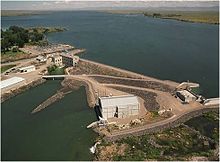
Minidoka Dam and Lake WalcottLocation of Minidoka Dam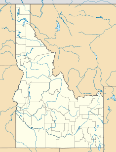

Location Minidoka County, Idaho, USA Coordinates 42°40′10″N 113°29′01″W / 42.66944°N 113.48361°WCoordinates: 42°40′10″N 113°29′01″W / 42.66944°N 113.48361°W Construction began 1904 Opening date 1906 Dam and spillways Height 86 feet (26 m) Length 4,475 feet (1,364 m) Impounds Snake River Type of spillway Gated and flashboard section Spillway capacity 40,800 cu ft/s (1,160 m3/s) Reservoir Creates Walcott Lake Capacity 210,200 acre feet (0.2593 km3) Catchment area 2,231 sq mi (5,780 km2) Surface area 4,245 feet (1,294 m) Power station Hydraulic head 74 ft (23 m) Turbines 2X10 MW Kaplan horizontal turbines (Units 8, 9) 3 and 5.5 MW Francis turbines (Units 6 and 7), Units 1-5 retired Installed capacity 28 MW Minidoka Dam and Power PlantArea: 640 acres (260 ha) Built: 1904 Governing body: Bureau of Reclamation NRHP Reference#: 74000746
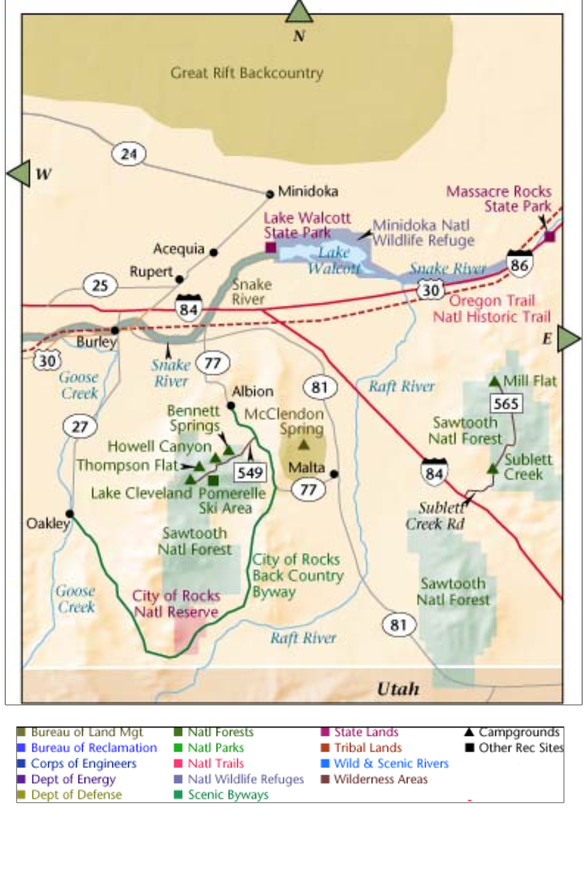
[1]Added to NRHP: October 29, 1974 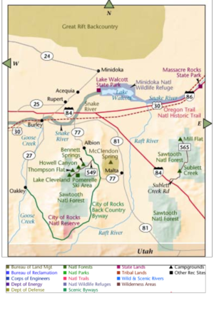 Regional map
The Minidoka Dam is an earthfill dam on the Snake River in south central Idaho. The dam, originally completed in 1906, is east of Rupert on county highway 400; it is 86 feet (26 m) high and nearly a mile (1.6 km) in length, with a 2,400-foot (730 m) wide overflow spillway section.[2] The dam and power plant were listed on the National Register of Historic Places in 1974.[1] Walcott Park, close to the dam, is a popular summertime picnic area. The headquarters for the Minidoka National Wildlife Refuge are adjacent to the dam.
Contents
History
The Minidoka dam was the first Reclamation Service project in Idaho, part of the Minidoka Project of dams, reservoirs and canals. Construction began in 1904 and by 1906 most of the dam's canals and laterals were finished. By 1909, Minidoka Dam's power plant, the first federal power plant in the northwest, was completed.[3] By its completion, the total cost of the dam was $5.8 million, which exceeded estimates. The Minidoka project brought water into the southeastern areas of Idaho near the cities of Rupert and Burley. The project was successful, as what was once an uninhabited sagebrush desert is now bountiful farmland. The powerplant installation was significant as a precursor of much larger projects on the Columbia River, including Bonneville Dam.[2]
A study examining the possibility of raising the crest of the dam by 5 feet (1.5 m) was conducted from 2000 to 2009, but with costs ranging from $150 million to $205 million the project has not been pursued.[4] A $50 million spillway repair project is expected to go ahead.[5]
Power plant
The Minidoka Dam was initially designed and constructed without power generation facilities, but the Minidoka power plant was soon added in 1909-1910. It was designed to generate electricity for pumping operations to support irrigation on the south bank of the Snake River. While irrigation water could flow by gravity to the north bank, water for the south bank had to be raised to a higer elevation. Units 1-5 generated power using propellor-style units., but did not efficiently use the water volume passing through the dam. Unit 6, a 3MW unit with a Francis turbine, was added in 1927, with the 5.5 MW Unit 7 added in 1942. Units 1 - 5 were retired in 1995, before the construction of the Allen E. Inman Powerplant in 1997. The new plant houses Unit 8 and 9, each with a 10MW Kaplan horizontal unit. The original plant housing Units 1 -5 has been preserved and is listed on the National Register of Historic Places.[6]
Excess power from the original powerplant was sold to local farmers, making the Minidoka area one of the first rural areas to have an electric power distribution system.[7]
Statistics
- Provides supplemental water supply to more than 1 million acres (4000 km²) of land.
- The reservoir has a storage capacity of 210,000 acre feet (260,000,000 m3).
- The reservoir, Lake Walcott, is named after a Bureau of Reclamation engineer.
- The reservoir extends 26 miles (42 km) up the Snake River and has a shoreline of 80 miles (130 km).
References
- ^ a b "National Register Information System". National Register of Historic Places. National Park Service. 2009-03-13. http://nrhp.focus.nps.gov/natreg/docs/All_Data.html.
- ^ a b Jackson, Donald C. (1988). Great American Bridges and Dams. The Preservation Press. pp. 289–290. ISBN 0-89133-129-8.
- ^ "Minidoka Project". U.S. Bureau of Reclamation. http://www.usbr.gov/projects/Project.jsp?proj_Name=Minidoka+Project. Retrieved 3 May 2011.
- ^ Lundquist, Laura (August 19, 2010). "Government finalizes study of Minidoka Dam". Magic Valley Times. http://www.magicvalley.com/news/local/mini-cassia/article_a2d07d40-8918-57fe-a795-79a03fecbdc4.html. Retrieved 4 May 2011.
- ^ Welch, Laurie (January 17, 2011). "Decade-long Minidoka Dam replacement effort hinges on federal money". Magic Valley Times. http://www.magicvalley.com/news/local/mini-cassia/article_3db5bc05-4dda-5553-a058-00ded0dc1423.html. Retrieved 4 May 2011.
- ^ "Minidoka Powerplant". U.S. Bureau of Reclamation. http://www.usbr.gov/projects/Powerplant.jsp?fac_Name=Minidoka%20Powerplant. Retrieved 5 May 2011.
- ^ "Minidoka Dam". Idaho Public TV. http://idptv.state.id.us/buildingbig/dams/minidoka.html. Retrieved 5 May 2011.
External links
Snake River Dams Ice Harbor • Lower Monumental • Little Goose • Lower Granite • Hells Canyon • Oxbow • Brownlee • Swan Falls • C. J. Strike • Milner • Minidoka • Palisades • American Falls • Jackson LakeU.S. National Register of Historic Places Topics Lists by states Alabama • Alaska • Arizona • Arkansas • California • Colorado • Connecticut • Delaware • Florida • Georgia • Hawaii • Idaho • Illinois • Indiana • Iowa • Kansas • Kentucky • Louisiana • Maine • Maryland • Massachusetts • Michigan • Minnesota • Mississippi • Missouri • Montana • Nebraska • Nevada • New Hampshire • New Jersey • New Mexico • New York • North Carolina • North Dakota • Ohio • Oklahoma • Oregon • Pennsylvania • Rhode Island • South Carolina • South Dakota • Tennessee • Texas • Utah • Vermont • Virginia • Washington • West Virginia • Wisconsin • WyomingLists by territories Lists by associated states Other  Category:National Register of Historic Places •
  Portal:National Register of Historic PlacesCategories:
- Buildings and structures in Cassia County, Idaho
- National Register of Historic Places in Idaho
- Dams in Idaho
- Hydroelectric power plants in Idaho
- Buildings and structures in Minidoka County, Idaho
- Snake River
- Dams on the National Register of Historic Places
- Minidoka Project
- Earth-filled dams


Wikimedia Foundation. 2010.