- Oxbow Dam
-
Oxbow Dam 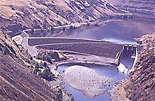
Official name Oxbow Dam Location Hells Canyon, Adams County, Idaho / Baker County, Oregon, USA Coordinates 44°58′15″N 116°50′04″W / 44.97083°N 116.83444°W Opening date 1961 Dam and spillways Height 175 ft (53 m) Impounds Snake River Reservoir Creates Oxbow Reservoir Capacity 58,200 acre feet (71,800,000 m3) Catchment area 73,300 square miles (189,800 km²) Surface area 1,150 acres (4.65 km²) Oxbow Dam is a hydroelectric run-of-the-river rockfill dam on the Snake River on the Idaho-Oregon border, in Hells Canyon (river mile 273). It is part of the Hells Canyon Project that also includes Hells Canyon Dam and Brownlee Dam, built and operated by Idaho Power Company.
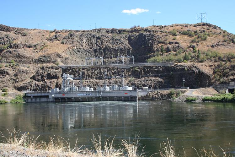
The dam's powerhouse contains four generating units with a total nameplate capacity of 190 megawatts.
Lacking passage for migrating salmon, the three Hells Canyon Project dams blocked access by anadromous salmonids to a stretch of the Snake River drainage basin from Hells Canyon Dam up to Shoshone Falls, which naturally prevents any upstream fish passage to the upper Snake River basin.
Contents
Heliport
Oxbow Heliport (FAA LID: OR83) is a private 100 by 100 ft (30 m). (30 x 30 m), turf heliport owned by Idaho Power Company.[1]
See also
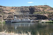 Oxbow Dam power station
References
- Oxbow Dam, Columbia Basin Research
- Oxbow Dam, Northwest Power and Conservation Council
- Oxbow Dam, Idaho Power
External links
- Resources for this airport:
- AirNav airport information for OR83
- FlightAware airport information and live flight tracker
- SkyVector aeronautical chart for OR83
Snake River Dams Ice Harbor • Lower Monumental • Little Goose • Lower Granite • Hells Canyon • Oxbow • Brownlee • Swan Falls • C. J. Strike • Milner • Minidoka • Palisades • American Falls • Jackson LakeCategories:- Buildings and structures in Adams County, Idaho
- Buildings and structures in Baker County, Oregon
- Dams in Idaho
- Dams in Oregon
- Hydroelectric power plants in Idaho
- Hydroelectric power plants in Oregon
- Snake River
- Run-of-the-river power stations

Wikimedia Foundation. 2010.