- Oxbow, Oregon
-
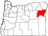
Oxbow — Unincorporated community — Location within the state of Oregon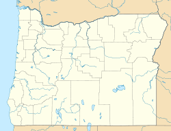
 Oxbow
OxbowCoordinates: 44°58′30″N 116°51′47″W / 44.9748786°N 116.8629359°WCoordinates: 44°58′30″N 116°51′47″W / 44.9748786°N 116.8629359°W Country United States State Oregon County Baker Elevation 1,982 ft (604 m) Time zone Pacific (PST) (UTC-8) – Summer (DST) PDT (UTC-7) ZIP code 97840 Area code(s) 541 and 458 GNIS feature ID 1167700[1] Oxbow is an unincorporated community in Baker County, Oregon, United States.[1] Oxbow is located on Oregon Route 86 next to the Snake River near the Oxbow Dam on the Oregon-Idaho border, about 17 miles northeast of Halfway.[2] Oxbow is just south of the site of the former mining town of Copperfield.[2] Although it is unincorporated, Oxbow has a post office with a ZIP code of 97840.[3]
There was once a station named Oxbow on a portion the Oregon Short Line Railroad now inundated by Oxbow Reservoir.[4][5] It was named for The Oxbow, a U-shaped bend in the Snake River named for the agricultural implement.[4][6] The present-day community of Oxbow was established in the early 1960s near the former site of Copperfield during the building of the Oxbow Dam by the Idaho Power Company.[4] Oxbow post office was established on May 1, 1965 after moving the office from Homestead six miles to the north.[4] At one time Oxbow had a school.[7]
By some accounts, Hells Canyon is defined as starting just outside of Oxbow.[citation needed]
References
- ^ a b "Oxbow". Geographic Names Information System, U.S. Geological Survey. May 22, 1986. http://geonames.usgs.gov/pls/gnispublic/f?p=gnispq:3:::NO::P3_FID:1167700. Retrieved 2011-03-27.
- ^ a b Oregon Atlas & Gazetteer (7th ed.). Yarmouth, Maine: DeLorme. 2008. pp. 79, 88. ISBN 0-89933-347-8.
- ^ "ZIP Code Lookup". United States Postal Service. http://zip4.usps.com/zip4/citytown_zip.jsp. Retrieved 2011-03-27.
- ^ a b c d McArthur, Lewis A.; McArthur, Lewis L. (2003) [First published 1928]. Oregon Geographic Names (7th ed.). Portland, Oregon: Oregon Historical Society Press. pp. 230, 476, 735. ISBN 9780875952772. OCLC 53075956.
- ^ "Oxbow (historical)". Geographic Names Information System, U.S. Geological Survey. April 1, 1993. http://geonames.usgs.gov/pls/gnispublic/f?p=gnispq:3:::NO::P3_FID:1157182. Retrieved 2011-03-27.
- ^ "The Oxbow". Geographic Names Information System, U.S. Geological Survey. November 28, 1980. http://geonames.usgs.gov/pls/gnispublic/f?p=gnispq:3:::NO::P3_FID:1127991. Retrieved 2011-03-27.
- ^ "Oxbow School (historical)". Geographic Names Information System, U.S. Geological Survey. November 28, 1980. http://geonames.usgs.gov/pls/gnispublic/f?p=gnispq:3:::NO::P3_FID:1125105. Retrieved 2011-03-27.
External links
- Images of Oxbow from Flickr
Municipalities and communities of Baker County, Oregon Cities Baker City | Greenhorn | Haines | Halfway | Huntington | Richland | Sumpter | Unity
Unincorporated
communitiesAuburn | Bridgeport | Carson | Copperfield | Cornucopia | Dixie | Durkee | Hereford | Homestead | Jimtown | Keating | Lime | Little Alps | McEwen | New Bridge | Oxbow | Pine | Pocahontas | Rock Creek | Salisbury | Sparta | Weatherby | Whitney | Wingville
Ghost towns Bourne | Robinette
Categories:- Unincorporated communities in Baker County, Oregon
- Oregon geography stubs


Wikimedia Foundation. 2010.