- Durkee, Oregon
-
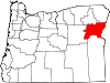
Durkee is an unincorporated community in Baker County, Oregon, United States. Although it is unincorporated, it has a post office with the ZIP code of 97905.[1] Durkee lies at the Vandercar Road exit of Interstate 84.[2]
Durkee was originally a stage stop called Express, and by the 1860s it was the only transfer point between Umatilla and Boise. It prospered as a water stop and telegraph station for the railroad, and even later as a stop on Highway 30, the only paved road in the area. It was platted in 1908, even though the population had already peaked.[3]
References
- ^ Zip Code Lookup
- ^ U.S. Geological Survey Geographic Names Information System: Durkee, Oregon
- ^ Bailey, Barbara Ruth (1982). Main Street: Northeastern Oregon. Oregon Historical Society. p. 51. ISBN 0875950736.
Municipalities and communities of Baker County, Oregon Cities Baker City | Greenhorn | Haines | Halfway | Huntington | Richland | Sumpter | Unity
Unincorporated
communitiesAuburn | Bridgeport | Carson | Copperfield | Cornucopia | Dixie | Durkee | Hereford | Homestead | Jimtown | Keating | Lime | Little Alps | McEwen | New Bridge | Oxbow | Pine | Pocahontas | Rock Creek | Salisbury | Sparta | Weatherby | Whitney | Wingville
Ghost towns Bourne | Robinette
Coordinates: 44°34′56″N 117°27′53″W / 44.5821048°N 117.4646418°W
Categories:- Unincorporated communities in Baker County, Oregon
- Populated places established in the 1860s

Wikimedia Foundation. 2010.