McEwen, Oregon

McEwen, Oregon

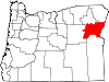
McEwen is an unincorporated community in Baker County, Oregon, United States. McEwen lies on Oregon Route 7 east of its interchange with Oregon Route 220. McEwen is southeast of Sumpter and west of Auburn.

McEwen was founded as a logging town, platted in 1891, and then was a rail stop on the Sumpter Valley Railway.[1] It was named after a Mormon missionary who converted Charles W. Nibley's parents to the LDS Church.[2]

References

  1. ^ Bailey, Barbara Ruth (1982). Main Street: Northeastern Oregon. Oregon Historical Society. pp. 21,51. ISBN 0875950736. 
  2. ^ Deumling, Dietrich (1972-05). The roles of the railroad in the development of the Grande Ronde Valley (masters thesis). Flagstaff, Arizona: Northern Arizona University. OCLC 4383986. 

Coordinates: 44°42′03″N 118°06′17″W / 44.70083°N 118.10472°W / 44.70083; -118.10472


Wikimedia Foundation. 2010.

Игры ⚽ Нужен реферат?

Look at other dictionaries:

  • Oregon School Activities Association — Abbreviation OSAA …   Wikipedia

  • Baker County, Oregon — Baker County Courthouse in Baker City …   Wikipedia

  • Athena, Oregon — Infobox Settlement official name = Athena, Oregon settlement type = City nickname = motto = imagesize = image caption = image imagesize = image caption = image mapsize = 250px map caption = Location in Oregon mapsize1 = map caption1 = subdivision …   Wikipedia

  • Rail transport in Oregon — Rail transport is an important element of the transportation network in the state of Oregon. Rail has existed in the state in some form since 1855 [ cite web url = http://www.columbiagorge.org/press releases.html title = Gorge Railroad History… …   Wikipedia

  • Baker City, Oregon —   City   Main Street …   Wikipedia

  • Copperfield, Oregon — Copperfield is a former town in Baker County, Oregon, United States, located on the west bank of the Snake River, near a place called The Oxbow. Contents 1 Early history 2 Martial law 3 Ghost town …   Wikipedia

  • Oxbow, Oregon — Oxbow   Unincorporated community   …   Wikipedia

  • National Register of Historic Places listings in Baker County, Oregon — This is a list of properties and districts in Baker County, Oregon that are listed on the National Register of Historic Places. Map of all coordinates from Google Map of all coordinates from Bing …   Wikipedia

  • Cornucopia, Oregon — Cornucopia is a ghost town of the gold mining boom of the 1880s in Eastern Oregon, United States. The name of the town was chosen since it meant Horn of Plenty .[1] Gold was discovered in Cornucopia in 1884. The town was platted in 1886.[2] It is …   Wikipedia

  • National Register of Historic Places listings in Grant County, Oregon — This is a list of properties and districts in Grant County, Oregon that are listed on the National Register of Historic Places. Map of all coordinates from Google Map of all coordinates from Bing …   Wikipedia

Share the article and excerpts

Direct link
Do a right-click on the link above
and select “Copy Link”