- Burnt River (Oregon)
-
Burnt River 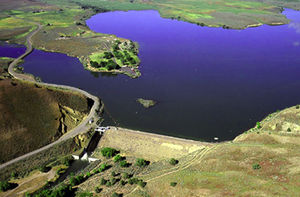 The Unity Dam, a dam on the river
Name origin: Either burned timber along its banks or burned-looking rocks along its course[1] Country United States State Oregon County Baker Source Blue Mountains - location near Unity, Oregon - elevation 3,824 ft (1,166 m) [2] - coordinates 44°30′15″N 118°10′51″W / 44.50417°N 118.18083°W [3] Mouth Snake River - location near Huntington, Oregon - elevation 2,073 ft (632 m) [3] - coordinates 44°21′54″N 117°13′34″W / 44.365°N 117.22611°W [3] Length 98 mi (158 km) [4] Basin 1,090 sq mi (2,823 km2) [5] 
 Location of the mouth of Burnt River in Oregon
The Burnt River is a 98-mile-long (158 km)[4] tributary of the Snake River in eastern Oregon, United States. It enters the Snake near Huntington, Oregon, at a point upstream of the Powder River and downstream of the Malheur River, slightly more than 327 miles (526 km) from the Snake's confluence with the Columbia River.[6] Draining 1,090 square miles (2,800 km2), it flows predominately west to east.[7]
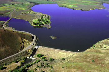
The river begins at Unity Reservoir at the confluence of the north, middle, and south forks of the river. The reservoir is slightly east of the Whitman National Forest in the Blue Mountains and slightly north of Unity. Unity Lake State Recreation Site adjoins the reservoir. As it leaves the lake, the river flows under Oregon Route 245, then runs east along the highway past Hereford and Bridgeport and, through the Burnt River Canyon, to Durkee. Turning generally south at Durkee, the river runs along Interstate 84 past Weatherby, Dixie, and Lime before flowing under the Interstate and turning east again. Shortly thereafter, it passes Huntington and reaches the Snake.[7]
See also
- List of rivers of Oregon
- List of longest streams of Oregon
References
- ^ McArthur, Lewis A.; Lewis L. McArthur (2003) [1928]. Oregon Geographic Names (7th ed.). Portland: Oregon Historical Society Press. p. 129. ISBN 0-87595-277-1.
- ^ Source elevation derived from Google Earth search using GNIS source coordinates.
- ^ a b c "Burnt River". Geographic Names Information System (GNIS). United States Geological Survey (USGS). November 28, 1980. http://geonames.usgs.gov/pls/gnispublic/f?p=gnispq:3:::NO::P3_FID:1139008. Retrieved February 28, 2011.
- ^ a b U.S. Geological Survey. National Hydrography Dataset high-resolution flowline data. The National Map, accessed May 3, 2011
- ^ "Bull Trout Recovery Plan: Columbia River/Klamath (2002), Chapter 13: Hells Canyon" (PDF). United States Fish and Wildlife Service. p. 2. http://www.fws.gov/pacific/bulltrout/RP/Chapter_13%20Hells%20Canyon.pdf. Retrieved February 28, 2011.
- ^ United States Geological Survey (USGS). "United States Geological Survey Topographic Map:Olds Ferry, Idaho, quadrangle". TopoQuest. http://www.topoquest.com/map.php?lat=44.36503&lon=-117.22907&datum=nad83&zoom=8&map=auto&coord=d&mode=zoomout&size=m. Retrieved February 28, 2011.
- ^ a b DeLorme Mapping. Oregon Atlas & Gazetteer (Map) (1991 ed.). Section 82–83. ISBN 0-89933-235-8.
Categories:- Rivers of Oregon
- Landforms of Baker County, Oregon

Wikimedia Foundation. 2010.