- Powder River (Oregon)
Infobox River
river_name = Powder River

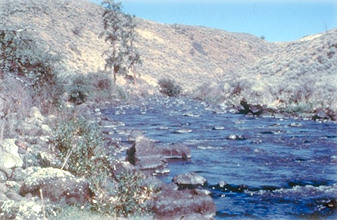
caption = Wild and Scenic Powder River
origin = Elkhorn Ridge, Blue Mountains
length = mi to km|110
mouth =Snake River
mouth_elevation =
elevation =
discharge =
watershed = The Powder River is a tributary of theSnake River , approximately 110 mi (177 km) long, in northeastOregon in theUnited States . It drains an area of theColumbia Plateau on the eastern side of the Blue Mountains.It rises in the southern Blue Mountains, along
Elkhorn Ridge , approximately 20 mi (32 km) west of Baker City in eastern Baker County. It flows east past Sumpter and the through thePhillips Reservoir , then turns sharply north to flow past Baker City, entering a broad arid agricultural valley where it is used forirrigation . It receives theNorth Powder River from the east at North Powder, then turns sharply ESE to flow throughThief Valley Reservoir in a valley along the southern edge of theWallowa Mountains . It enters the Snake River on theIdaho -Oregon state line from the west, upstream from theBrownlee Dam , approximately 30 mi east of Baker City. The upper reaches of the river in the Blue Mountains are located in theUmatilla National Forest .In
1988 , 11.7 miles of the Powder River was designated Wild and Scenic. Between the Thief Valley Dam and the Highway 203 bridge, this stretch flows through a rugged canyon with spectacular geologic formations.ee also
*
List of Oregon rivers
*List of National Wild and Scenic Rivers
Wikimedia Foundation. 2010.
