- Old Mine Park Archeological Site
-
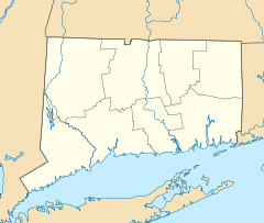
Old Mine Park Archaeological Site
Location: Trumbull, Connecticut Coordinates: 41°14′30″N 73°12′0″W / 41.24167°N 73.2°WCoordinates: 41°14′30″N 73°12′0″W / 41.24167°N 73.2°W Area: 72.1 acres (29.2 ha) Built: 1757-1828 Governing body: Town of Trumbull, CT NRHP Reference#: 90001807[1] Added to NRHP: 1990 The Old Mine Park Archaeological Site is a historic site in the Long Hill, Trumbull, Connecticut section of Trumbull, Connecticut. It was mined from 1828 to 1920 and during 1942-1946. It was added to the National Register of Historic Places in 1990.
Main article: History of Trumbull, ConnecticutHistorical significance
Hubbard Tungsten Mine at Long Hill The first mention of minerals at Saganawamps, or Old Mine Park, is found in the February 21 1757 deed giving Howkins Nichols of Stratford a lease for 200 years of 5 acres (20,000 m2) "at a place commonly called Saganawam for obtaining ye ore or mineral substances."[2]
Some time around 1818, Ephraim Lane took some samples of rocks he found at Saganawamps to Yale University Professor Benjamin Silliman for identification. Silliman reported, in his new American Journal of Science, that he had identified tungsten, tellurium, topaz and fluorite. Shortly after the articles were published, Ephraim Lane was making specimens available to collectors at a price and apparently to protect his supply of minerals, Lane acquired a lease to 4 acres (16,000 m2) in Trumbull later to be known as "Shagamywamps the mine lot" in 1828 from Elijah Hawley.[3] Lane then leased the land to Thomas R. Hubbard.
In 1837 the first (and at the time only) prismatic barite ore of tungsten in the United States was discovered at the mine. It was scientifically studied in 1887 by Adolph Gurlt of the University of Bonn. The area has previously been mined for copper, silver, lead and gold as well as limestone. The Hubbard Mine for tungsten was operated by the Rare Minerals Company from 1898 and later by the American Tungsten Mining and Milling Company, ceasing operations after a fire in 1916.[4][5] Besides tungsten, the mine was also a source of beryl, opal, topaz, tourmaline and 60 other crystals and minerals in varying quantities.[6]
Park
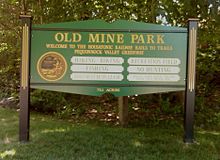
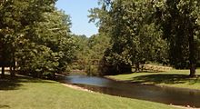
The Old Mine Park[7] is a 72-acre (290,000 m2) open space created in 1937 on the site of the mine. The park features:
- An 11-mile (18 km) loop trail for biking & hiking.[8]
- Two Pavilions and Picnic Area
- Lavatory
- Pheobe Meadows multi-purpose field
- The Trumbull Counseling Center (121 Old Mine Road)
- A walking bridge over the Pequonnock River.
References
- ^ "National Register Information System". National Register of Historic Places. National Park Service. 2010-02-04. http://nrhp.focus.nps.gov/natreg/docs/All_Data.html.
- ^ History and Minerals of Old Mine Park (Saganawamps), Earle Sullivan, Trumbull Historical Society, 1985, p. 7
- ^ History and Minerals of Old Mine Park (Saganawamps), Earle Sullivan, Trumbull Historical Society, 1985, p. 8
- ^ http://pubs.acs.org/doi/abs/10.1021/ed019p215
- ^ http://www.trumbullhistory.org/oldmines/
- ^ http://www.mindat.org/loc.php?loc=23342&ob=4
- ^ http://www.trumbullct.com/ParkOldMine.htm
- ^ http://www.trails.com/tcatalog_trail.aspx?trailid=BGN031-039
U.S. National Register of Historic Places Topics Lists by states Alabama • Alaska • Arizona • Arkansas • California • Colorado • Connecticut • Delaware • Florida • Georgia • Hawaii • Idaho • Illinois • Indiana • Iowa • Kansas • Kentucky • Louisiana • Maine • Maryland • Massachusetts • Michigan • Minnesota • Mississippi • Missouri • Montana • Nebraska • Nevada • New Hampshire • New Jersey • New Mexico • New York • North Carolina • North Dakota • Ohio • Oklahoma • Oregon • Pennsylvania • Rhode Island • South Carolina • South Dakota • Tennessee • Texas • Utah • Vermont • Virginia • Washington • West Virginia • Wisconsin • WyomingLists by territories Lists by associated states Other  Category:National Register of Historic Places •
  Portal:National Register of Historic PlacesCategories:
- Archaeological sites in Fairfield County, Connecticut
- Trumbull, Connecticut
- Buildings and structures on the National Register of Historic Places in Connecticut
- Parks in Fairfield County, Connecticut
- Mining in Connecticut
- Connecticut Registered Historic Place stubs
Wikimedia Foundation. 2010.


