- Highways in Niagara County, New York
-
 Map showing the location of where Niagara County is in New York
 Map of Niagara County's highways
Niagara County, New York is located in the extreme western part of New York State called Western New York. It is the location of Niagara Falls, Fort Niagara, the western portion of the Erie Canal, and has many parks and lake shore recreation communities. Niagara County is located just north of Buffalo and Erie County, west of Orleans County, south of Lake Ontario, and east of the Niagara River and Ontario, Canada on its western border.
Niagara County has 32 state-maintained highways (highways maintained by the New York State Department of Transportation or NYSDOT), which form a combined 287.2 miles (462.2 km) of the touring routes in New York.[1] Of those 32, there are 21 signed state routes, 11 unsigned reference routes (except the LaSalle Expressway and Robert Moses Parkway which are signed but also carry an unsigned reference number). Additionally, there are Niagara County Routes which are unsigned and maintained by the various municipalities they cross as well as the Niagara County Highway Department which maintains main thoughofares. County routes make up 282.9 miles (455.3 km).[1] With all state, county, and local roads included, there are approximately 3,047.6 miles (4,904.6 km) of centerline highway mileage in Niagara County.[1]
Other roadways in the county include the Seaway Trail, that parallels the Niagara River and Lake Ontario, the Niagara Historic Trail which creates a loop within the county, and the Niagara Wine Trail.
Contents
Interstate highway
Niagara County contains one Interstate Highway; I-190, which is an auxiliary interstate of Interstate 90.
I-190
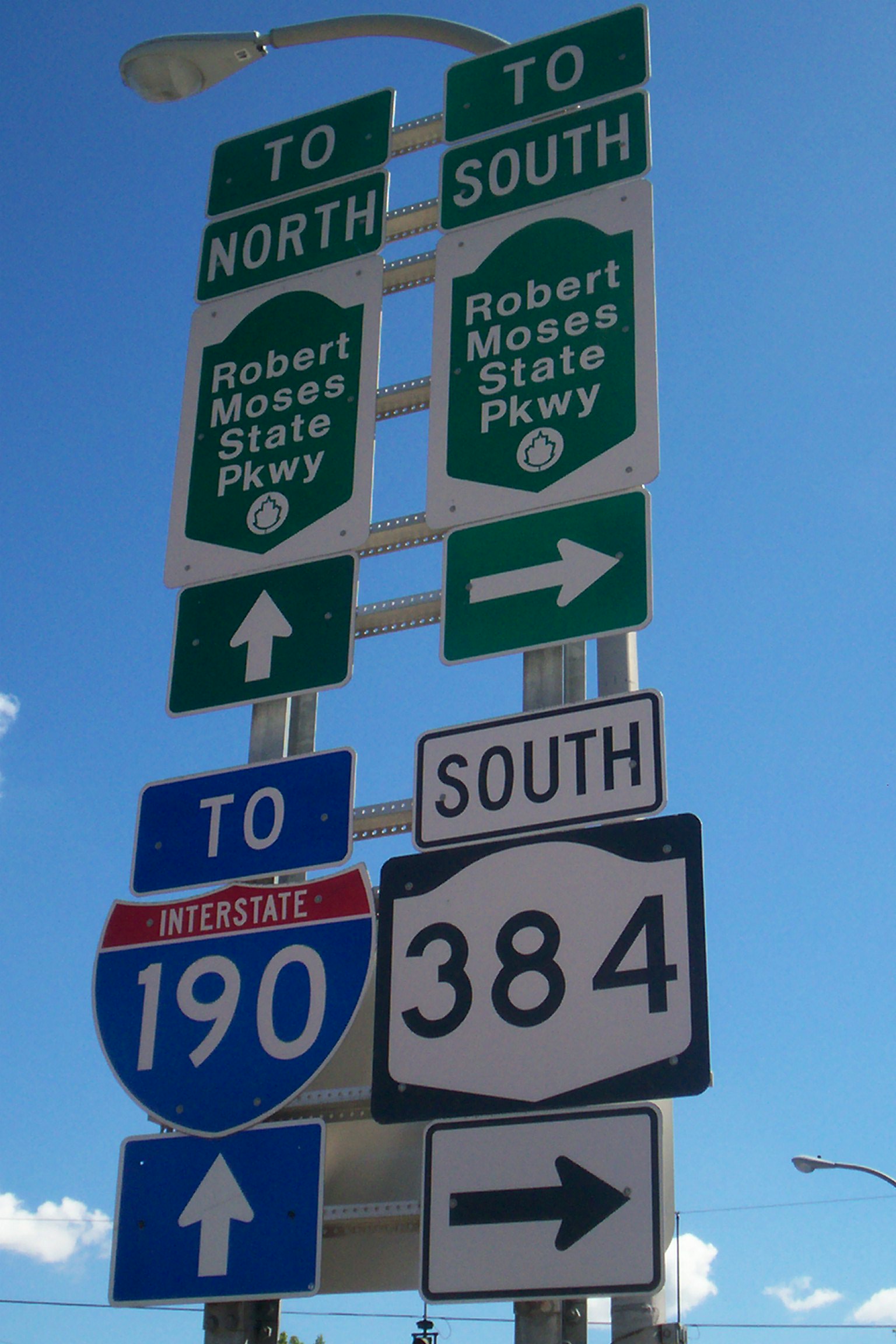
Main article: Interstate 190 (New York) I-190/NY 104 overhead highway signs on I-190 in Lewiston
Interstate 190 enters Niagara County by crossing the North Grand Island Bridge with NY 324, but NY 324 ends at a complex interchange with NY 384, the Robert Moses State Parkway, and the LaSalle Expressway on the north side of the bridge. Farther north, I-190 meets US 62 (Niagara Falls Blvd.) at exit 22, and NY 182 at exit 23, all in Niagara Falls. In Lewiston, the expressway meets NY 31 at exit 24 southwest of the large Robert Moses Niagara Power Plant reservoir, continues north, crossing the canal between the reservoir and the power plant on a small dam also used by NY 265, and then there is an interchange with NY 265, Robert Moses State Parkway, and NY 104 at exit 25 before curving to the west and terminating at the approach to the Lewiston-Queenston Bridge. As the highway crosses the bridge, the highway becomes Highway 405. in Queenston, Ontario. In 1957, the route was assigned the number Interstate 90N, but was renumbered I-190 in 1959.[2] Also, I-190 is the only three-digit Interstate Highway to reach the Canada-United States border.
US Routes
Additionally, Niagara County contains one US Route, US 62, and its business route through the City of Niagara Falls.
US 62
Main article: U.S. Route 62 in New YorkUS Route 62 enters Niagara County as Niagara Falls Boulevard and into Wheatfield where the highway intersects NY 425, NY 429, and turns to the northwest intersecting NY 182, NY 265 and I-190. On the east side of Niagara Falls, the route diverges into US 62 and its parallel route, US 62 Business. Through downtown Niagara Falls, US 62 loses the Niagara Falls Boulevard name and is divided up into two-one way streets: Walnut Avenue westbound and Ferry Avenue eastbound. The northern (eastern) terminus for both US 62 is at NY 104 near the Rainbow Bridge. US 62 is signed as north-south, although it travels more east-west in Niagara County.
US 62 BUS
Main article: U.S. Route 62 Business (Niagara Falls, New York)US 62 Business is a business route of US 62 located mostly within the City of Niagara Falls that runs parallel to US 62 one block north. It is an east-west route, although it is signed as a north-south route because US 62 is signed as a north-south route in New York State. It is named Pine Avenue and spans 2.12 miles (3.41 km) between NY 104 at its western end and US 62 at its eastern end.
New York State routes
Throughout Niagara County, there are 21 signed state routes:
NY 18
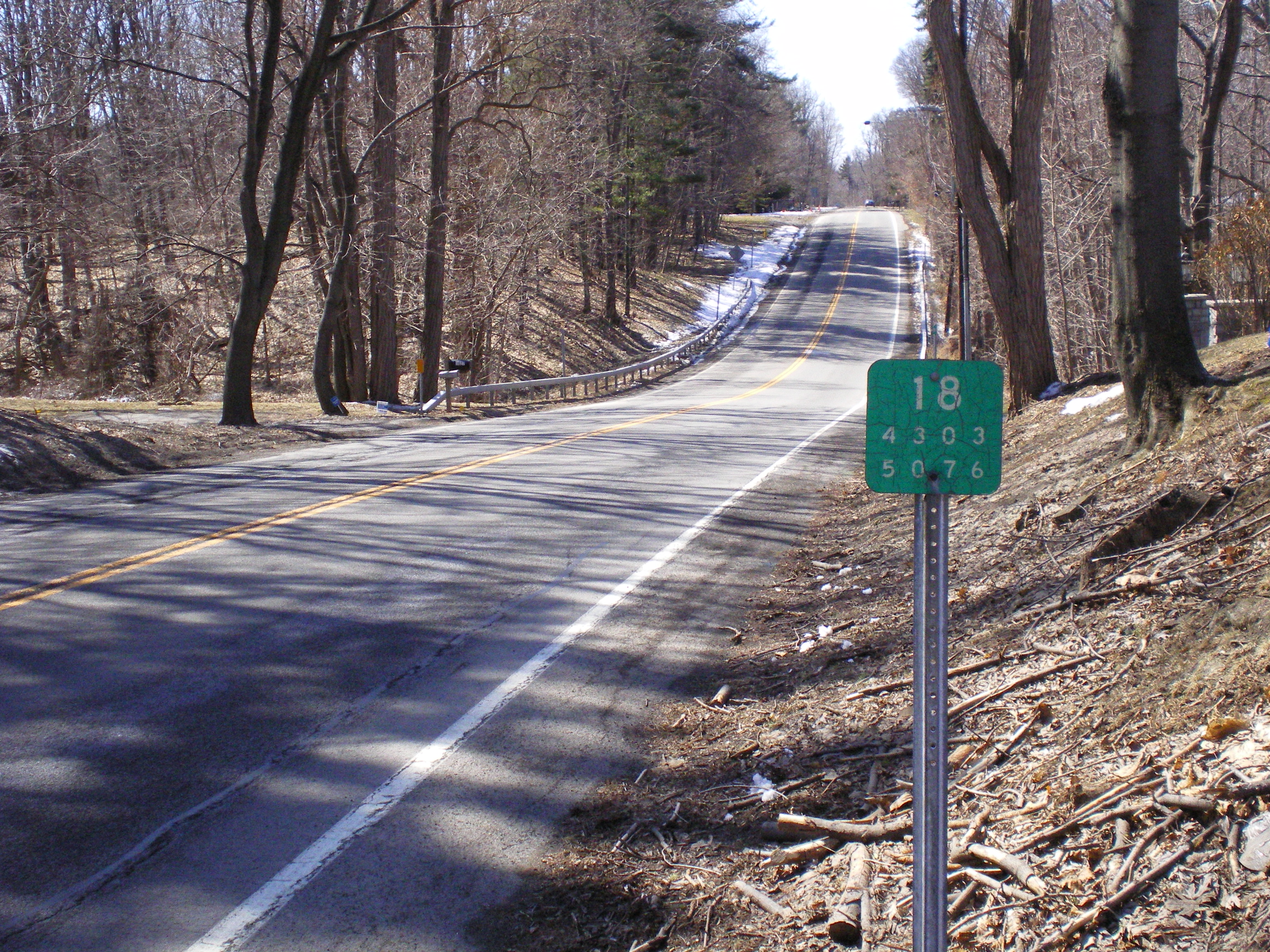
Main article: New York State Route 18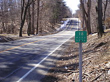 Reference marker on NY 18
New York State Route 18 begins at NY 104 south of a complex grade-separated interchange that includes NY 18F, NY 104, and the Robert Moses State Parkway on the eastern edge of the village of Lewiston, north of Niagara Falls. From here (despite its east-west signage) NY 18 runs primarily north-south through the western portion of Niagara County, but turn northeast and heads east once it nears Lake Ontario. For the rest of the county, it parallels the south shore of Lake Ontario. Once NY 18 intersects the northern terminus of NY 269 in the hamlet of County Line, at the Niagara-Orleans county line (Somerset/Yates town line); ending NY 18's run through Niagara County. NY 18 continues east to Rochester through Orleans and into Monroe County.
NY 18F
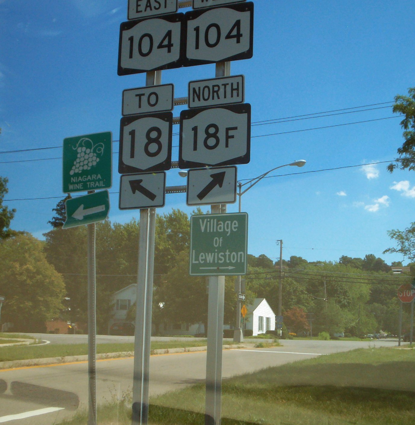
Main article: New York State Route 18F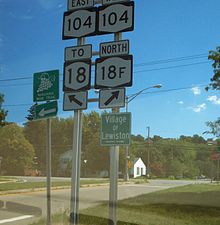 NY 18, NY 18F and NY 104 in Lewiston
New York State Route 18F is 9.80-mile (15.77 km) state highway located in northwestern Niagara County. The southern terminus of the route is at an interchange with NY 104 and the Robert Moses State Parkway just east of the Village of Lewiston. The northern terminus is NY 18 near Four Mile Creek State Park in Porter. NY 18F parallels NY 18 for most of its alignment, taking a more westerly course than its parent. NY 18F is the only remaining suffixed route of NY 18 and was once part of NY 18 itself.
NY 18FX
NY 18FX is the designation for the bridge carrying NY 18F over State Park Road in Lewiston
NY 31
Main article: New York State Route 31 I-190 near Exit 24 (NY 31 - Witmer Road) in the Town of Niagara
New York State Route 31 dates back to the 1920s when it was to mainly assigned to what is now NY 104 west of Rochester. With the commissioning of US 104, NY 31 was realigned west of Rochester to follow its modern routing, and only minor realignments have occurred since. Route 31 is an east-west route that begins at NY 104 in northern Niagara Falls and travels through central Niagara County named Saunders Settlement Road between Niagara Falls and the City of Lockport. NY 31 passes through the City of Lockport, intersecting NY 78 on the edge of the Erie Canal. NY 31 continues east out of Lockport. Just east of the Village of Middleport, NY 31 crosses into Orleans County.
NY 31E
Main article: New York State Route 31ENew York State Route 31E begins at NY 31 in the Village of Middleport in eastern Niagara County. The route heads north, overlapping NY 271 (which also begins at NY 31) through the village along Main Street. Just south of the Erie Canal at State Street, NY 31E splits from NY 271, with NY 31E east, following State Street out of the village and into the Orleans County town of Ridgeway, where it becomes Telegraph Road.
NY 61
Main article: New York State Route 61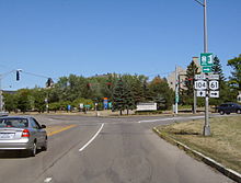 The northern end of NY 61 from NY 104 eastbound in Lewiston
New York State Route 61, known as Hyde Park Boulevard, is a state highway located almost entirely in the City of Niagara Falls except for a short section in Lewiston at its north end. The road runs across the city in a northwest-southeast direction, beginning its south end at NY 384 and ending at NY 104 at its northern end. NY 61 forms the eastern border of downtown Niagara Falls, and interestingly is the second-shortest two-digit route in New York, after NY 71 in Columbia County.
NY 61X
NY 61X is the designation for the bridge carrying NY 61 over Gill Creek in Niagara Falls
NY 77
Main article: New York State Route 77New York State Route 77 runs between its southern terminus at Java Center in Wyoming County and its northern terminus near the City of Lockport in Niagara County, making it a north-south route. For the Niagara County portion, NY 77 enters Niagara County from Genesee County and the route travels northwesterly towards NY 31 where it ends east of Lockport. In Niagara County NY 77 is known as Chestnut Ridge Road near NY 31 and Lewiston Road more towards the Genesee County line.
NY 78
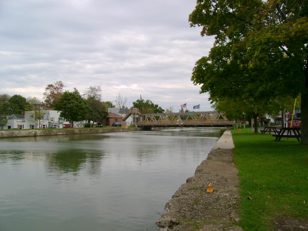
Main article: New York State Route 78New York State Route 78 enters Niagara County from the south named Transit Road, a major thoroughfare into the City of Lockport. NY 78 intersects NY 93 just south of the City of Lockport, and finally in the city, the miles-long Transit strip comes to an end just past the NY 31 junction at the Erie Canal. NY 78 turns off Transit north of downtown and comes out onto Lake Avenue and follows this road north from Lockport through some rolling countryside (mostly fields). It runs north, but no longer along the straight course set by Transit. Commercial development returns at the Wright Corners junction, where the highway has a brief concurrency with NY 104. North of NY 104, NY 78 is known as Lockport-Olcott Road until It reaches its northern terminus at NY 18 in Olcott, a small hamlet on the shore of Lake Ontario.
NY 93
Main article: New York State Route 93New York State Route 93 begins in the center of the Village of Youngstown named Lockport Street at an intersection with NY 18F (Main Street). NY 93 has an interchange with the Robert Moses State Pkwy at the eastern village line then proceeds in an east southeast direction across the Town of Porter and a short segment in southwestern Wilson and into the Town of Cambria as Youngstown-Lockport Road and then as N. Ridge Road. When 93 meets NY 104, NY 93 runs concurrent with NY 104 as Ridge Road until the Lockport town line, where it then turns south along Townline Road. At NY 31, NY 93 turns east, joining NY 31 towards the City of Lockport as Saunders Settlement Road. The southward continuation of the road becomes NY 270. Just outside the city of Lockport, NY 93 leaves NY 31 at the intersection with the Lockport Bypass. It heads southeast and south across the southwest corner of the city along the Lockport Bypass until the intersection with Robinson Road. From here, NY 93 then turns east along Robinson Road, later becoming Dysinger Road, southeast of the city. Soon after crossing into the town of Royalton, NY 93 turns onto Akron Road, which proceeds generally southeast towards Tonawanda Creek and into Erie County to head to the village of Akron.
NY 104
Main article: New York State Route 104 NY 104 eastbound at the western terminus of NY 18 in Lewiston
New York State Route 104 is an east-west route in the county (that was formerly designated as US 104) that runs from NY 384 just east of the Rainbow Bridge, but travels in a more north-northeasterly direction as it heads north (east). At the city limits, NY 104 interchanges with the Robert Moses State Parkway. And after passing by the Niagara Power Visitors Center, NY 104 interchanges with I-190 at exit 25 via Upper Mountain Road (New York State Reference Route 954P). NY 104 intersects the western terminus of NY 18 by way of an interchange, and the Robert Moses State Parkway one more time as well as the eastern terminus of NY 18F. The interchange is also the beginning of NY 104's occupation of Ridge Road. From here on out NY 104 travels east through north-central Niagara County as Ridge Road. Running concurrent with NY 93 in Cambria and NY 78 in Wrights Corners. Once NY 104 passes the southern terminus of NY 269, which sits on the Niagara-Orleans county line, NY 104 leaves the county.
NY 148
Main article: New York State Route 148New York State Route 148 is located entirely within northeastern Niagara County and is named Quaker Road. It runs north-south between a NY 104 in Hartland and NY 18 in Somerset. The entire length of NY 148 is maintained by Niagara County as County Route 15 (CR 15).
NY 182
Main article: New York State Route 182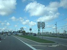 US 62 north at NY 182's east end in the Town of Niagara
New York State Route 182 runs across the City of Niagara Falls and into the Town of Niagara. NY 182 begins at Whirlpool Rapids Bridge and ends at Niagara Falls Boulevard, US 62 right near the Niagara Falls International Airport. Ny 182 is known by several names, the most prominent being Porter Road. NY 182 was formerly designated as NY 18D from 1935 to 1960s.
NY 265
Main article: New York State Route 265New York State Route 265 enters Niagara County as River Road, and shortly thereafter, joins NY 384, and the two highways run together along the Niagara River. The concurrency ends just short of the North Grand Island Bridge, with 265 continuing northwest along Military Road into the Town of Niagara. As NY 265 heads northwest, it makes its way to the reservoir at the Niagara Power Project, a joint U.S.-Canadian hydroelectric venture that provides a significant portion of New York's electricity. The highway runs along I-190 as the two cross over the reservoir's dramatic outlet and into Town of Lewiston. Shortly thereafter, access to the interstate and Canada is provided through the proximity of the last exit before the Lewiston-Queenston Bridge and the border. From there it is an equally short distance to 265's northern terminus, at NY 104.
NY 269
Main article: New York State Route 269New York State Route 269 runs north-south along the Niagara-Orleans county line for its entire length and is called County Line Road. NY 269 runs from the community of County Line in the north at NY 18, through Millers and North Ridgeway to Jeddo at its south end at NY 104. The road also forms the boundary between the Towns of Somerset and Hartland in Niagara County and the Towns of Yates and Ridgeway in Orleans County. Something to note is that NY 269 is one of only two state highways in New York that are located wholly along a county boundary (the other one is NY 272 on the other side of Orleans County).
NY 270
Main article: New York State Route 270New York State Route 270 is a north-south route named Campbell Boulevard in central Niagara County. It enters Niagara County crossing Tonawanda Creek/Erie Canal continuing mostly straight due north, then northeast intersecting Lockport Road, then heading due north to an end at an intersection with NY 31 and NY 93.
NY 271
Main article: New York State Route 271See also: List of county routes in Niagara County, New York (26-50)#Route 26 and List of county routes in Niagara County, New York (26-50)#Route 45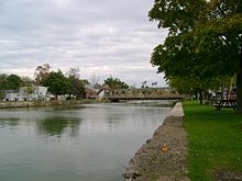
New York State Route 271 is a short state highway (3.21 miles) located entirely in eastern Niagara County. It serves as Middleport's Main Street, connecting NY 31 and NY 104. NY 31E runs concurrent with NY 271 for about a half a mile before splitting off onto State Street while NY 271 continues north on Main Street to NY 104.
NY 271 is maintained by Niagara County as CR 45 (North Main Street) from Mill Street to the Middleport village line and CR 26 (Stone Road) from the Middleport village line to NY 104.[3]
NY 324
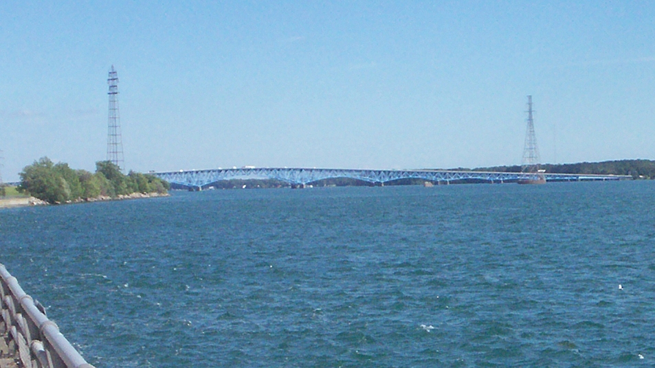
Main article: New York State Route 324 I-190 and NY 324 crossing the Niagara River on the North Grand Island Bridge from Grand Island to Niagara Falls (view from Robert Moses State Pkwy)
New York State Route 324 officially begins at NY 384 in Niagara Falls and overlaps Interstate 190 (the Niagara Section of the New York State Thruway) south to Grand Island and into Erie County, where it separates from I-190 and continues southward as Grand Island Boulevard. Thus, NY 324's length in Niagara County is very short at 0.48 miles. The route which was assigned in the 1930s, once extended northwest to downtown Niagara Falls; however, it was truncated to its current alignment in the 1960s.
NY 384
Main article: New York State Route 384 NY 384 in Niagara Falls
New York State Route 384 enters Niagara County and is Main Street in North Tonawanda. Shortly thereafter, it joins NY 265 and becomes River Road as the two highways run along the Niagara River. The concurrency ends just short of the North Grand Island Bridge, with 384 continuing along the riverside as it provides the southernmost Niagara County exit for I-190. NY 384 enters the city of Niagara Falls as Buffalo Avenue, intersecting NY 61 at the city line. Farther west, the route splits from Buffalo Avenue and continues onto Rainbow Boulevard, until an intersection with southern segment of the Robert Moses State Parkway. At the intersection, NY 384 turns north onto John B. Daly Boulevard, following the street (former Reference Route 952B) to its end at Niagara Street. NY 384 turns west onto Niagara Street (partially former Reference Route 951A) to access downtown Niagara Falls, where it intersects the western terminus of NY 104 and the southern terminus of the northern segment of the Robert Moses State Parkway, as well as the Rainbow Bridge, at Rainbow Boulevard. NY 384 terminates at the intersection, just before the Rainbow Bridge.
End of NY 384 at Rainbow Br/Robert Moses St PkwyNY 425
Main article: New York State Route 425New York State Route 425 begins in the Town of Tonawanda (Erie County) at I-290. It immediately becomes a divided four-lane highway named Twin Cities Memorial Highway with exits as it crosses the eastern half of the city of Tonawanda, running due north. Once past Tonawanda Creek/Erie Canal NY 425 enters into North Tonawanda and Niagara County. At Wheatfield Street, NY 425 forks to the northeast and becomes two-lane Erie Avenue. Once NY 425 reaches US 62 (Niagara Falls Blvd.) it assumes the name Shawnee Road, and it returns to a northerly course. The only major highway junction is at NY 31. North of there, it descends the Niagara Escarpment, then briefly follows the east-west Lower Mountain Road to get to its final routing north along Cambria-Wilson Road. NY 425 crosses both NY 104 and NY 93 in close distance, and a few miles beyond, it finally reaches Wilson and becomes Lake Street before ending at NY 18 near the shores of Lake Ontario.
NY 429
Main article: New York State Route 429New York State Route 429 begins at an intersection with NY 265/NY 384 in North Tonawanda, as Wheatfield Street. The route heads east to Oliver Street, then follows Oliver Street north through the city to Ward Road. As Ward Road, it leaves the city following a due north course, crossing US 62 in Wheatfield and north to Sanborn, where NY 429 becomes Buffalo Street. 429 heads east concurrent with NY 31 then north a short distance later on Townline Road where it follows the Lewiston-Cambria town line for the rest of its route. It then reaches a crest at Upper Mountain Road (Niagara CR 5) in Pekin, and then begins to descend the Niagara Escarpment. A mile north of the Escarpment, having descended 328 feet (100 m) from Pekin, Route 429 reaches its north end at NY 104.
Route 429 from Pekin north to US 104 overlooking the escarpment
New York State reference routes
 NY 951B reference marker
New York State Reference Routes and Expressway or Parkway Routes are New York State Highways that are unsigned (except for some expressways and parkways), that the New York State Department of Transportation (NYSDOT) has determined are too minor to have a signed number. In some cases they are former state highways that have since been deleted, their original numbers possibly reassigned elsewhere. They are normally signed on reference markers, located every tenth-mile on the side of the road, though a few exceptions exist, and all reference routes have a number in the 900's. The first digit of the second row indicates the NYSDOT Region (1 through 11). Within each of the regions, the counties are listed alphabetically and represented by the second digit. Thus, markers in Niagara County bear the designation of "5" (Region 5) and all reference numbers are in the 950's.[4] Within Niagara County there are 11 unsigned reference routes (except the LaSalle Expressway and Robert Moses Parkway which are signed).
NY 950U
The NY 950U designation belongs to a stretch of Highland Avenue in Niagara Falls between Maryland Avenue and NY 61/Hyde Park Boulevard. It is only 0.3 miles (0.48 km)[5] in length and is located near Highland's north end at NY 61.
LaSalle Expressway / NY 951A
Main article: LaSalle Expressway LaSalle Expwy sign
The LaSalle Expressway is a short east-west highway located in the southeasternpart of the City of Niagara Falls. The expressway begins near the North Grand Island Bridge at an interchange with Interstate 190 (Niagara Expressway) and Robert Moses State Parkway. The expressway is 2.62 miles (4.22 km) in length, having three exits, one with 77th Street and the second with NY 384, however only a eastbound exit/westbound entrance. The last exit is at the eastern terminus of the expressway at Williams Road (NY 952V). The Expressway was originally proposed as an Outer Loop for the Buffalo-Niagara Falls area, with the Interstate 890 designation. It would've stretched from I-190 in Niagara Falls south to Blasdell. The mile-long Milestrip Expressway (NY 179) in Blasdell and the LaSalle were the only portions of the proposed loop that were constructed.[6]
NY 951A designation
The LaSalle Expressway is part of unsigned New York Reference Route 951A; the other portion, not connected to the LaSalle Expressway, is located along Niagara Street between the Rainbow Bridge and Fifth Street in downtown Niagara Falls.
LaSalle Expressway routingNY 951B
The NY 951B designation belongs to Walnut Street in the City of Lockport from NY 31 to Pound Street with a distance of 0.4 miles (0.64 km)[5]
NY 952B
The NY 952B designation belongs to John B. Daly Boulevard in the City of Niagara Falls from Robert Moses State Parkway to Niagara Street. Its length is 0.42 miles (0.68 km)[5]
NY 952V
The NY 952V designation belongs to Williams Road near the western edge of the Town of Wheatfield just east of the City of Niagara Falls. NY 952V is a busy north-south roadway that travels from NY 265/NY 384 (River Rd.) north 1.94 miles[5] to US 62 (Niagara Falls Blvd.) at the Niagara Falls International Airport. NY 952V also is the eastern terminus for the LaSalle Expressway which ends just north of its south end.
NY 954M
See also: New York State Route 93The NY 954M designation belongs to Akron Road in the Towns of Lockport and Royalton east of the City of Lockport. It is the former routing of New York State Route 93 through Lockport and Royalton before NY 93 was re-routed around the City of Lockport on the Lockport Bypass. It has a general northwest-southeast routing and is 3.47 miles long.[5] It travels from the Lockport City Line near Davidson Road southeast to the intersection of Dysinger and Akron Roads to NY 93's current routing.
NY 954P
NY 954P is the designation for Upper Mountain Road between the Robert Moses State Parkway and NY 265 in Lewiston. At six-tenths of a mile in length,[5] NY 954P provides access from the Robert Moses and NY 265 (Military Rd.) as well as exits onto and off of NY 104 and I-190 (Exit 25).
NY 955A
Rainbow Bridge
 Rainbow Bridge to Canada signage in Niagara Falls
 Rainbow Bridge in Niagara Falls
NY 955A is designated for the Rainbow Bridge that links Niagara Falls, New York, United States and Niagara Falls, Ontario, Canada. Something to note is that the Ontario Ministry of Transportation also designates the bridge as part of Highway 420, even though it is separated from the rest of the route by a regional road.
NY 955C
Whirlpool Rapids Bridge
 Whirlpool Rapids Bridge
NY 955C is designated for the Whirlpool Rapids Bridge that links Niagara Falls, New York, United States and Niagara Falls, Ontario, Canada north of the Rainbow Bridge. The bridge has two decks, of which the upper carries the railway traffic while the lower deck is a roadway reserved for passenger vehicles - for subscribers to NEXUS, a joint program implemented by the Canada Border Services Agency (CBSA) and United States Customs and Border Protection (CBP). There is one lane of traffic to the United States and one lane to Canada. The American side connects to New York State Route 104 and New York State Route 182, while the Canadian side connects to Niagara Regional Road 43. The bridge also permits no commercial trucks.
Robert Moses State Parkway / NY 957A
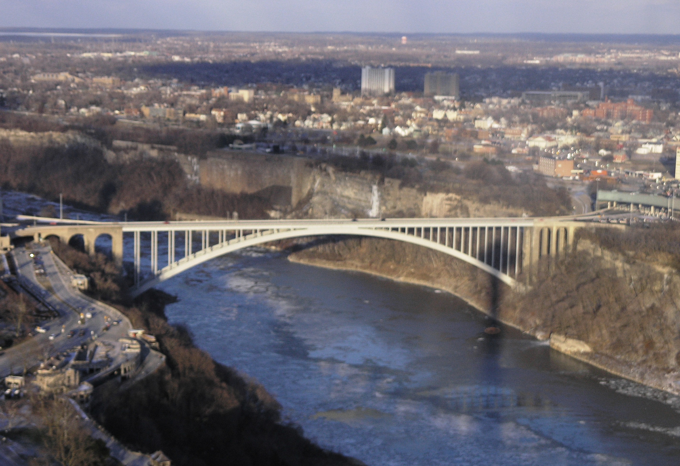
Main article: Robert Moses State Parkway Robert Moses State Parkway looking northbound - the early stages of converting the Parkway from Niagara Falls to Lewiston into a two-laned road
 Robert Moses State Pkwy sign
Robert Moses State Pkwy The Robert Moses State Parkway is a 19.58 miles (31.51 km) long north-south parkway in western Niagara County. The Robert Moses State Parkway is designated as unsigned New York Reference Route 957A. The southern terminus is at an interchange with Interstate 190 and the LaSalle Expressway east of downtown Niagara Falls. The northern terminus is at NY 18 at Four Mile Creek State Park in Porter. Due to low usage, a portion of the parkway near Niagara Falls was removed, separating the parkway into two sections. The parkway begins in Niagara Falls, where the I-190 meets with the LaSalle Expressway, from there it heads west along the north side of the Niagara River to Niagara Falls State Park. The original route also passed under the approach to the Rainbow Bridge. Today, the parkway is interrupted because of the closed section. Traffic must now employ NY 384 to bridge the two sections of the parkway. From downtown Niagara Falls, the Robert Moses heads north the east side of the Niagara Gorge and is a very scenic route. It continues north into Lewiston and Porter, where it travels north, inland, away from the river. The Robert Moses has a spur into Fort Niagara before ending approximately 3 miles later at NY 18 near Lake Ontario in northwestern Niagara County at Four Mile Creek State Park.
Robert Moses State Pkwy routing
Robert Moses State Parkway (Fort Niagara Spur)/ NY 958A
Main article: Robert Moses State Parkway Split of the Fort Niagara spur of the Robert Moses State Parkway northbound. (signed here as New York State Route 18F) Located in the Town of Porter
The Robert Moses State Parkway's short spur west into Fort Niagara State Park and to Fort Niagara in Porter is only 1.16 miles (1.87 km) in length and is designated Reference Route 958A
RMSP - Ft Niagara Spur routing
Former Routes in Niagara County
Former routes in the county include: I-90N, US 104, NY 3, NY 18D, NY 18E, NY 62A, NY 359, and NY 950H (reference route).
I-90N
 I-90N shieldMain article: Interstate 190 (New York)
In 1957, I-190 at that time was assigned the number Interstate 90N, as intercity routes were numbered before the three-digit Interstates were assigned to the shorter intracity routes.[7] On February 24, 1959, Interstate 90N was renumbered Interstate 190.[2]
US 104
 US 104 shieldMain article: New York State Route 104
Prior to 1934, what became US 104 was NY 18 (NY 34 prior to the 1930 renumbering) from Niagara Falls north to Lewiston, NY Route 31 from Lewiston east to Rochester.[8] US 104 was assigned ca. 1935, overlapping NY 18 from Niagara Falls to Lewiston and replacing NY 31 along Ridge Road from Lewiston to Rochester. Route 31 was then shifted south to replace Route 3 west of Rochester.[9][10] US 104 was redesignated as NY 104 ca. 1972.[11][12]
NY 3
 NY 3 shieldMain article: New York State Route 3See also: New York State Route 31 and New York State Route 425
New York State Route 3 began at what is now the intersection of US 62 and NY 425 and followed NY 425 north to where it currently meets NY 31 midway between Niagara Falls and Lockport. There, NY 3 turned east and remained on what is now NY 31 through Lockport to Rochester.[13] In the 1930 renumbering, NY 3 was realigned in both Niagara County and in the North Country. In Niagara County, the western terminus of the route was moved to Niagara Falls, where it began at then-NY 18 (now NY 104) north of downtown. NY 3 then proceeded west along Lockport Street and Lockport Road to NY 425, where it rejoined its pre-1930 routing. The old routing south of Lockport Road was redesignated as NY 425.[14] From NY 425 to Watertown, the Route 3 remained unchanged. The routing of NY 3 was altered once more in 1934 when U.S. Route 104 was assigned to the routing of then-NY 31 west of Rochester and NY 3 from Rochester to Maple View.[15][16] NY 31 was then rerouted onto the alignment of pre-1934 NY 3 from Niagara Falls to Rochester[17] while NY 3 was truncated to Sterling and rerouted to follow its current alignment between Sterling and Watertown.
NY 18D
Main article: New York State Route 182 NY 18D shield
New York State Route 18D was commissioned as early as 1935.[18] NY 18D began its west end at the Whirlpool Rapids Bridge and ended at US 62 at its east end. The entire length of NY 18D was redesignated as New York State Route 182[19][20] when New York State Route 18 was truncated to New York State Route 104 in Lewiston in the early 1960s.[21][22]
NY 18E
Main article: New York State Route 18E NY 18E shield
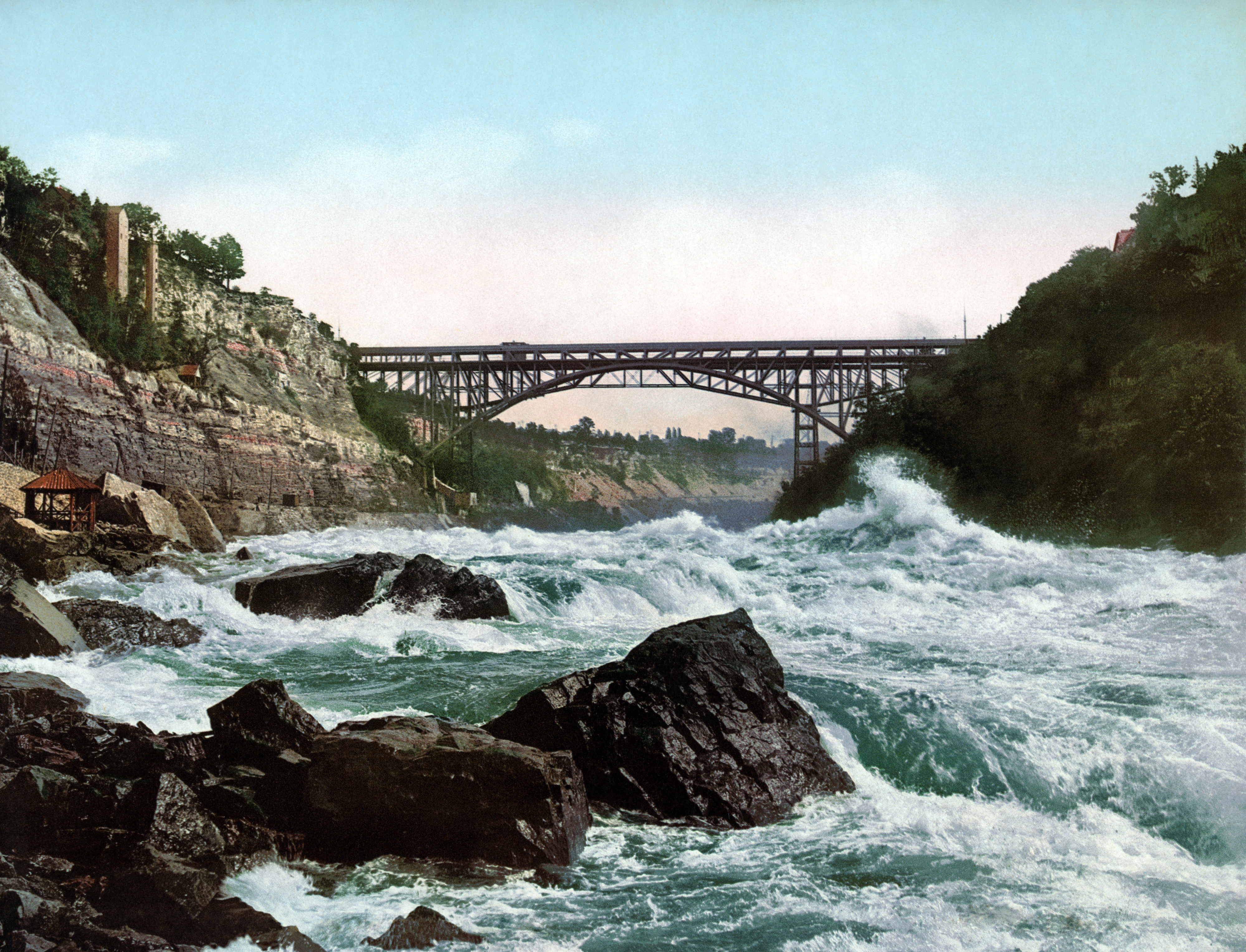
 Original Lewiston-Queenston Bridge
NY 18E was a short spur assigned in the 1930s to a connector between then NY 18 (now NY 18F) and the original Queenston-Lewiston Bridge in Lewiston.[10] It was removed in the early 1960s when the original bridge to Queenston was replaced with the modern Lewiston-Queenston Bridge a short distance upstream.[23][24]
NY 62A
Main article: U.S. Route 62 Business (Niagara Falls, New York) NY 62A shield
New York State Route 62A was the former designation for Pine Avenue in Niagara Falls. It was designated as Business US 62 in 2007, ending the NY 62A designation it held since 1980.
NY 359
Main article: New York State Route 359See also: List of county routes in Niagara County, New York (1-25)#Route 10 and List of county routes in Niagara County, New York (101-125)#Route 108 NY 359 shield
New York State Route 359 was the former designation along Main Street (Niagara CR 10) and Hartland Road (Niagara CR 108) prior to 1938; between NY 31 and US 104 (now NY 104). NY 359 began its south end at NY 31 (Rochester Road) in Gasport (A hamlet in northern Royalton) as Main Street, and is presently is designated as Niagara CR 10. Once CR 10/Main Street crosses the Erie Canal the roadway turns into Hartland Road and is designated as Niagara CR 108. NY 359 continued due north into and through Hartland until it reached US 104 (now NY 104) where it had its northern terminus.[25][26]
NY 950H
Main article: New York State Route 425 NY 950H reference route sign
In the 1960' s, construction began on a new divided highway connecting NY 425 in North Tonawanda to Interstate 290 in Tonawanda.[27] The highway, known as the Twin Cities Memorial Highway, was initially designated as New York State Route 950H, an unsigned reference route,[28] upon opening in the early 1970s.[29] It became part of a rerouted NY 425 between 1970 and 1977.[30] When first built, the Twin Cities Memorial Highway was planned to continue as a divided highway north through North Tonawanda and Wheatfield to connect with the LaSalle Expressway in Niagara Falls, however the connection was never built, but evidence remains of the initial plans at the respective termini of each highway.
Niagara County routes
Main article: List of county routes in Niagara County, New YorkNiagara County routes are not signed and there is no apparent numbering pattern. Most of the county routes act as primary roads in the less developed areas and also serve to interconnect the various villages and hamlets of Niagara County. Niagara County maintains few county routes, including only the most important connecting thoroughfares, and those are maintained by the Niagara County highway department. Most of the roads in the County, including many of the local through highways, are maintained by the Towns.
In all there are 282.9 miles (455.3 km) of county road.[31]
Trails/Scenic driving
Seaway Trail
Main article: Seaway TrailThe Seaway Trail is a 518-mile (834 km) National Scenic Byway located mostly in New York and also Pennsylvania. The Seaway Trail consists of a series of designated roads and highways that travel along Lake Erie, the Niagara River, Lake Ontario, and the Saint Lawrence Seaway. The Seaway Trail was first designated in 1978 and is maintained by the non-profit Seaway Trail, Inc.[32]
Niagara Historic Trail
The Niagara Historic Trail was created in 1975 as part of the 1776 Bicentennial.[33] The Trail creates a loop through Niagara County for secenic driving and points of interest.
Niagara Wine Trail
The Niagara Wine Trail allows travelers to find a combination of wineries, farm vistas, and rural life within an afternoons drive. The Niagara Wine Trail is composed of two routes: the Niagara Wine Trail and the Niagara Escarpment Wine Trail. The Niagara Escarpment Wine Trail follows the natural land contour of the Escarpment and links Niagara Falls with the Trail.[34] It follows NY 104 out of Niagara Falls and east through Niagara County. In Cambria, the trail diverts onto some local roadways to access other wineries, but the trail continues east on 104 through the rest of the county. The trail turns north in Jeddo, a hamlet on the county line, onto New York State Route 269 (County Line Road) and from there heads north along the Niagara-Orleans County Line to end at the New York State Route 18 (Lake Road/Seaway Trail) and the northeast end of the Niagara Wine Trail.
The Niagara Wine Trail follows Lake Ontario and links Wilson Harbor and Amherst with the Trail.[34] It begins at Interstate 290 in Amherst and heads north along US 62 (Niagara Falls Boulevard), then turns north onto NY 425 (Shawnee Road) and continues on NY 425 through the central part of the county changing into Lower Mountain Road then Cambria-Wilson Road before entering the Village of Wilson. In Wilson, the Niagara Wine Trail turns east and parallels Lake Ontario on NY 18 (Lake Road/Seaway Trail) until the Niagara-Orleans County Line, where the Niagara Escarpment Wine trail has its end.
Niagara Wine Trail website Niagara Wine Trail Map
Interstate, U.S. highways, and State routes
The chart below shows current interstate, U.S., and state highways by year of creation, length, and the cities, towns, and villages crossed.
Route Number Year created Length within Niagara County Cities, Towns, Villages Crossed  I-190
I-1901959[7] 7.52 miles (12.10 km)[5] Niagara (town), Lewiston (town)  US 62
US 621932 13.24 miles (21.31 km)[5] Wheatfield, Niagara (town), Niagara Falls 
US 62 BUS2007 (early 1980s as NY 62A) 2.12 miles (3.41 km)[35] Niagara Falls  NY 18
NY 181924,[36] 1960s NY 18
West end in Lewiston[37]36.3 miles (58.4 km)[5] Lewiston, Porter, Wilson, Wilson (village), Somerset  NY 18F
late 1940s[25] 9.80 miles (15.77 km)[28] Lewiston (village), Lewiston, Porter  NY 31
NY 311920s[38] 31.57 miles (50.81 km)[5] Niagara Falls, Niagara (town),  NY 31E
By 1952.[39] 0.8 miles (1.3 km)[5] Middleport  NY 61
NY 611930[8] 3.86 miles (6.21 km)[28] Niagara Falls, Niagara (town), Lewiston  NY 77
NY 771930,[14] (1938 North end in Niagara County)[26] 10.5 miles (16.9 km)[5] Lockport (town), Royalton  NY 78
NY 781930[8] 18.0 miles (29.0 km)[5] Olcott (village), Newfane, Lockport (town), Lockport (city)  NY 93
NY 9334.55 miles (55.60 km)[5] Youngstown, Porter, Wilson, Cambria, Lockport (town), Lockport (city), Pendleton, Royalton  NY 104
ca. 1972[11][12] 37.5 miles (60.4 km)[5] Niagara Falls, Lewiston, Lewiston (village), Cambria, Lockport (town), Newfane, Hartland  NY 148
1961[40][41] 7.53 miles (12.12 km)[35] Hartland, Somerset  NY 182
1960s[19][20] 6.18 miles (9.95 km)[28] Niagara Falls, Niagara (town)  NY 265
13.36 miles (21.50 km)[5] North Tonawanda, Wheatfield  NY 269
1930[42] 6.36 miles (10.24 km)[28] Niagara-Orleans County Line  NY 270
5.8 miles (9.3 km)[5] Pendleton  NY 271
1930[42] 3.21 miles (5.17 km)[28] Middleport, Hartland  NY 324
1930s,[10] 1960s North end at NY 384.[43] 0.48 miles (0.77 km)[5] Niagara Falls  NY 384
1930[42] 19.2 miles (30.9 km)[5] Niagara Falls, Wheatfield, North Tonawanda  NY 425
1930, 1970s (in Erie County).[29][30] 22.2 miles (35.7 km)[5] North Tonawanda, Wheatfield, Cambria, Wilson  NY 429
1930s[10][14] 12.16 miles (19.57 km)[28] North Tonawanda, Wheatfield, Lewiston, Lewiston/Cambria  LaSalle Expwy
1960s[44] 2.62 miles (4.22 km)[28]
Niagara Street: 0.42 miles (0.68 km)
Total length of NY 951A: 3.04 miles (4.89 km)Niagara Falls, Niagara (town)  Robert Moses State Pkwy
Early 1960s[45] 19.58 miles (31.51 km)
NY 957A: 18.42 miles (29.64 km)[28]
NY 958A: 1.16 miles (1.87 km)[28]Niagara Falls, Lewiston, Porter Former state touring routes  I-90N
I-90N1957-February 24, 1959[2] 7.52 miles (12.10 km)[5] Niagara (town), Lewiston (town)  US 104
ca. 1935[9][10] – ca. 1972[11][12] 37.5 miles (60.4 km)[5] Niagara Falls, Lewiston, Lewiston (village), Cambria, Lockport (town), Newfane, Hartland  NY 3
NY 31924[36] 26.19 miles (42.15 km)[5] Wheatfield, Cambria, Lockport, Royalton, Middleport  NY 18D
By 1935-1960s.[18] 6.18 miles (9.95 km)[28] Niagara (town), Niagara Falls  NY 18E
By 1936[46]-by 1965[47] 0.50 miles (0.80 km)[5] Lewiston (village)  NY 62A
Early 1980s - 2007 2.12 miles (3.41 km)[35] Niagara Falls  NY 359
- 1938[26] 3.15 miles (5.07 km) Royalton (Gasport), Hartland Reference routes located in Niagara County
# From Via To Length
(mi)(km) Notes  950H
950H I-290 exit 2
in TonawandaTwin Cities Memorial Highway Wheatfield Street in North Tonawanda 2.87 4.62 Now part of NY 425950U Maryland Avenue Highland Avenue in Niagara Falls NY 610.22 0.35 951A Rainbow Bridge customs plaza in Niagara Falls Niagara Street and LaSalle Expressway Williams Road in Wheatfield 3.04 4.89 Gap in designation from 5th Street to I-190 951B NY 31Walnut Street in Lockport Pound Street 0.40 0.64 952B  Robert Moses State Parkway
John B. Daly Boulevard in Niagara Falls Niagara Street 0.42 0.68 952V NY 265/NY 384
in WheatfieldWilliams Road US 62 in Niagara Falls1.94 3.12 954M Lockport city line in Lockport Akron Road NY 93 in Royalton3.47 5.58 Former routing of NY 93954P Robert Moses State ParkwayUpper Mountain Road in Lewiston NY 2650.60 0.97 955A United States-Canada border Rainbow Bridge in Niagara Falls NY 3840.30 0.48 Maintained by Niagara Falls Bridge Commission 955C United States-Canada border Whirlpool Rapids Bridge in Niagara Falls NY 1820.14 0.23 Maintained by Niagara Falls Bridge Commission 957A LaSalle Expressway in Niagara Falls Robert Moses State Parkway NY 18 in Porter18.42 29.64 Maintained by New York State Parks Department 958A Robert Moses State ParkwaySpur to Fort Niagara in Porter Fort Niagara State Park 1.16 1.87 Maintained by New York State Parks Department  Niagara County Municipalities
External links
References
- ^ a b c Overview of mileage in Niagara County, New York. New York State Department of Transportation. 2006.
- ^ a b c American Association of State Highway and Transportation Officials (2006). "Today in Interstate History: February 24". http://www.interstate50th.org/history/2006-02-24.shtml. Retrieved October 30, 2007.[dead link]
- ^ Empire State Roads (2001). Niagara County - County Roads (Map). http://www.empirestateroads.com/cr/crniagara.html. Retrieved December 19, 2008.
- ^ Empire State Roads, Region and County Code Listing
- ^ a b c d e f g h i j k l m n o p q r s t u v w x "Google Maps". Google Maps. https://www.maps.google.com. Retrieved October 15, 2008.
- ^ Interstate 890 at Kurumi.com
- ^ a b American Association of State Highway Officials (August 14, 1957). Official Route Numbering for the National System of Interstate and Defense Highways (Map).
- ^ a b c Dickinson, Leon A. (January 12, 1930). "New Signs for State Highways". New York Times: p. 136.
- ^ a b Texas Oil Company (1934). Road Map of New York (Map). Cartography by Rand McNally and Company.
- ^ a b c d e Sun Oil Company (1935). Road Map & Historical Guide – New York (Map). Cartography by Rand McNally and Company.
- ^ a b c Gulf Oil (1971). Ontario (Map). Cartography by Rolph-McNally Limited. http://www.ontarioroadmaps.ca/Oil_Companies/Gulf/1971_CDN/Municipalities/NiagaraFrontier.jpg. Retrieved April 4, 2009.
- ^ a b c Texaco (1972). Ontario (Map). Cartography by H.M. Gousha Company. http://www.ontarioroadmaps.ca/Oil_Companies/Texaco/1972_US/Municipalities/Buffalo.jpg. Retrieved April 4, 2009.
- ^ Rand McNally (1926). Rand McNally Auto Road Atlas (western New York) (Map). http://www.broermapsonline.org/members/NorthAmerica/UnitedStates/Midatlantic/NewYork/unitedstates1926ra_008.html. Retrieved October 10, 2007.
- ^ a b c Automobile Legal Association (ALA) Automobile Green Book, 1930/31 and 1931/32 editions, (Scarborough Motor Guide Co., Boston, 1930 and 1931). The 1930/31 edition shows New York state routes prior to the 1930 renumbering
- ^ Sun Oil Company (1935). Road Map & Historical Guide - New York (Map). Cartography by Rand McNally and Company.
- ^ Shell (1935). Ontario (Map). Cartography by H.M. Gousha Company. http://www.ontarioroadmaps.ca/Oil_Companies/Shell/1935/1935.htm. Retrieved October 10, 2007.
- ^ Shell (1935). Ontario (Niagara Region inset) (Map). Cartography by H.M. Gousha Company. http://www.ontarioroadmaps.ca/Oil_Companies/Shell/1935/Niagara.jpg. Retrieved October 10, 2007.
- ^ a b Shell (1935). Niagara Falls and Vicinity (Map). Cartography by H.M. Gousha Company. http://www.ontarioroadmaps.ca/Oil_Companies/Shell/1935/Niagara.jpg. Retrieved November 22, 2007.
- ^ a b White Rose (1963). Ontario (Map). Cartography by Rolph-McNally Limited. http://www.ontarioroadmaps.ca/Oil_Companies/White_Rose/1963/Municipalities/NiagaraFrontier.jpg. Retrieved November 22, 2007.
- ^ a b Supertest (1964). Ontario (Map). Cartography by H.M. Gousha Company. http://www.ontarioroadmaps.ca/Oil_Companies/Supertest/1964/Municipalities/Buffalo.jpg. Retrieved November 22, 2007.
- ^ Pennsylvania Department of Highways (1960). Official Map of Pennsylvania (Map). ftp://ftp.dot.state.pa.us/public/pdf/BPR_pdf_files/Maps/Statewide/Historic_OTMs/1960fr.pdf. Retrieved November 22, 2007.
- ^ United States Geological Survey (1962). Buffalo, NY Quadrangle (Map). 1:250,000. Eastern United States 1:250,000.
- ^ Cities Service (1960). Buffalo-Niagara Falls - New York-Ontario (Map). Cartography by H.M. Gousha Company. http://www.ontarioroadmaps.ca/Oil_Companies/Cities_Service/1960/Maps/Buffalo_Niagara.jpg. Retrieved December 5, 2007.
- ^ White Rose (1963). Niagara Frontier (Map). Cartography by Rolph-Clark-Stone. http://www.ontarioroadmaps.ca/Oil_Companies/White_Rose/1963/Municipalities/NiagaraFrontier.jpg. Retrieved December 5, 2007.
- ^ a b State of New York Department of Public Works. Official Highway Map of New York State (Map). Cartography by General Drafting (1947-48 ed.).
- ^ a b c Automobile Legal Association (ALA) Automobile Green Book, 1938/39 edition, (W.A. Thibodeau, 1938).
- ^ National Bridge Inventory, a database compiled by the United States Department of Transportation Federal Highway Administration, available at www.nationalbridges.com. Accessed March 6, 2008.
- ^ a b c d e f g h i j k "2007 Traffic Data Report for New York State" (PDF). New York State Department of Transportation. July 25, 2008. https://www.nysdot.gov/divisions/engineering/technical-services/hds-respository/NYSDOT_Traffic_Data_Report_2007.pdf. Retrieved July 17, 2009.
- ^ a b State of New York Department of Transportation (January 1, 1970) (PDF). Official Description of Touring Routes in New York State. http://www.greaternyroads.info/pdfs/state70.pdf. Retrieved July 16, 2009.
- ^ a b Exxon (1977). New York (Map). Cartography by General Drafting (1977-78 ed.).
- ^ "Overview of mileage in Niagara County, New York". New York State Department of Transportation. 2006. https://www.nysdot.gov/divisions/engineering/technical-services/hds-respository/niagara.pdf. Retrieved December 9, 2008.
- ^ "About Us - Seaway Trail Inc". Seaway Trail Incorporated. 2008. http://www.seawaytrail.com/05_aboutus.asp. Retrieved December 9, 2008.
- ^ "Niagara Historic Trail Guidebook". New York Council for the Humanities. 2008. http://www.nyhumanities.org/events/event.php?event_id=1871. Retrieved December 16, 2008.
- ^ a b "Niagara Wine Trail". Elizabeth Rose Designs. 2008. http://www.niagarawinetrail.org/. Retrieved January 1, 2009.
- ^ a b c "2008 Traffic Data Report for New York State" (PDF). New York State Department of Transportation. June 16, 2009. pp. 203, 251. https://www.nysdot.gov/divisions/engineering/technical-services/hds-respository/NYSDOT_Traffic_Data_Report_2008.pdf. Retrieved January 22, 2010.
- ^ a b "New York's Main Highways Designated by Numbers". New York Times: p. XX9. December 21, 1924.
- ^ Pennsylvania Department of Highways (1960). Official Map of Pennsylvania (Map). ftp://ftp.dot.state.pa.us/public/pdf/BPR_pdf_files/Maps/Statewide/Historic_OTMs/1960fr.pdf. Retrieved December 5, 2007.
- ^ "Rand McNally Auto Road Atlas". Rand McNally. 1926. http://www.broermapsonline.org/members/NorthAmerica/UnitedStates/Midatlantic/NewYork/unitedstates1926ra_008.html. Retrieved September 8, 2007.
- ^ Sunoco (1952). New York (Map). Cartography by Rand McNally and Company.
- ^ Gulf (1960). New York and New Jersey Tourgide Map (Map). Cartography by Rand McNally and Company.
- ^ Sunoco (1961). New York and Metropolitan New York (Map). Cartography by H.M. Gousha Company (1961-62 ed.).
- ^ a b c Standard Oil Company of New York (1930). Road Map of New York (Map). Cartography by General Drafting.
- ^ New York State Department of Transportation (January 2009) (PDF). Official Description of Highway Touring Routes, Bicycling Touring Routes, Scenic Byways, & Commemorative/Memorial Designations in New York State. https://www.nysdot.gov/divisions/operating/oom/transportation-systems/repository/2009%20tour-bk.pdf. Retrieved July 16, 2009.
- ^ "Lois Gibbs returns to Love Canal, calls state's health study a 'whitewash'". The Buffalo News. August 1, 2000. http://google.com/search?q=cache:KU-aWP1CkH4J:www.buffalonews.com/home/story/404349.html+LaSalle+Expressway,+year+built&hl=en&ct=clnk&cd=14&gl=us. Retrieved January 19, 2009.
- ^ "Robert Moses Parkway Talk Draws Big Falls Crowd". WGRZ-TV. December 2008. http://www.wgrz.com/news/NFVoice_article.aspx?storyid=62706. Retrieved January 19, 2009.
- ^ Esso (1936). New York State Map (Map). Cartography by General Drafting Inc..
- ^ Mobil (1965). New York (Map).
US Route 62 Business
NY State Routes: New York State Route 18 • New York State Route 18F • New York State Route 31 • New York State Route 31E • New York State Route 61 • New York State Route 77 • New York State Route 78 • New York State Route 93 • New York State Route 104 • New York State Route 148 • New York State Route 182 • New York State Route 265 • New York State Route 269 • New York State Route 270 • New York State Route 271 • New York State Route 324 • New York State Route 384 • New York State Route 425 • New York State Route 429 • LaSalle Expressway • Robert Moses State Parkway
Former: Interstate 90N • US Route 104 • New York State Route 3 • New York State Route 18D • New York State Route 18E • New York State Route 62A • New York State Route 359
Other Highways: Niagara County Routes • Seaway Trail • Niagara Historic Trail • Niagara Wine TrailCategories:- Transportation in Niagara County, New York


Wikimedia Foundation. 2010.