- Niagara, New York
-
- See also: Niagara Falls (disambiguation).
Niagara, New York — Town — Location within the state of New York
 Niagara, New York
Coordinates: 43°6′58″N 78°59′22″W / 43.11611°N 78.98944°WCoordinates: 43°6′58″N 78°59′22″W / 43.11611°N 78.98944°W Country United States State New York County Niagara Government – Type Town Council – Town Supervisor Steven C. Richards (R) – Town Council Members' ListArea – Total 9.4 sq mi (24.3 km2) – Land 9.4 sq mi (24.3 km2) – Water 0.0 sq mi (0.0 km2) Elevation 623 ft (190 m) Population (2010) – Total 8,378 – Density 883.4/sq mi (341.1/km2) Time zone Eastern (EST) (UTC-5) – Summer (DST) EDT (UTC-4) FIPS code 36-51033 GNIS feature ID 0979275  Location within Niagara County.
Niagara is a town in Niagara County, New York, United States. As of the 2010 census, the town had a total population of 8,378. The town is named after the famous waterfall Niagara Falls.
The Town of Niagara is the neighbor to the City of Niagara Falls, which actually adjoins the famed Niagara Falls cataract. The town is located in the southwest corner of the county and is famed for its factory outlet mall (formerly Prime Outlet Niagara Falls), frequently visited by nearby Canadians based on the favorable currency exchange. Also located within the town is Niagara Falls International Airport, which serves the Niagara County area.
There is no separate post office, so the mailing address is Niagara Falls, NY. Both Niagara, NY, and Town of Niagara, NY, are not acceptable according to the US Postal Service when writing an address.
Contents
History
The Town of Niagara was founded in 1812 (originally as the "Town of Schlosser") from the Town of Cambria.
In 1892, the City of Niagara Falls was formed from the town, taking about half of its land. In 1903, the city annexed another quarter of the town, reducing its size to 9.4 square miles. Its borders have remained the same since.
Geography
According to the United States Census Bureau, the town has a total area of 9.4 square miles (24 km2), all of it land.
Adjacent Cities & Towns
- Town of Lewiston - north
- Town of Wheatfield - east
- City of Niagara Falls - west,south
Major Highways in the Town of Niagara
 Interstate 190 (Niagara Expressway),This interstate through the western part of town from the Niagara Falls city line to the Lewiston town line. In the town there are exits at Porter Rd. (NY 182) and Witmer Rd. (NY 31).
 U.S. Route 62 (Niagara Falls Blvd.), North-South highway that has a short distance in the town from the Wheatfield town line to the Niagara Falls city line.
 New York State Route 31 (Witmer Rd., Saunders Settlement Rd.), East-West Highway across the northwestern part of town from the Lewiston town line to the Niagara Falls city line.
 New York State Route 61 (Hyde Park Blvd.), North-South Roadway mostly in the City of Niagara Falls, but has a short distance in the southwest corner of town where the route has its northern end at Lewiston Rd. (NY 104).
 New York State Route 182 (Porter Rd.), East-West roadway through the town from the Niagara Falls city line near its interchange with I-190 to its eastern terminus at Niagara Falls Blvd. (US 62).
 New York State Route 265 (Military Rd.), North-South roadway through the town from the Niagara Falls city line to the Lewiston town line.
Demographics
As of the census[1] of 2000, there were 8,978 people, 3,611 households, and 2,480 families residing in the town. The population density was 955.8 people per square mile (369.2/km²). There were 3,879 housing units at an average density of 412.9 per square mile (159.5/km²). The racial makeup of the town was 92.99% White, 3.02% African American, 1.47% Native American, 0.56% Asian, 0.02% Pacific Islander, 0.22% from other races, and 1.72% from two or more races. Hispanic or Latino of any race were 1.17% of the population.
There were 3,611 households out of which 29.6% had children under the age of 18 living with them, 51.1% were married couples living together, 13.0% had a female householder with no husband present, and 31.3% were non-families. 26.1% of all households were made up of individuals and 9.9% had someone living alone who was 65 years of age or older. The average household size was 2.49 and the average family size was 2.99.
In the town the population was spread out with 23.4% under the age of 18, 8.9% from 18 to 24, 28.0% from 25 to 44, 25.1% from 45 to 64, and 14.6% who were 65 years of age or older. The median age was 39 years. For every 100 females there were 95.1 males. For every 100 females age 18 and over, there were 92.3 males.
The median income for a household in the town was $37,327, and the median income for a family was $43,689. Males had a median income of $35,657 versus $25,358 for females. The per capita income for the town was $17,500. About 7.1% of families and 9.3% of the population were below the poverty line, including 14.6% of those under age 18 and 3.9% of those age 65 or over.
References
- ^ "American FactFinder". United States Census Bureau. http://factfinder.census.gov. Retrieved 2008-01-31.
External links
Municipalities and communities of Niagara County, New York Cities 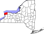
Towns Villages Barker | Lewiston | Middleport | Wilson | Youngstown
CDPs Gasport | Newfane | Olcott | Ransomville | Rapids | South Lockport
Other
hamletsAppleton | Beach Ridge | Blairville | Burt | Cambria Center | Carlisle Gardens | Colonial Village | Comstock Corners | Coolidge Beach | Corwin | Dickersonville | Dysinger | East Wilson | Elberta | Gilberts Corners | Hartland | Hess Road | Hickory Corners | Highland Park | Hoffman | Hopkins Beach | Johnson Creek | Mapleton | McNalls Corners | Millers | Model City | Molyneaux Corners | Nashville | North Hartland | North Ridge | Nottingham Estates | Orangeport | Pekin | Pendleton | Pendleton Center | Pleasant Corners | Porter Center | Raymond | Ridgewood | Roosevelt Beach | Royalton Center | St. Johnsburg | Sanborn | Sawyer | Shawnee | Shooktown | Somerset | South Somerset | South Wilson | Streeters Corners | Sunset Beach | Terrys Corners | Towers Corners | Walmore | Warrens Corners | Wendelville | West Somerset | Wolcottsville | Wrights Corners
Indian
reservationsTonawanda Reservation‡ | Tuscarora Reservation
Footnotes ‡This populated place also has portions in an adjacent county or counties
Categories:- Towns in New York
- Buffalo – Niagara Falls metropolitan area
- Populated places in Niagara County, New York


Wikimedia Foundation. 2010.