- West Argyle Street Historic District
-
West Argyle Street Historic District

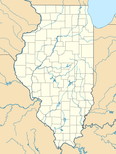

Location: Chicago, Illinois Coordinates: 41°58′24″N 87°39′25″W / 41.97333°N 87.65694°WCoordinates: 41°58′24″N 87°39′25″W / 41.97333°N 87.65694°W Architect: Multiple NRHP Reference#: 10000311 Added to NRHP: June 3, 2010 The West Argyle Street Historic District (also known as New Chinatown, Little Saigon, or Little Vietnam) is a historic district in the Uptown community area of Chicago, Illinois. It was listed on the National Register of Historic Places on June 3, 2010. The district covers an area of about 41 acres (0.17 km2); its rough boundaries are Broadway to the west, Winona Street to the north, Sheridan Road to the east, and Ainslie Street to the south.
Contents
History
The area covered by the historic district originally developed in the 1880s as a suburb called Argyle Park. The suburb had been named by Chicago Alderman and developer James A. Campbell for his ancestors the Dukes of Argyll in Scotland.[1] Development was centered around a station on the new Chicago & Evanston line of the Chicago, Milwaukee and St. Paul Railway that opened in May 1885.[2][3] The village, along with the rest of the Lake View Township, was annexed into Chicago in 1889.[4] In 1908 the Northwestern Elevated Railroad was extended north from Wilson Avenue, using the tracks of the Chicago, Milwaukee & St. Paul Railroad,[5] This linked the suburb into Chicago's 'L' network, and the area became popular with people of limited means who wanted to live on the Lake Michigan shore.[6] The railroad tracks were elevated onto an embankment between 1914 and 1922.
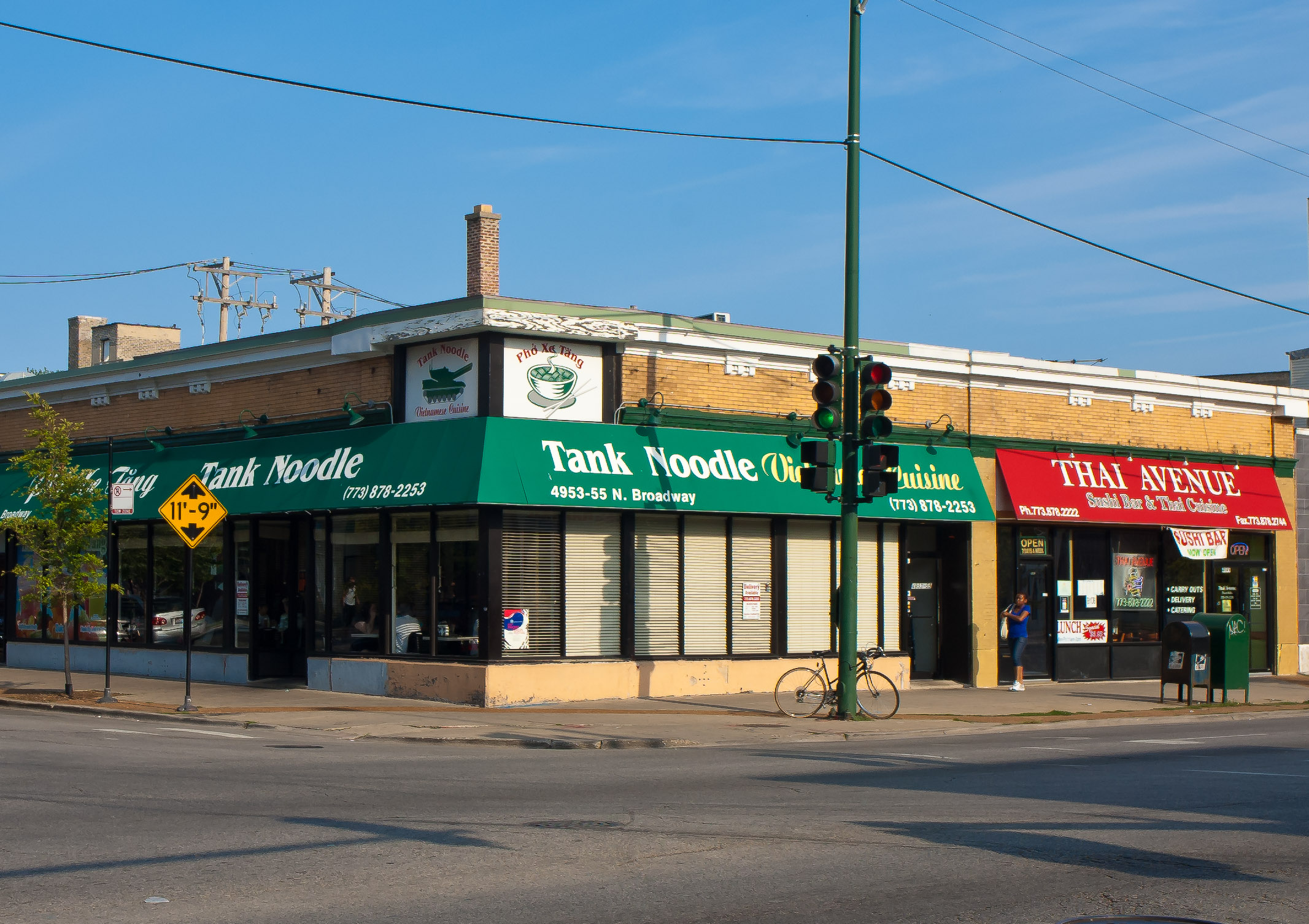
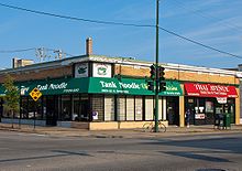 Vietnamese and Thai restaurants at the corner of Argyle Street and Broadway
Chicago restaurateur Jimmy Wong bought property in the area in the 1960s and planned its rebirth as New Chinatown. He envisioned a mall with pagodas, trees and reflecting ponds to replace the empty storefronts.[7] The Hip Sing Association, a Chinese cultural group, moved its Chicago offices to Argyle street in 1971,[8] and by 1974 Wong and the Hip Sing Association owned 80% of the three-block stretch on Argyle. Wong had an accident and broke both hips, leaving him unable to follow through on his plans. In 1979 Charlie Soo, founder of the Asian American Small Business Association, took up the cause, and the area developed not solely as a Chinese enclave but also including Vietnamese, Laotian, Cambodian, and Japanese businesses.[9] Soo campaigned to get the Chicago Transit Authority to give the Argyle 'L' station a $250,000 face-lift, then in 1981 he started the "Taste of Argyle," an annual food festival. He also secured funds from Chicago Mayor Jane Byrne to fix the sidewalks, and later from Mayor Harold Washington to repair building facades. Because of his tireless work in promoting the neighborhood, Soo would later be known as the unofficial "Mayor of Argyle Street."[10] By 1986 it was estimated that Uptown had about 8000 Chinese and Vietnamese residents.[8]
The concentration of Vietnamese restaurants, bakeries and shops; as well as Chinese, Cambodian, Laotian and Thai businesses along Argyle Street, centered on the Argyle 'L' station has led to the neighborhood being nicknamed New Chinatown, Little Saigon, or Little Vietnam.[6] On June 3, 2010 the area roughly bounded by Broadway to the west, Winona Street to the north, Sheridan Road to the east, and Ainslie Street to the south was entered into the National Register of Historic Places.[6][11]
See also
References
- ^ Callary, Edward (2009). Place names of Illinois. University of Illinois Press. p. 13. ISBN 0252033566.
- ^ "The Chicago & Evanston". Chicago Daily Tribune. May 22, 1885.
- ^ "Suburban". Chicago Daily Tribune. November 8, 1885.
- ^ "Ten New Sister Wards". Chicago Daily Tribune. July 20, 1889.
- ^ "Electrification of the Evanston Suburban Line of the Chicago Milwaukee & St. Paul". The Railway Age 44 (14): 467. October 4, 1907. http://books.google.com/books?id=D5RMAAAAYAAJ&pg=PA467. Retrieved July 29, 2010.
- ^ a b c "Uptown's Argyle Street Named To Historic Register". CBS2 Chicago: Chicago Area Local News. CBS Broadcasting Inc. June 14, 2010. http://cbs2chicago.com/local/argyle.street.historic.2.1750415.html. Retrieved July 29, 2010.[dead link]
- ^ Madhani, Aamer (July 6, 2001). "Jimmy Wong 1914-2001 - Restaurateur helped start `new Chinatown'". Chicago Tribune.
- ^ a b Congbalay, Dean (March 31, 1986). "Argyle Street shopping strip weaves pattern of prosperity". Chicago Tribune.
- ^ Heise, Kenan (November 20, 1981). "N. Side's Argyle Street takes on Far East flavor". Chicago Tribune.
- ^ Lynch, Kevin; Janega, James (April 4, 2001). "Charlie Soo 1945-2001: Argyle Street 'Mayor,' bold promoter of Asian shops". Chicago Tribune.
- ^ "Weekly list of actions taken on properties: 6/01/10 through 6/04/10". National Park Service. http://www.nps.gov/history/nr/listings/20100611.htm. Retrieved July 29, 2010.
External links
U.S. National Register of Historic Places Topics Lists by states Alabama • Alaska • Arizona • Arkansas • California • Colorado • Connecticut • Delaware • Florida • Georgia • Hawaii • Idaho • Illinois • Indiana • Iowa • Kansas • Kentucky • Louisiana • Maine • Maryland • Massachusetts • Michigan • Minnesota • Mississippi • Missouri • Montana • Nebraska • Nevada • New Hampshire • New Jersey • New Mexico • New York • North Carolina • North Dakota • Ohio • Oklahoma • Oregon • Pennsylvania • Rhode Island • South Carolina • South Dakota • Tennessee • Texas • Utah • Vermont • Virginia • Washington • West Virginia • Wisconsin • WyomingLists by territories Lists by associated states Other City of Chicago Architecture · Beaches · Climate · Colleges and Universities · Community areas · Culture · Demographics · Economy · Flag · Freeways · Geography · Government · History · Landmarks · Literature · Media · Music · Neighborhoods · Parks · Public schools · Skyscrapers · Sports · Theatre · Transportation Categories:
- Chinatowns in the United States
- National Register of Historic Places in Chicago, Illinois
- Historic districts in Chicago, Illinois


Wikimedia Foundation. 2010.