- National Register of Historic Places listings in Kay County, Oklahoma
-
 Location of Kay County in Oklahoma
This is a list of the National Register of Historic Places listings in Kay County, Oklahoma.
This is intended to be a complete list of the properties and districts on the National Register of Historic Places in Kay County, Oklahoma, United States. The locations of National Register properties and districts for which the latitude and longitude coordinates are included below, may be seen in a Google map.[1]
There are 35 properties and districts listed on the National Register in the county, including 3 National Historic Landmarks.
-
- This National Park Service list is complete through NPS recent listings posted November 10, 2011.[2]
Current listings
[3] Landmark name [4] Image Date listed Location City or town Summary 1 Big V Ranch House August 23, 1984 Off State Highway 156
36°37′09″N 97°10′31″W / 36.619167°N 97.175278°WPonca City 2 Blackwell Armory September 8, 1988 6th and Doolin Sts.
36°48′40″N 97°17′28″W / 36.811111°N 97.291111°WBlackwell 3 Blaine Stadium and Fieldhouse September 8, 1988 5th and Brookfield Sts.
36°43′06″N 97°04′38″W / 36.718333°N 97.077222°WPonca City 4 Bryson Archeological Site 
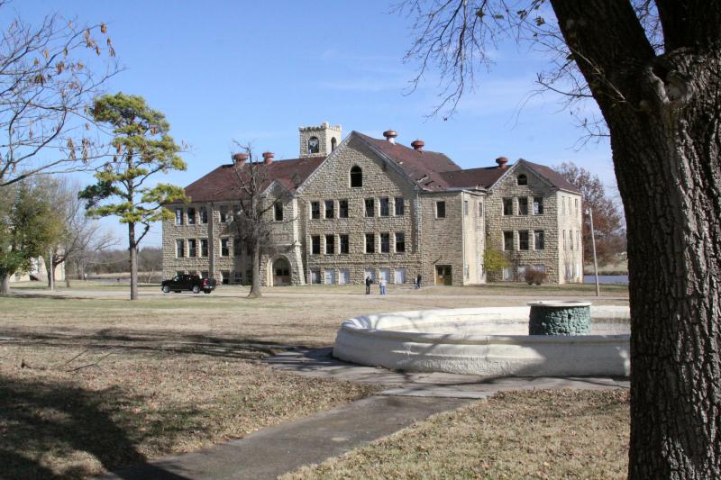
September 20, 1979 Address Restricted Newkirk 5 Chilocco Indian Agricultural School 
September 8, 2006 U.S. Route 77 and E0018 Rd.
36°59′06″N 97°03′45″W / 36.985°N 97.0625°WNewkirk 6 Darr School of Aeronautics Hangar No. 3 September 8, 2006 Southwest of the junction of Darr Park Dr. and Lindsey Rd.
36°44′10″N 97°05′50″W / 36.736111°N 97.097222°WPonca City 7 Deer Creek Site October 15, 1966 Address Restricted Newkirk 8 Daniel J. Donahoe House March 10, 1982 302 S. 7th St.
36°42′04″N 97°04′33″W / 36.701111°N 97.075833°WPonca City 9 Downtown Ponca City Historic District March 21, 2011 Roughly bounded by Pine St., Chestnut St., 7th St., and Central Ave.
36°42′15″N 97°04′52″W / 36.704167°N 97.081111°WPonca City 10 Electric Park Pavilion September 29, 1976 300 S. Main
36°48′06″N 97°16′54″W / 36.801667°N 97.281667°WBlackwell 11 First Presbyterian Church of Tonkawa September 22, 1994 109 S. 4th St.
36°40′43″N 97°18′18″W / 36.678611°N 97.305°WTonkawa 12 Huston Elementary School March 4, 2009 304 Vinnedge Ave.
36°47′11″N 97°17′12″W / 36.786389°N 97.286667°WBlackwell 13 Gov. William W. Jenkins Homestead Site October 14, 1976 Address Restricted Newkirk 14 Kaw City Depot October 3, 1979 West of Kaw City on Washungah Dr.
36°45′53″N 96°51′29″W / 36.764722°N 96.858056°WKaw City 15 Kaw Indian Agency April 11, 1973 North of the Arkansas River
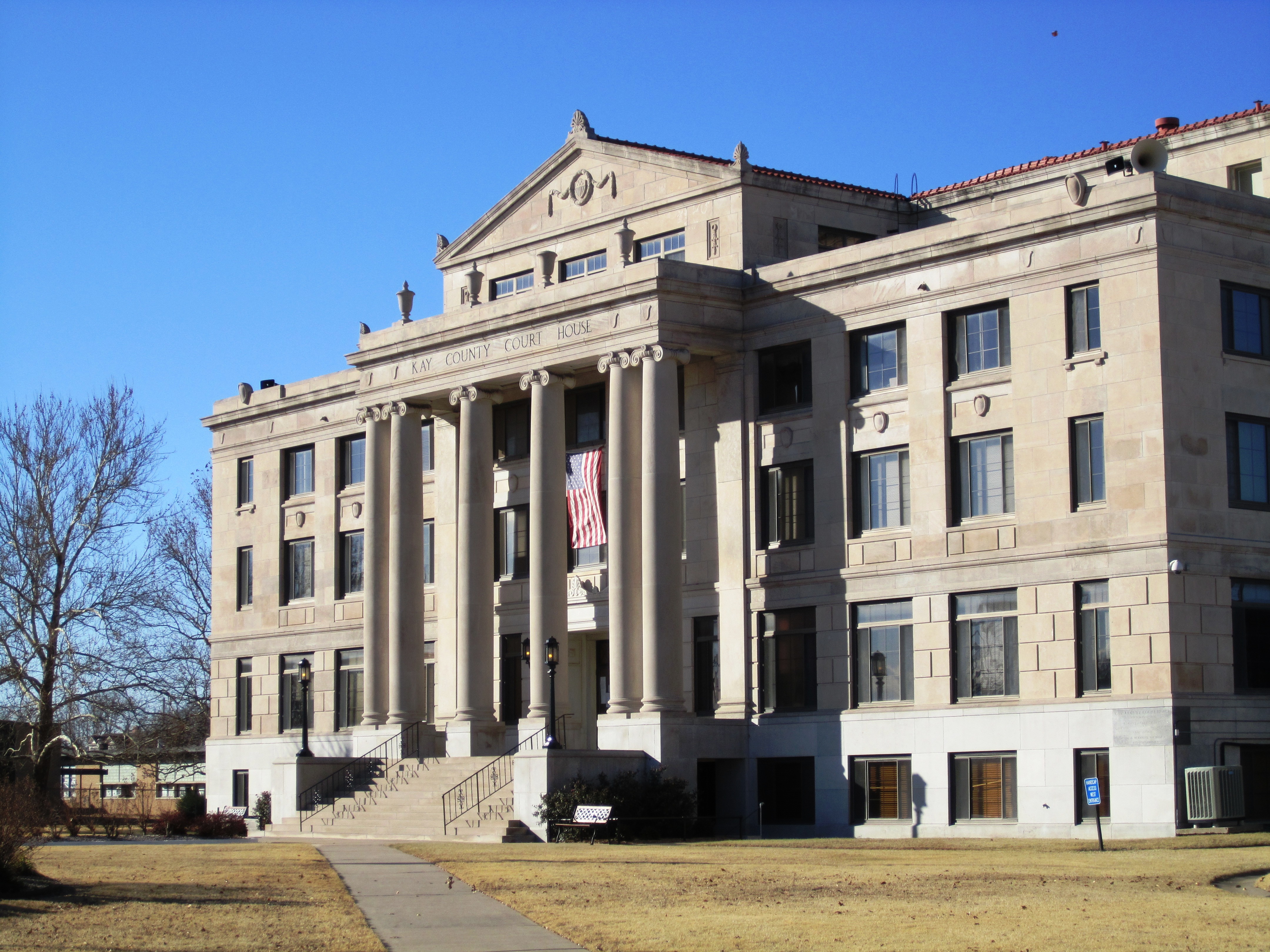
36°46′36″N 96°50′00″W / 36.776667°N 96.833333°WWashunga 16 Kay County Courthouse 
August 23, 1984 Courthouse Square
36°52′51″N 97°03′14″W / 36.880833°N 97.053889°WNewkirk 17 Mahoney House and Garage July 3, 1984 302 N. Main Ave.
36°40′53″N 97°18′33″W / 36.681389°N 97.309167°WTonkawa 18 E. W. Marland Mansion 
April 11, 1973 Monument Rd.
36°43′00″N 97°03′37″W / 36.716667°N 97.060278°WPonca City 19 Marland-Paris House September 28, 1976 1000 E. Grand
36°42′11″N 97°04′17″W / 36.703056°N 97.071389°WPonca City 20 Newkirk Central Business District February 23, 1984 Main and 7th Sts.
36°54′01″N 97°03′10″W / 36.900278°N 97.052778°WNewkirk 21 Newkirk Water Purification Plant September 8, 1988 10th and Elm Sts.
36°52′44″N 97°03′04″W / 36.878889°N 97.051111°WNewkirk 22 Nez Perce Reservation February 15, 1974 Address Restricted Tonkawa 23 Northside Elementary School February 23, 2009 720 W. Doolin Ave.
36°48′41″N 97°17′33″W / 36.811389°N 97.2925°WBlackwell 24 One-hundred-and-one Ranch April 11, 1973 12 miles southwest of Ponca City on State Highway 156
36°36′47″N 97°08′34″W / 36.613056°N 97.142778°WPonca City 25 Parkside Elementary School February 23, 2009 502 E. College Ave.
36°48′05″N 97°16′36″W / 36.801389°N 97.276667°WBlackwell 26 Pioneer Woman Statue 
August 31, 1978 Monument Circle
36°42′36″N 97°03′55″W / 36.71°N 97.065278°WPonca City 27 Poncan Theatre November 13, 1984 104 E. Grand Ave.
36°42′11″N 97°04′58″W / 36.703056°N 97.082778°WPonca City 28 Sheets House September 8, 2011 1350 W. Peckingham Rd.
36°53′01″N 97°04′10″W / 36.883611°N 97.069444°WNewkirk vicinity 29 Soldani Mansion June 24, 1982 819 E. Central St.
36°42′09″N 97°04′25″W / 36.7025°N 97.073611°WPonca City 30 J.P. Tipton Farmstead February 5, 1998 3.1 miles east of Newkirk
36°53′01″N 96°59′08″W / 36.883611°N 96.985556°WNewkirk 31 Tonkawa Armory September 8, 1988 3rd and North Sts.
36°41′25″N 97°18′10″W / 36.690278°N 97.302778°WTonkawa 32 Tonkawa Lodge No. 157 A.F. & A.M. September 6, 2007 112 N. 7th St.
36°40′45″N 97°18′28″W / 36.679167°N 97.307778°WTonkawa 33 Washington Elementary School March 4, 2009 723 W. College Ave.
36°48′05″N 97°17′32″W / 36.801389°N 97.292222°WBlackwell 34 Wentz Camp September 3, 2010 Intersection of L.A. Cann Dr. and E. Prospect Ave.
36°44′18″N 97°01′33″W / 36.738333°N 97.025833°WPonca City 35 White Eagle Park June 8, 2007 North of White Eagle White Eagle See also
- List of National Historic Landmarks in Oklahoma
- National Register of Historic Places listings in Oklahoma
References
- ^ The latitude and longitude information provided in this table was derived originally from the National Register Information System, which has been found to be fairly accurate for about 99% of listings. For about 1% of NRIS original coordinates, experience has shown that one or both coordinates are typos or otherwise extremely far off; some corrections may have been made. A more subtle problem causes many locations to be off by up to 150 yards, depending on location in the country: most NRIS coordinates were derived from tracing out latitude and longitudes off of USGS topographical quadrant maps created under the North American Datum of 1927, which differs from the current, highly accurate WGS84 GPS system used by Google maps. Chicago is about right, but NRIS longitudes in Washington are higher by about 4.5 seconds, and are lower by about 2.0 seconds in Maine. Latitudes differ by about 1.0 second in Florida. Some locations in this table may have been corrected to current GPS standards.
- ^ "National Register of Historic Places: Weekly List Actions". National Park Service, United States Department of the Interior. Retrieved on November 10, 2011.
- ^ Numbers represent an ordering by significant words. Various colorings, defined here, differentiate National Historic Landmark sites and National Register of Historic Places Districts from other NRHP buildings, structures, sites or objects.
- ^ "National Register Information System". National Register of Historic Places. National Park Service. . http://nrhp.focus.nps.gov/natreg/docs/All_Data.html.
U.S. National Register of Historic Places Topics Lists by states Alabama • Alaska • Arizona • Arkansas • California • Colorado • Connecticut • Delaware • Florida • Georgia • Hawaii • Idaho • Illinois • Indiana • Iowa • Kansas • Kentucky • Louisiana • Maine • Maryland • Massachusetts • Michigan • Minnesota • Mississippi • Missouri • Montana • Nebraska • Nevada • New Hampshire • New Jersey • New Mexico • New York • North Carolina • North Dakota • Ohio • Oklahoma • Oregon • Pennsylvania • Rhode Island • South Carolina • South Dakota • Tennessee • Texas • Utah • Vermont • Virginia • Washington • West Virginia • Wisconsin • WyomingLists by territories Lists by associated states Other Municipalities and communities of Kay County, Oklahoma Cities Blackwell | Kaw City | Newkirk | Ponca City‡ | Tonkawa

Towns Unincorporated
communitiesBois D'Arc | Chilocco | Eddy | Hardy | Nardin | Peckham | White Eagle
Ghost towns Autwine | Washunga
Footnotes ‡This populated place also has portions in an adjacent county or counties
Categories:- Kay County, Oklahoma
- National Register of Historic Places in Oklahoma by county
-


Wikimedia Foundation. 2010.