- National Register of Historic Places listings in Jerauld County, South Dakota
-
 Location of Jerauld County in South Dakota
This is a list of the National Register of Historic Places listings in Jerauld County, South Dakota.
This is intended to be a complete list of the properties on the National Register of Historic Places in Jerauld County, South Dakota, United States. The locations of National Register properties for which the latitude and longitude coordinates are included below, may be seen in a Google map.[1]
There are 12 properties listed on the National Register in the county.
-
- This National Park Service list is complete through NPS recent listings posted November 10, 2011.[2]
Current listings
[3] Landmark name [4] Image Date listed Location City or town Summary 1 Alpena Bathhouse and Swimming Pool June 22, 2000 Junction of 5th and Main
44°10′58″N 98°22′14″W / 44.182778°N 98.370556°WAlpena 2 Archeological Site 39JE10 February 23, 1984 Address Restricted Wessington Springs 3 Archeological Site 39JE11 February 23, 1984 Address Restricted Gann Valley 4 Jerauld County Courthouse 
February 10, 1993 Junction of South Dakota Ave. and Burrett St.
44°04′42″N 98°34′10″W / 44.078333°N 98.569444°WWessington Springs 5 Methodist Episcopal Church of Wessington Springs December 17, 1999 Southeastern corner of Main and State Sts.
44°04′47″N 98°34′18″W / 44.079722°N 98.571667°WWessington Springs 6 Municipal Field House June 2, 2000 418 2nd St., SW.
44°04′37″N 98°34′19″W / 44.076944°N 98.571944°WWessington Springs 7 L.P. Nielson Barn December 15, 2004 23251 393rd Ave.
44°01′03″N 98°22′24″W / 44.0175°N 98.373333°WWoonsocket 8 Shakespeare Garden and Shay House November 14, 1979 Off Highway 34
44°05′07″N 98°34′39″W / 44.085278°N 98.5775°WWessington Springs 9 Robert S. Vessey House April 26, 1978 118 College Ave.
44°04′44″N 98°34′24″W / 44.078889°N 98.573333°WWessington Springs 10 Wessington Springs Carnegie Library June 3, 1999 124 N. Main Ave.
44°04′45″N 98°34′19″W / 44.079167°N 98.571944°WWessington Springs 11 Wessington Springs Opera House July 21, 1976 111 Dakota Ave., N.
44°04′42″N 98°33′36″W / 44.078333°N 98.56°WWessington Springs 12 H.P. Will House February 5, 2003 214 Alene Ave., N.
44°04′51″N 98°34′32″W / 44.080833°N 98.575556°WWessington Springs See also
- List of National Historic Landmarks in South Dakota
- National Register of Historic Places listings in South Dakota
References
- ^ The latitude and longitude information provided in this table was derived originally from the National Register Information System, which has been found to be fairly accurate for about 99% of listings. For about 1% of NRIS original coordinates, experience has shown that one or both coordinates are typos or otherwise extremely far off; some corrections may have been made. A more subtle problem causes many locations to be off by up to 150 yards, depending on location in the country: most NRIS coordinates were derived from tracing out latitude and longitudes off of USGS topographical quadrant maps created under North American Datum of 1927, which differs from the current, highly accurate GPS system used by Google maps. Chicago is about right, but NRIS longitudes in Washington are higher by about 4.5 seconds, and are lower by about 2.0 seconds in Maine. Latitudes differ by about 1.0 second in Florida. Some locations in this table may have been corrected to current GPS standards.
- ^ "National Register of Historic Places: Weekly List Actions". National Park Service, United States Department of the Interior. Retrieved on November 10, 2011.
- ^ Numbers represent an ordering by significant words. Various colorings, defined here, differentiate National Historic Landmark sites and National Register of Historic Places Districts from other NRHP buildings, structures, sites or objects.
- ^ "National Register Information System". National Register of Historic Places. National Park Service. . http://nrhp.focus.nps.gov/natreg/docs/All_Data.html.
U.S. National Register of Historic Places Topics Lists by states Alabama • Alaska • Arizona • Arkansas • California • Colorado • Connecticut • Delaware • Florida • Georgia • Hawaii • Idaho • Illinois • Indiana • Iowa • Kansas • Kentucky • Louisiana • Maine • Maryland • Massachusetts • Michigan • Minnesota • Mississippi • Missouri • Montana • Nebraska • Nevada • New Hampshire • New Jersey • New Mexico • New York • North Carolina • North Dakota • Ohio • Oklahoma • Oregon • Pennsylvania • Rhode Island • South Carolina • South Dakota • Tennessee • Texas • Utah • Vermont • Virginia • Washington • West Virginia • Wisconsin • WyomingLists by territories Lists by associated states Other Municipalities and communities of Jerauld County, South Dakota City 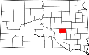
Towns Townships Alpena | Anina | Blaine | Chery | Crow | Crow Lake | Franklin | Harmony | Logan | Marlar | Pleasant | Viola | Wessington Springs
Unincorporated
communitiesCrow Lake | Spring Valley Colony
Categories:- Jerauld County, South Dakota
- National Register of Historic Places in South Dakota by county
- Buildings and structures in Jerauld County, South Dakota
-


Wikimedia Foundation. 2010.