- National Register of Historic Places listings in Gloucester County, Virginia
-
This list includes properties and districts listed on the National Register of Historic Places in Gloucester County, Virginia. Click the "Map of all coordinates" link to the right to view a Google map of all properties and districts with latitude and longitude coordinates in the table below.[1]
-
- This National Park Service list is complete through NPS recent listings posted November 10, 2011.[2]
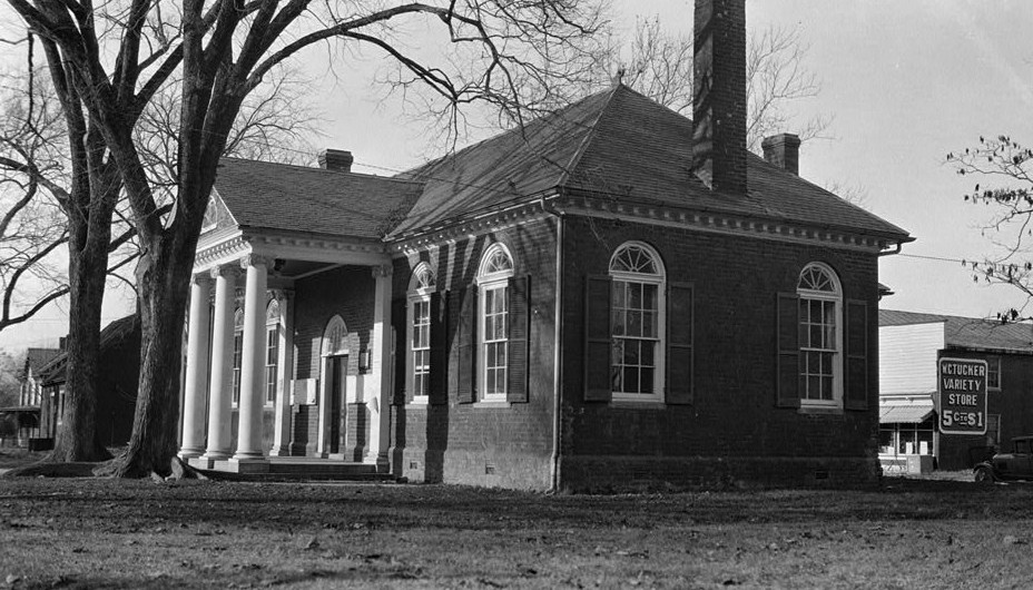
[3] Landmark name [4] Image Date listed Location City or town Summary 1 Abingdon Church 
September 15, 1970 U.S. 17, S of jct. with VA 614
37°20′00″N 76°30′49″W / 37.333333°N 76.513611°WWhite Marsh 2 Abingdon Glebe House 
September 15, 1970 S of jct. of U.S. 17 and VA 615
37°22′36″N 76°32′22″W / 37.376667°N 76.539444°WGloucester 3 Airville December 6, 1990 VA 629 S of jct. with VA 626
37°23′12″N 76°30′15″W / 37.386667°N 76.504167°WGloucester 4 Burgh Westra October 8, 1976 E of Gloucester off VA 3
37°25′11″N 76°27′14″W / 37.419722°N 76.453889°WGloucester 5 Cappahosic House April 11, 2003 3198 Cappahosic Rd.
37°22′49″N 76°38′00″W / 37.380278°N 76.633333°WGloucester 6 Gloucester Downtown Historic District December 27, 2010 Seven blocks of Main St. from the courthouse circle to Ware House Rd.
37°24′48″N 76°31′26″W / 37.413333°N 76.523889°WGloucester 7 Fairfield Site July 16, 1973 Address Restricted White Marsh 8 Gloucester County Courthouse Square Historic District 
October 3, 1973 Main St. and Gloucester County Courthouse Sq.
37°24′53″N 76°31′47″W / 37.414722°N 76.529722°WGloucester 9 Gloucester Point Archaeological District June 10, 1985 Address Restricted Gloucester 10 Gloucester Women's Club 
January 24, 1974 On U.S. 17
37°24′44″N 76°31′11″W / 37.412222°N 76.519722°WGloucester 11 Hockley July 9, 2010 6640 Ware Neck Rd.
37°24′14″N 76°27′48″W / 37.403889°N 76.463333°WGloucester 12 Holly Knoll December 21, 1981 Off RR 662
37°23′17″N 76°38′38″W / 37.388056°N 76.643889°WCapahosic Also known as Robert R. Moton House 13 Kempsville December 21, 1978 E of Shacklefords on VA 33
37°33′38″N 76°38′18″W / 37.560556°N 76.638333°WShacklefords 14 Lands End 
November 6, 1974 SE of Naxera on VA 614
37°19′35″N 76°25′34″W / 37.326389°N 76.426111°WNaxera 15 Little England 
December 18, 1970 E of Gloucester on VA 672
37°15′09″N 76°28′33″W / 37.2525°N 76.475833°WGloucester 16 Lowland Cottage September 22, 1971 SW of Ware Neck, 0.5 mi. S of VA 623
37°24′04″N 76°28′06″W / 37.401111°N 76.468333°WWare Neck 17 Walter Reed Birthplace 
September 20, 1973 SW of Gloucester at jct. of VA 614 and 616
37°23′18″N 76°35′18″W / 37.388333°N 76.588333°WBelroi 18 Roaring Spring September 22, 1972 0.3 mi. E of VA 616
37°25′53″N 76°31′49″W / 37.431389°N 76.530278°WGloucester 19 Rosewell 
October 1, 1969 Address Restricted Gloucester 20 Shelly Archeological District July 12, 1990 Address Restricted Hayes 21 Site 44GL103-Quest End September 10, 1979 5488 & 5476 Roanes Wharf Rd.
37°21′42″N 76°28′00″W / 37.361797°N 76.466797°WSelden 22 Timberneck September 10, 1979 E of Wicomico off VA 635
37°17′45″N 76°32′08″W / 37.295833°N 76.535556°WWicomico 23 Toddsbury 
November 12, 1969 E of jct. of Rtes. 662 and 14
37°26′00″N 76°27′09″W / 37.433333°N 76.4525°WGloucester 24 T.C. Walker House December 4, 2009 1 Main St.
37°24′47″N 76°31′19″W / 37.413103°N 76.521817°WGloucester 25 Ware Neck Store and Post Office June 3, 2009 6495 VA 629
37°24′12″N 76°27′32″W / 37.403333°N 76.458889°WWare Neck 26 Ware Parish Church 
March 20, 1973 NE of Gloucester on VA 14
37°25′21″N 76°30′27″W / 37.4225°N 76.5075°WGloucester 27 Warner Hall November 25, 1980 VA 629
37°20′24″N 76°28′36″W / 37.34°N 76.476667°WGloucester 28 Werowocomoco Archeological Site March 15, 2006 3051 Ginny Hill Rd.
37°24′44″N 76°39′21″W / 37.412222°N 76.655833°WGloucester 29 White Hall August 16, 1984 VA 668
37°22′11″N 76°28′17″W / 37.369722°N 76.471389°WZanoni 30 Woodville School February 11, 2004 4310 George Washington Memorial Highway
37°19′29″N 76°30′55″W / 37.324722°N 76.515278°WOrdinary 31 Zion Poplars Baptist Church August 5, 1999 7000 T.C. Walker Rd.
37°23′57″N 76°30′25″W / 37.399167°N 76.506944°WGloucester See also
- National Register of Historic Places listings in Virginia
- List of National Historic Landmarks in Virginia
References
- ^ The latitude and longitude information provided in this table was derived originally from the National Register Information System, which has been found to be fairly accurate for about 99% of listings. For about 1% of NRIS original coordinates, experience has shown that one or both coordinates are typos or otherwise extremely far off; some corrections may have been made. A more subtle problem causes many locations to be off by up to 150 yards, depending on location in the country: most NRIS coordinates were derived from tracing out latitude and longitudes off of USGS topographical quadrant maps created under North American Datum of 1927, which differs from the current, highly accurate GPS system used by Google maps. Chicago is about right, but NRIS longitudes in Washington are higher by about 4.5 seconds, and are lower by about 2.0 seconds in Maine. Latitudes differ by about 1.0 second in Florida. Some locations in this table may have been corrected to current GPS standards.
- ^ "National Register of Historic Places: Weekly List Actions". National Park Service, United States Department of the Interior. Retrieved on November 10, 2011.
- ^ Numbers represent an ordering by significant words. Various colorings, defined here, differentiate National Historic Landmark sites and National Register of Historic Places Districts from other NRHP buildings, structures, sites or objects.
- ^ "National Register Information System". National Register of Historic Places. National Park Service. . http://nrhp.focus.nps.gov/natreg/docs/All_Data.html.
U.S. National Register of Historic Places Topics Lists by states Alabama • Alaska • Arizona • Arkansas • California • Colorado • Connecticut • Delaware • Florida • Georgia • Hawaii • Idaho • Illinois • Indiana • Iowa • Kansas • Kentucky • Louisiana • Maine • Maryland • Massachusetts • Michigan • Minnesota • Mississippi • Missouri • Montana • Nebraska • Nevada • New Hampshire • New Jersey • New Mexico • New York • North Carolina • North Dakota • Ohio • Oklahoma • Oregon • Pennsylvania • Rhode Island • South Carolina • South Dakota • Tennessee • Texas • Utah • Vermont • Virginia • Washington • West Virginia • Wisconsin • WyomingLists by territories Lists by associated states Other  Category:National Register of Historic Places •
  Portal:National Register of Historic Places
Municipalities and communities of Gloucester County, Virginia County seat: Gloucester Courthouse CDPs 
Unincorporated
communitiesAchilles | Adner | Almondsville | Ark | Baileys | Batt | Bellamy | Belroi | Bena | Beulah | Brays Landing | Broad Marsh | Capahosic | Carters Cove | Clay Bank | Clay Bank Acres | Clopton | Clopton Heights | Concord | Country Village | Crab | Creekwood Cove Estates | Dutton | Edgehill | Elmington | Freeport | Glen Roy Estates | Glenns | Gum Fork | Harbor Hills | Harcum | Hayes | Hermitage | Hermitage Banks | Hockley | Hornets Nest | Lands End | Marlfield | Marshall Heights | Maryus | Mill Creek | Millwood | Money | Naxera | Neva Terrace | New Upton | Nuttall | Oakdale | Olivers Estates | Ordinary | Owl Trap | Oyster Cove | Pampa | Perrin | Pinero | Pinetta | Point Lookout | Powhatan Shores | Quiet Cove | Roanes | Robert Heights | Rosemont | Rosewell | Rosewell Harbor | Rowes Haven | Sassafras | Schley | Selden | Severn | Severn Manor | Signpine | Tidemill | Victory Hill | Wan | Ware Neck | West End | White Marsh | Wicomico | Woods Crossroads | York River Farms | York River Pines | York View | Zanoni
Categories:- Gloucester County, Virginia
- National Register of Historic Places in Virginia
- Virginia-related lists
-


Wikimedia Foundation. 2010.