- National Register of Historic Places listings in Gage County, Nebraska
-
 Location of Gage County in Nebraska
This is a list of the National Register of Historic Places listings in Gage County, Nebraska.
This is intended to be a complete list of the properties and districts on the National Register of Historic Places in Gage County, Nebraska, United States. The locations of National Register properties and districts for which the latitude and longitude coordinates are included below, may be seen in a Google map.[1]
There are 27 properties and districts listed on the National Register in the county.
-
- This National Park Service list is complete through NPS recent listings posted November 10, 2011.[2]
Current listings
[3] Landmark name Image Date listed Location City or town Summary 1 Barneston Site January 21, 1974 Address Restricted Barneston 2 Beatrice Chautauqua Pavilion and Gatehouse April 9, 1979 6th and Grable Sts.
40°15′08″N 96°44′22″W / 40.252222°N 96.739444°WBeatrice 3 Beatrice City Library July 12, 1976 220 N. 5th St.
40°16′03″N 96°44′50″W / 40.2675°N 96.747222°WBeatrice 4 Beatrice Municipal Auditorium November 16, 2005 205 N. 4th St.
40°16′02″N 96°44′59″W / 40.267222°N 96.749722°WBeatrice 5 Big Indian Creek Bridge June 29, 1992 Township road over Big Indian Creek, 3 miles southwest of Wymore
40°05′13″N 96°43′22″W / 40.086944°N 96.722778°WWymore 6 Bloody Run Bridge June 29, 1992 Township road over Bloody Run, 4 miles southwest of Virginia
40°12′39″N 96°33′29″W / 40.210833°N 96.558056°WVirginia 7 Blue Springs Site August 14, 1973 Address Restricted Blue Springs 8 Bridge June 29, 1992 Township road over Sicily Creek, 6 miles northwest of Wymore
40°09′06″N 96°47′03″W / 40.151667°N 96.784167°WWymore 9 Burlington Northern Depot May 2, 1975 118 Court St.
40°15′59″N 96°45′09″W / 40.266389°N 96.7525°WBeatrice 10 Christ Church Episcopal November 29, 1999 520 N. 5th St.
40°16′17″N 96°44′51″W / 40.271389°N 96.7475°WBeatrice 11 DeWitt Flour Mills and King Iron Bridge December 27, 1978 East of DeWitt on the Big Blue River
40°23′31″N 96°54′15″W / 40.391944°N 96.904167°WDeWitt 12 Marion and Ruth Ann Dole House December 10, 2010 1908 S. 4th St.
40°14′46″N 96°44′56″W / 40.246111°N 96.748889°WBeatrice 13 Farmers State Bank June 11, 1992 601 Main
40°27′35″N 96°30′29″W / 40.459722°N 96.508056°WAdams 14 Elijah Filley Stone Barn April 11, 1977 South of Filley off U.S. Route 136
40°15′47″N 96°32′25″W / 40.263056°N 96.540278°WFilley 15 First Commercial Bank November 15, 2007 301 Main St.
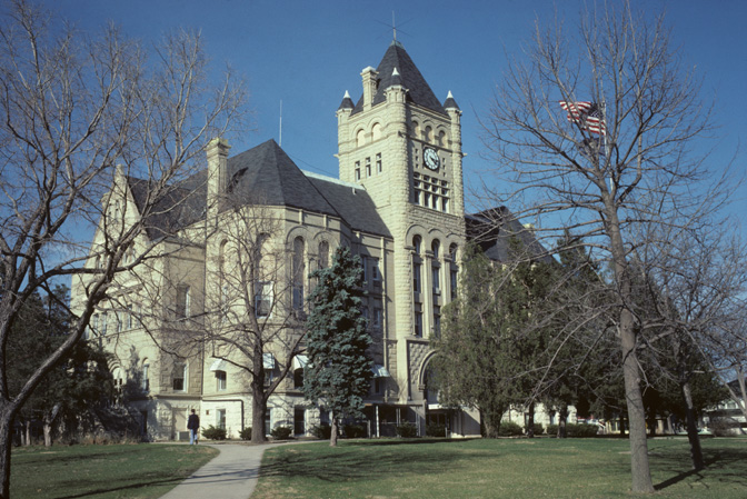
40°03′00″N 96°48′06″W / 40.05°N 96.801667°WOdell 16 Gage County Courthouse 
January 10, 1990 612 Grant St.
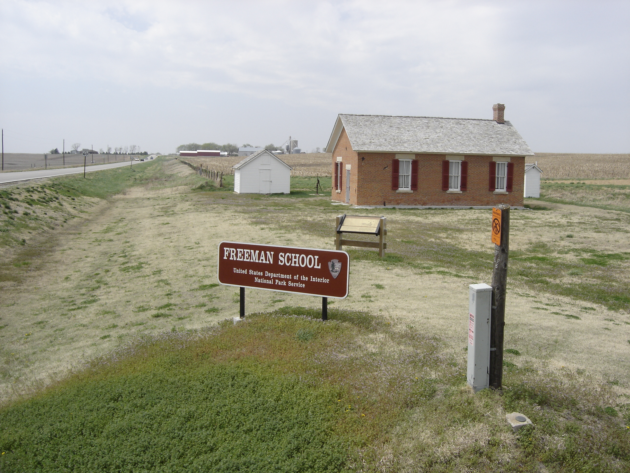
40°16′16″N 96°44′45″W / 40.271111°N 96.745833°WBeatrice 17 Homestead National Monument of America 
October 15, 1966 4.5 miles northwest of Beatrice on Nebraska Highway 4
40°17′15″N 96°50′07″W / 40.2875°N 96.835278°WBeatrice 18 Hoyt Street Bridge June 29, 1992 Vacated township road over the Big Blue River
40°16′39″N 96°46′40″W / 40.2775°N 96.777778°WBeatrice 19 Institution for Feeble Minded Youth Farm December 8, 1997 1 mile east of Beatrice State Home and 1 mile north of Nebraska Highway 3
40°16′27″N 96°41′19″W / 40.274167°N 96.688611°WBeatrice 20 Samuel D. Kilpatrick House December 20, 1984 701 N. 7th St.
40°16′22″N 96°44′43″W / 40.272778°N 96.745278°WBeatrice 21 Lake Bridenthal House February 24, 1983 113 S. 9th St.
40°07′18″N 96°39′53″W / 40.121667°N 96.664722°WWymore 22 Mission Creek Bridge June 29, 1992 County road over Mission Creek, 7 miles southwest of Barneston
40°00′15″N 96°27′48″W / 40.004167°N 96.463333°WBarneston 23 North Seventh Street Historic District March 10, 2010 N. 7th St. bounded by Garfield St. on the north and Washington St. on the south
40°16′27″N 96°44′43″W / 40.274264°N 96.745264°WBeatrice 24 North Eleventh Street Historic District March 10, 2010 N. 11th St. bounded by Garfield St. on the north and Lincoln St. on the south
40°16′26″N 96°44′23″W / 40.273772°N 96.739792°WBeatrice 25 Paddock Hotel November 30, 1987 105 N. 6th St.
40°15′58″N 96°44′49″W / 40.266111°N 96.746944°WBeatrice 26 Algernon S. Paddock House March 14, 1973 1401 N. 10th St.
40°16′49″N 96°44′28″W / 40.280278°N 96.741111°WBeatrice 27 Rachel Kilpatrick Purdy House November 8, 2006 1201 N. 11th St.
40°16′42″N 96°44′23″W / 40.278333°N 96.739722°WBeatrice See also
- List of National Historic Landmarks in Nebraska
- National Register of Historic Places listings in Nebraska
References
- ^ The latitude and longitude information provided in this table was derived originally from the National Register Information System, which has been found to be fairly accurate for about 99% of listings. For about 1% of NRIS original coordinates, experience has shown that one or both coordinates are typos or otherwise extremely far off; some corrections may have been made. A more subtle problem causes many locations to be off by up to 150 yards, depending on location in the country: most NRIS coordinates were derived from tracing out latitude and longitudes off of USGS topographical quadrant maps created under the North American Datum of 1927, which differs from the current, highly accurate WGS84 GPS system used by Google maps. Chicago is about right, but NRIS longitudes in Washington are higher by about 4.5 seconds, and are lower by about 2.0 seconds in Maine. Latitudes differ by about 1.0 second in Florida. Some locations in this table may have been corrected to current GPS standards.
- ^ "National Register of Historic Places: Weekly List Actions". National Park Service, United States Department of the Interior. Retrieved on November 10, 2011.
- ^ Numbers represent an ordering by significant words. Various colorings, defined here, differentiate National Historic Landmark sites and National Register of Historic Places Districts from other NRHP buildings, structures, sites or objects.
U.S. National Register of Historic Places Topics Lists by states Alabama • Alaska • Arizona • Arkansas • California • Colorado • Connecticut • Delaware • Florida • Georgia • Hawaii • Idaho • Illinois • Indiana • Iowa • Kansas • Kentucky • Louisiana • Maine • Maryland • Massachusetts • Michigan • Minnesota • Mississippi • Missouri • Montana • Nebraska • Nevada • New Hampshire • New Jersey • New Mexico • New York • North Carolina • North Dakota • Ohio • Oklahoma • Oregon • Pennsylvania • Rhode Island • South Carolina • South Dakota • Tennessee • Texas • Utah • Vermont • Virginia • Washington • West Virginia • Wisconsin • WyomingLists by territories Lists by associated states Other Municipalities and communities of Gage County, Nebraska Cities 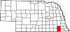
Villages Townships Unincorporated
communityLanham
Categories:- National Register of Historic Places in Nebraska by county
- Gage County, Nebraska
- Buildings and structures in Gage County, Nebraska
-

Wikimedia Foundation. 2010.