- Wymore, Nebraska
Infobox Settlement
official_name = Wymore, Nebraska
settlement_type =City
nickname =
motto =
imagesize =
image_caption =
image_
imagesize =
image_caption =
image_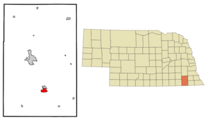
mapsize = 250px
map_caption = Location of Wymore, Nebraska
mapsize1 =
map_caption1 =subdivision_type = Country
subdivision_name =United States
subdivision_type1 = State
subdivision_name1 =Nebraska
subdivision_type2 = County
subdivision_name2 = Gage
government_footnotes =
government_type =
leader_title =
leader_name =
leader_title1 =
leader_name1 =
established_title =
established_date =unit_pref = Imperial
area_footnotes =area_magnitude =
area_total_km2 = 4.9
area_land_km2 = 4.9
area_water_km2 = 0.0
area_total_sq_mi = 1.9
area_land_sq_mi = 1.9
area_water_sq_mi = 0.0population_as_of = 2000
population_footnotes =
population_total = 1656
population_density_km2 = 335.6
population_density_sq_mi = 869.2timezone = Central (CST)
utc_offset = -6
timezone_DST = CDT
utc_offset_DST = -5
elevation_footnotes =
elevation_m = 378
elevation_ft = 1240
latd = 40 |latm = 7 |lats = 22 |latNS = N
longd = 96 |longm = 39 |longs = 56 |longEW = Wpostal_code_type =
ZIP code
postal_code = 68466
area_code = 402
blank_name = FIPS code
blank_info = 31-53835GR|2
blank1_name = GNIS feature ID
blank1_info = 0834893GR|3
website =
footnotes =Wymore is a city in Gage County,
Nebraska ,United States . The population was 1,656 at the 2000 census. Wymore was founded onApril 7 ,1881 on land donated by Sam Wymore as arailroad town. The "Welsh Capitol of the Great Plains," Wymore became home to generations of immigrants fromWales , who continued their culture in day-to-day life, founding aWelsh-language church, school and cemetery, as well as preserving the Welsh traditions ofpoetry ,dance , and intricatemusic in minor. In 2000, the Wymore Welsh Heritage Project was founded to preserve the legacy of these early settlers. It has since expanded to include amuseum , an archive of genealogical records, and one of the largest Welsh-language libraries inNorth America . It is also home to the Southern Raiders a class C school that consists of students from Barneston, Holmesville, Blue Springs, Wymore, and Liberty. The school has won 2 state championships, both in wrestling(1974 and 1980). The Wymore Arbor State baseball ballfield also has one of the few covered, behind plate bleachers in the state.Wymore, Nebraska is also the burial place of author and anthropologist R. Clark Mallam, whose book, "Indian Creek Memories; A Sense of Place" is set in and around the town.
Geography
Wymore is located at coor dms|40|7|22|N|96|39|56|W|city (40.122765, -96.665494)GR|1.
According to the
United States Census Bureau , the city has a total area of 1.9square mile s (4.9km² ), all of it land.Demographics
As of the
census GR|2 of 2000, there were 1,656 people, 713 households, and 444 families residing in the city. Thepopulation density was 869.2 people per square mile (334.8/km²). There were 776 housing units at an average density of 407.3/sq mi (156.9/km²). The racial makeup of the city was 96.68% White, 0.12% African American, 1.51% Native American, 0.42% Asian, 0.12% Pacific Islander, 0.18% from other races, and 0.97% from two or more races. Hispanic or Latino of any race were 1.27% of the population.There were 713 households out of which 27.3% had children under the age of 18 living with them, 49.4% were married couples living together, 9.0% had a female householder with no husband present, and 37.7% were non-families. 35.1% of all households were made up of individuals and 20.6% had someone living alone who was 65 years of age or older. The average household size was 2.25 and the average family size was 2.87.
In the city the population was spread out with 23.8% under the age of 18, 7.0% from 18 to 24, 24.2% from 25 to 44, 19.7% from 45 to 64, and 25.4% who were 65 years of age or older. The median age was 42 years. For every 100 females there were 87.5 males. For every 100 females age 18 and over, there were 84.8 males.
The median income for a household in the city was $25,947, and the median income for a family was $33,150. Males had a median income of $26,200 versus $18,800 for females. The
per capita income for the city was $13,978. About 12.2% of families and 13.8% of the population were below thepoverty line , including 22.0% of those under age 18 and 7.3% of those age 65 or over.Attractions
Wymore Welsh Heritage CentreIncludes the Welsh Language library(catalogued in English as well as Welsh), oral and written histories of early settlers artifacts of Welsh life in the Great Plains.307 South 7th StreetWymore, Nebraska 402-645-3186
Pleasantview SchoolhouseFully restored, 1900s era schoolhouse and museum. Home of the bi-annual "Day at a Country School" where students are invited to learn about Welsh heritage and language from teachers attired in traditional Welsh Costume.
Bethel CemeteryThe final resting place of many of Wymore's Welsh Founders. Many of the tombstones date to the mid to late 1800s with inscriptions in Welsh.
References
External links
* [http://www.welshheritage.org/ Wymore Welsh Heritage Museum]
Wikimedia Foundation. 2010.