- National Register of Historic Places listings in Campbell County, Virginia
-
This list includes properties and districts listed on the National Register of Historic Places in Campbell County, Virginia. Click the "Map of all coordinates" link to the right to view a Google map of all properties and districts with latitude and longitude coordinates in the table below.[1]
-
- This National Park Service list is complete through NPS recent listings posted November 10, 2011.[2]
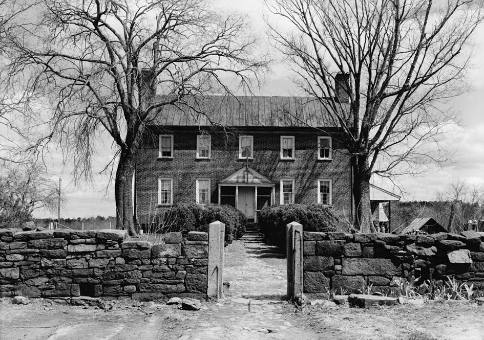
[3] Landmark name [4] Image Date listed Location City or town Summary 1 Altavista Downtown Historic District May 28, 2010 400 and 500 blocks of 7th St.; 500, 600, and 700 blocks of Broad St.; 500 and 600 blocks of Main St.; and 400 block of Washington St.
37°06′34″N 79°17′27″W / 37.109431°N 79.290714°WAltavista 2 Avoca September 16, 1982 N of Altavista on US 29
37°08′N 79°16′W / 37.13°N 79.27°WAltavista 3 Blenheim May 31, 1979 2.4 mi. SW of Spring Mills
37°13′15″N 78°57′07″W / 37.220833°N 78.951944°WSpring Mills Boundary increase (listed May 26, 1994): E of VA 648, 3500 ft. S of jct. with VA 604 4 Brookneal Historic District June 8, 2011 Adams Ferry Rd., Old Main, E. Rush & Commerce Sts., Lynchburg, Wycliffe & Cook Aves., & Pick St.
37°03′01″N 78°56′39″W / 37.050278°N 78.944167°WBrookneal 5 Campbell County Courthouse October 29, 1981 US 501
37°16′38″N 79°06′03″W / 37.277222°N 79.100833°WRustburg 6 Caryswood March 17, 2010 8291 Colonial Hwy.
37°13′57″N 79°15′11″W / 37.232592°N 79.253°WEvington 7 Cat Rock Sluice of the Roanoke Navigation March 25, 1980 W of Brookneal
37°02′35″N 78°57′38″W / 37.043056°N 78.960556°WBrookneal 8 Federal Hill September 9, 1982 S of Forest on VA 623
37°18′37″N 79°17′04″W / 37.310278°N 79.284444°WForest 9 Green Hill 
November 12, 1969 SW of Long Island near jct. of Rtes. 633 and 728
37°03′51″N 79°04′16″W / 37.064167°N 79.071111°WLong Island 10 Mount Athos July 24, 1975 Address Restricted Kelly 11 Norfolk Southern Six Mile Bridge No. 58 October 12, 1995 Over James R. W of jct. of VA 726 and Norfolk & Western RR tracks
37°23′35″N 79°03′42″W / 37.393056°N 79.061667°WLynchburg 12 Oak Grove May 16, 2002 7378 Gladys Rd.
37°07′04″N 79°13′34″W / 37.117778°N 79.226111°WAltavista 13 Shady Grove August 26, 1982 E of Gladys on VA 650
37°10′21″N 79°02′54″W / 37.1725°N 79.048333°WGladys 14 Walnut Hill January 27, 2000 Rte. 2, Lawyers Rd.
37°16′19″N 79°13′16″W / 37.271944°N 79.221111°WLynchburg See also
- National Register of Historic Places listings in Virginia
- List of National Historic Landmarks in Virginia
References
- ^ The latitude and longitude information provided in this table was derived originally from the National Register Information System, which has been found to be fairly accurate for about 99% of listings. For about 1% of NRIS original coordinates, experience has shown that one or both coordinates are typos or otherwise extremely far off; some corrections may have been made. A more subtle problem causes many locations to be off by up to 150 yards, depending on location in the country: most NRIS coordinates were derived from tracing out latitude and longitudes off of USGS topographical quadrant maps created under the North American Datum of 1927, which differs from the current, highly accurate WGS84 GPS system used by Google maps. Chicago is about right, but NRIS longitudes in Washington are higher by about 4.5 seconds, and are lower by about 2.0 seconds in Maine. Latitudes differ by about 1.0 second in Florida. Some locations in this table may have been corrected to current GPS standards.
- ^ "National Register of Historic Places: Weekly List Actions". National Park Service, United States Department of the Interior. Retrieved on November 10, 2011.
- ^ Numbers represent an ordering by significant words. Various colorings, defined here, differentiate National Historic Landmark sites and National Register of Historic Places Districts from other NRHP buildings, structures, sites or objects.
- ^ "National Register Information System". National Register of Historic Places. National Park Service. . http://nrhp.focus.nps.gov/natreg/docs/All_Data.html.
U.S. National Register of Historic Places Topics Lists by states Alabama • Alaska • Arizona • Arkansas • California • Colorado • Connecticut • Delaware • Florida • Georgia • Hawaii • Idaho • Illinois • Indiana • Iowa • Kansas • Kentucky • Louisiana • Maine • Maryland • Massachusetts • Michigan • Minnesota • Mississippi • Missouri • Montana • Nebraska • Nevada • New Hampshire • New Jersey • New Mexico • New York • North Carolina • North Dakota • Ohio • Oklahoma • Oregon • Pennsylvania • Rhode Island • South Carolina • South Dakota • Tennessee • Texas • Utah • Vermont • Virginia • Washington • West Virginia • Wisconsin • WyomingLists by territories Lists by associated states Other Municipalities and communities of Campbell County, Virginia Towns 
CDPs Unincorporated
communitiesEvington | Long Island | Lynch Station
Categories:- Campbell County, Virginia
- National Register of Historic Places in Virginia
- Virginia-related lists
-

Wikimedia Foundation. 2010.