- U.S. Route 501
-
U.S. Route 501

Route information Auxiliary route of US 1 Length: 355 mi (571 km) Existed: 1935 – present Major junctions South end: 
 US 17 Bus. in Myrtle Beach, SC US 17 near Myrtle Beach

 US 701 / US 378 in Conway, SC
 I-95 near South of the Border, SC
 US 301 between Rowland, NC and Hamer


 I-74 / US 15 / US 74 / US 401 in Laurinburg, NC
 US 1 in Sanford, NC and Aberdeen, NC
 I-40 near Downtown Durham, NC
 I-85 / US 15 in Durham, NC

 US 58 / US 360 in South Boston, VA

 US 29 / US 460 in Lynchburg, VA
North end:  US 60 in Buena Vista, VA
Location States: South Carolina, North Carolina, Virginia Highway system United States Numbered Highways
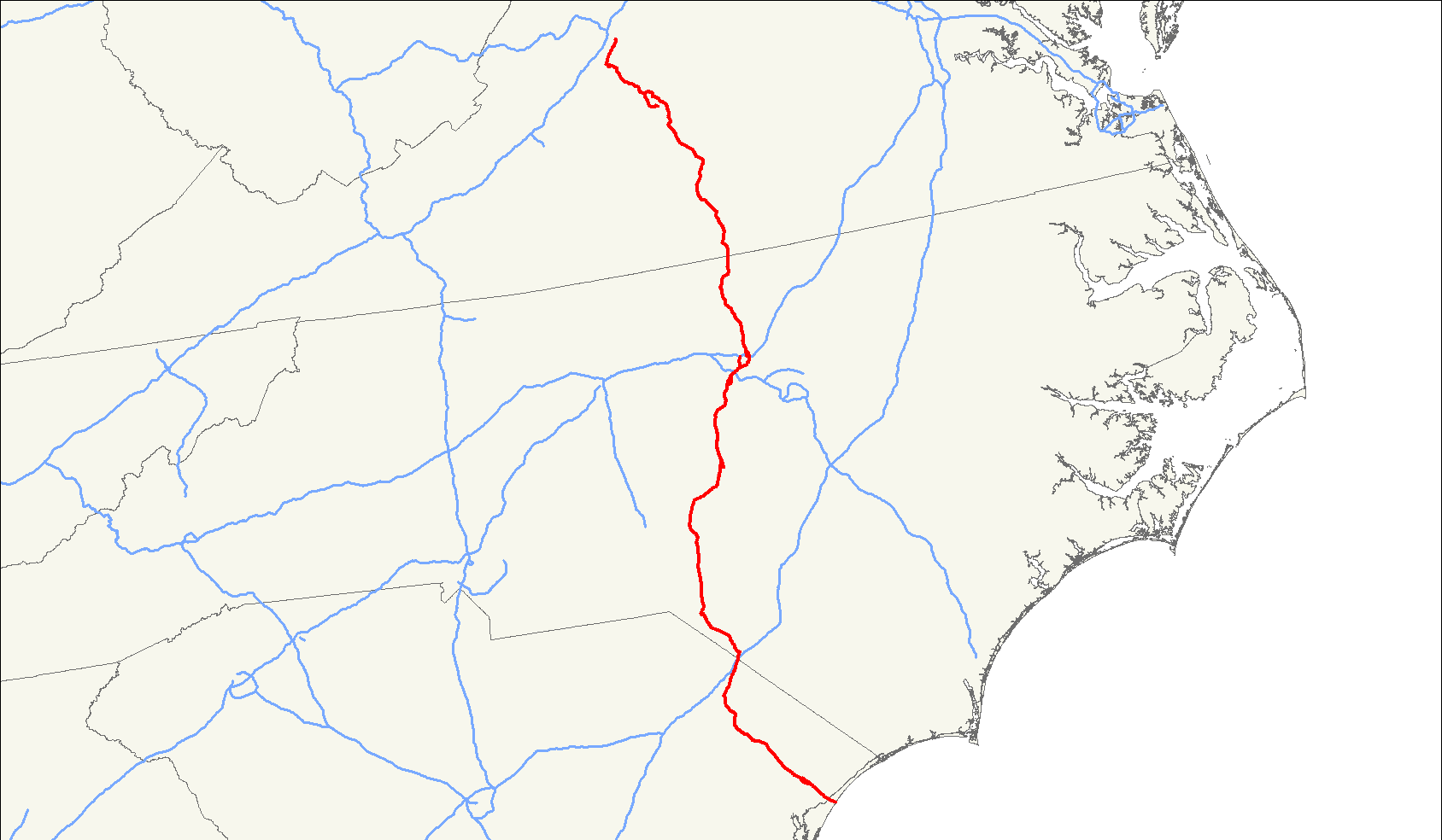
List • Bannered • Divided • ReplacedU.S. Route 501 is a spur of U.S. Route 1. It runs 355 miles (571 km) from Buena Vista, Virginia at U.S. Route 60 to Myrtle Beach, South Carolina at U.S. Route 17 Business. It passes through the states of Virginia, North Carolina and South Carolina. From Durham to Laurinburg, a 108-mile (174 km) section of US 501 overlaps U.S. Route 15 (15-501 Concurrency). Sections of US 15-501 also share routings with U.S. Route 1 in sections near Sanford, North Carolina and Aberdeen, North Carolina.
Contents
Route description
Lengths mi km SC 74 119 NC 211 340 VA 145 233 Total 430 692 South Carolina
US 501 begins at US 17 Bus. in Myrtle Beach, South Carolina. From Myrtle Beach to Marion, US 501 is a multilane highway and a Freeway with an interchange of US 17 Bypass. It passes through the city of Conway before reaching Marion, where US 501 bypasses the town to the east. North of Marion, US 501 meets SC 38, a connector to Interstate 95. From SC 38, US 501 heads to the northeast, meeting US 301 in Latta. US 301 merges with US 501, forming a concurrency through Dillon to the North Carolina border, where it passes South of the Border prior to exiting South Carolina and an interchange on Interstate 95 near Hamer in Dillon County.
North Carolina
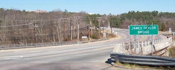
Main article: U.S. Route 15-501 in North Carolina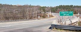 James Taylor Bridge, Chapel Hill, North Carolina, part of the US-15/501 route
US 301 and US 501 enter North Carolina south of Rowland. In Rowland, US 501 splits from US 301 and heads northwest to Laurinburg, where it briefly overlaps with US 74 south of the city. Upon departing US 74, US 501 immediately embarks on an overlap with US 15. The routes remain concurrent for 108 miles (174 km) to Durham, passing through Aberdeen, Pinehurst, Sanford, and Chapel Hill in between. North of Durham, US 501 passes through the city of Roxboro prior to entering Virginia.
Virginia
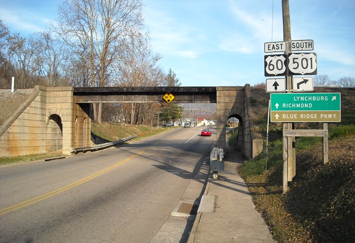
Main article: U.S. Route 501 in Virginia Northern terminus of US 501 at US 60 in Buena Vista, Virginia
In Virginia, US 501 runs 111.42 miles (179.31 km) from the North Carolina state line near Cluster Springs to its northern terminus at US 60 in Buena Vista. US 501 is the primary highway between Lynchburg and both South Boston in Southside Virginia and Durham in North Carolina's Research Triangle.
History
Major intersections
South Carolina
County Location Mile Roads intersected Notes Horry Myrtle Beach
US 17 Bus. – Briarcliffe Acres, Springmaid BeachSouthern Terminus of US 501 Robert Grissom Parkway US 17 (Freeway) – Briarcliffe Acres, SocasteeBridge over Intracoastal Waterway  SC 31 (Carolina Bays Parkway) – North Myrtle Beach, Socastee
Conway 

 US 501 Bus. north
 SC 544 south – Socastee
Northern end of SC 544 US 701 – Yuhannah, Allsbrook US 378
US 501 Bus. south SC 22 east (Veterans Highway) – Briarcliffe Acres
Western end of SC 22 Aynor  SC 319 south
Northern end of SC 319 Marion Rains  SC 41 – Mullins, Centenary
Marion 

 US 501 Bus. north / SC 41 Alt. to SC 576
 US 76 – Florence, Mullins
SC 41 Alt.
US 501 Bus. southSellers  SC 38 north – Sellers
Southern end of SC 38 Dillon Latta US 301 south – Mars BluffSouth end of US 301 overlap  SC 917
Dillon 

 SC 9 / SC 57 east / SC 34 west – Lake View, Floydale, Bigham
Southern end of SC 9/SC 57 overlap;
Eastern end of SC 34 SC 9 / SC 57 west – Little Rock, ClioNorthern end of SC 9/SC 57 overlap North Carolina
County Location Mile Destinations Notes Robeson South of the Border I-95 (Exit 1)Rowland  US 301 north / NC 130 east
Northeast end of US 301 and NC 130 overlap  NC 710
South end of NC 710 Raemon NC 130 westWest end of NC 130 overlap  NC 83
NC 83For a special route and other intersections see U.S. Route 15/501 concurrency Person Timberlake  NC 57 south
North end of NC 57 overlap Roxboro  US 158 east
East end of US 158 overlap US 158 westWest end of US 158 overlap  NC 49 north
South end of NC 49 overlap Virginia
Main article: U.S. Route 501 in Virginia#Major intersections1.000 mi = 1.609 km; 1.000 km = 0.621 mi
Concurrency terminus • Closed/Former • Incomplete access • UnopenedBannered Routes
South Carolina business loops

U.S. Route 501 Business
Location: Conway, South Carolina Length: 4.4 mi (7.1 km)
U.S. Route 501 BusinessLocation: Marion, South Carolina Length: 6.6 mi (10.6 km) North Carolina business loops
U.S. Route 501 BusinessLocation: Laurinburg, North Carolina
U.S. Route 501 BusinessLocation: Durham, North Carolina Virginia business loop
U.S. Route 501 BusinessLocation: Lynchburg, Virginia External links
References
U.S. Routes related to US 1  Categories:
- Three-digit U.S. Highways
- U.S. Highways in South Carolina
- U.S. Highways in North Carolina
- U.S. Route 1
- Transportation in Horry County, South Carolina
- Roads in Myrtle Beach, South Carolina

Wikimedia Foundation. 2010.