- South Carolina Highway 22
-
This article is about the South Carolina highway. For proposed New Hampshire highway, see Conway Bypass (New Hampshire). For the Maryland highway, see Interstate 70 in Maryland#Korean War Veterans Highway.
SC 22
Conway Bypass/Veterans Highway 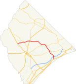
Route information Maintained by SCDOT Length: 39 mi (63 km) Existed: 2001 – present Major junctions East end:  US 17 near Briarcliffe Acres
 SC 31 near N. Myrtle Beach
 SC 90 near N. Myrtle Beach
 SC 905 near Conway
 US 701 near Homewood
 SC 319 near Conway
West end:  US 501 near Conway
Location Counties: Horry Highway system ←  US 21
US 21SC 23  →
→South Carolina Highway 22, also known as the Conway Bypass and Veterans Highway, is a four lane freeway that connects U.S. 501 north of Conway, South Carolina to U.S. 17 in Myrtle Beach. The road was opened to traffic on May 4, 2001, six months ahead of schedule. There is speculation that this could become part of Interstate 73 in the near future. The road lacks lights and uses the interstate-style exits and entrances, but the shoulders on the bypass are not wide enough to support interstate traffic and need widening to support the increase in traffic.[citation needed]
Contents
History
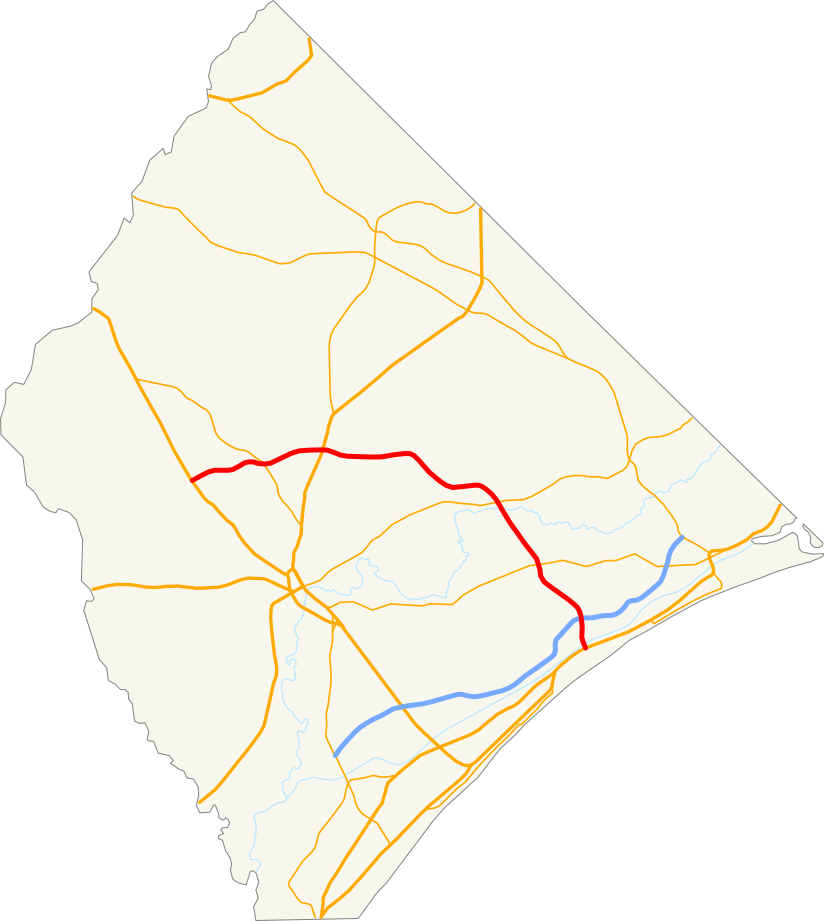
 Path of SC Highway 22
In 1994, the original contract with Fluor Daniel called for six lanes from U.S. 17 to SC 905 and four lanes the rest of the way to U.S. 501. This money depended on a one-cent sales tax devoted to road funding, but voters turned that down.[1]
A bridge was built over the Intracoastal Waterway near Briarcliffe Acres, but it remained the "Bridge to Nowhere" for three years because there was no money to build the road. In February 1999, the South Carolina Senate passed a bill naming the bridge for Billy Alford, state highway commissioner from 1990 to 1994 and commission chair in 1993.[2]
On February 24, 1999, the South Carolina Department of Transportation Commission approved $95 million to make the bypass four lanes. Two years earlier, since money was short, the bypass had been reduced to two lanes beyond SC 90, though the $291.3 million project had six lanes to SC 31.
Even with the changes, the road would end up being cheaper than planned because of narrower shoulders and bridges, and more bridges over wetlands.[1]
On March 4, 1999, The Joint Bond Review Committee approved selling bonds for the money approved in February. Widening the bridges was considered, since some believed that the road could need six lanes in only a few years.[3]
In June 2000, the first section of the Conway Bypass opened 17 months sooner than expected despite flooding from Hurricane Floyd. In November 2000, the section from SC 90 to SC 905, including a 29-foot-high bridge over the Waccamaw River, opened 13 months sooner than planned. The final section opened with a ribbon cutting ceremony in May 2001.[4]
In 2003, the South Carolina General Assembly approved a resolution asking that the Conway Bypass be designated I-73.[5]
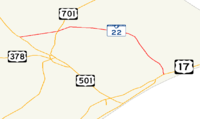
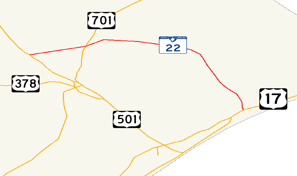
Exit list
The entire route is in the unincorporated Horry County.
Location Mile Destinations Notes Aynor 0.0 US 501 – Aynor, Marion, ConwayWestern terminus 4.3 SC 319 – Aynor, HomewoodHomewood 7.6 US 701 – Loris, ConwayHickory Grove 18.5 SC 905 – Longs, ConwayWampee 22.6 SC 90 – Nixonville, Star Bluff CrossroadsN. Myrtle Beach 26.5 SC 31 – Carolina Forest, Little RiverFull Interchange Bridge across the Intracoastal Waterway Briarcliffe Acres 28.3 Kings Rd.
US 17 – Atlantic Beach, Myrtle BeachWestbound exit only;Eastern terminus References
- ^ a b Zane Wilson, "DOT commits $95 million for Conway Bypass lanes," The Sun News, February 25, 1999.
- ^ Zane Wilson, "Bridge to Nowhere to Get Name," The Sun News, February 22, 1999.
- ^ Zane Wilson, "South Carolina Approves Bond Sale to Pay for Conway Bypass," The Sun News, March 5, 1999.
- ^ "Conway Bypass / Veterans Highway (SC 22), SC, USA". http://www.roadtraffic-technology.com/projects/conway/. Retrieved 2010-03-30.
- ^ "Bill 291, South Carolina General Assembly, 115th Session, 2003-2004". http://www.scstatehouse.gov/sess115_2003-2004/bills/291.htm. Retrieved 2010-03-30.
External links
Roadway and highway network Limited access highwaysS.C. Route 31 (future I-74) - S.C. Route 22 (future I-73) - Robert Edge Parkway (future I-174) - Southern Evacuation Lifeline (proposed)U.S. and State highwaysCounty and city roadsAirports Commercial aviationGeneral aviationConway-Horry County Airport (KHYW) - Georgetown County Airport (KGGE) - Grand Strand Airport (KCRE) - Twin City AirportCategories:- State highways in South Carolina
- Transportation in Horry County, South Carolina
- Roads in Myrtle Beach, South Carolina
- Freeways in the United States

Wikimedia Foundation. 2010.