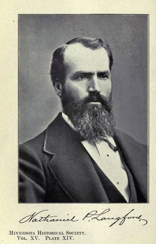
- Mount Langford
-
Mount Langford 
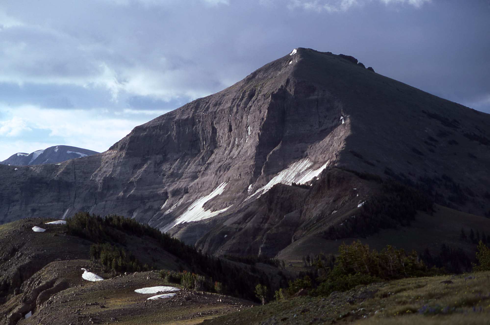
1977Elevation 10,623 ft (3,238 m) [1] Location Location Yellowstone National Park, Park County, Wyoming Range Absaroka Range Coordinates 44°24′25″N 110°06′37″W / 44.40694°N 110.11028°WCoordinates: 44°24′25″N 110°06′37″W / 44.40694°N 110.11028°W[1] Topo map Plenty Coups Peak Mount Langford el. 10,623 feet (3,238 m) is a mountain peak in the Absaroka Range in Yellowstone National Park. The peak is named for Nathaniel P. Langford, the first superintendent of Yellowstone and a leader of the Washburn–Langford–Doane Expedition to Yellowstone in 1870. The expedition and Langford's subsequent promotion in Scribner's helped in the creation of the park in 1872.
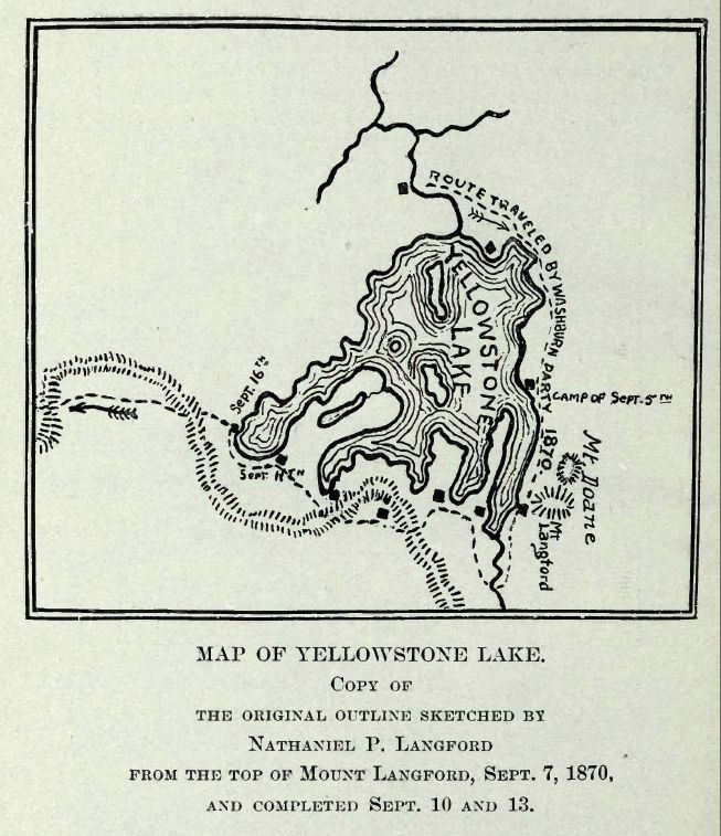
On September 7, 1870 the Washburn expedition was camped along the southestern shore of Yellowstone Lake. That day Langford and Lt. Gustavus Cheyney Doane chose to ascend a nearby peak. From that peak, Langford sketched the first reasonably accurate map of Yellowstone Lake. Upon their return to camp, Henry D. Washburn named the peak they ascended and a nearby secondary peak: Mount Langford and Mount Doane[2]. They are annotated on the map Langford sketched. Langford described the summit with these words:
The view from the summit of this mountain, for wild and rugged grandeur, is surpassed by none I ever before saw. The Yellowstone basin and the Wind river mountains were spread out before us like a map. On the south the eye followed the source of the Yellowstone above the lake, until, twenty-five miles away, it was lost in an immense canon, beyond which two immense jets of vapor rose to a height of probably three hundred feet, indicating that there were other and perhaps greater wonders than those embraced in our prescribed limit of exploration. On the north the outlet of the lake and the steam from the mud geyser and mud volcano were distinctly visible, while on the southeast the view followed to the horizon a succession of lofty peaks and ridges at least thirty miles in width, whose jagged slopes were filled with yawning caverns, pine-embowered recesses and beetling precipices, some hundreds and some thousands of feet in height...Lieutenant Doane and I were somewhat fatigued with our climb of four hours' duration, and we refreshed ourselves with such creature comforts as we found on the summit; but, although we attained the "crest," we did not discern any "free and generous spirit," save that which we saw "through a glass darkly."
— Nathaniel P. Langford, 1870[3]
During the Hayden Geological Survey of 1871, Hayden, for unknown reasons, moved the names of Mount Langford and Doane to peaks farther north. The original Mount Langford remained unnamed until 1885 when Arnold Hague named it Colter Peak.
Images of Mount Langford 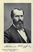
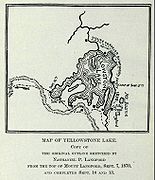 Map of Yellowstone Lake, sketched by Langford in 1870
See also
Notes
- ^ a b "Mount Langford". Geographic Names Information System, U.S. Geological Survey. http://geonames.usgs.gov/pls/gnispublic/f?p=gnispq:3:::NO::P3_FID:1600836.
- ^ Whittlesey, Lee (1988). Yellowstone Place Names. Helena, MT: Montana Historical Society Press. pp. 106. ISBN 0917298152.
- ^ Langford, Nathaniel Pitt (1905). The Discovery of Yellowstone Park; Diary of the Washburn Expedition to the Yellowstone and Firehole Rivers in the Year 1870. St. Paul, MN: Frank Jay Haynes. pp. 59–61. http://www.archive.org/details/diaryofwashburne00langrich.
Historic structures and other attractions in the Yellowstone Lake, West Thumb, South and East Entrance areasStructures and History 
West Thumb Geyser Basin Geography and Geology Barlow Peak • Buffalo Bill Cody Scenic Byway • Cody, Wyoming • Colter Peak • Eagle Peak (Wyoming) • Factory Hill • Hayden Valley • Heart Lake • Heart River (Wyoming) • Jackson, Wyoming • Lewis Falls • Lewis Lake • Lewis River • Mount Chittenden • Mount Doane • Mount Hancock • Mount Schurz • Mount Sheridan • Mount Stevenson • Shoshone Lake • Snake River • Sulphur Spring • Sylvan Pass • Yellowstone Lake • Yellowstone RiverList of Yellowstone National Park related articles
 Media related to West Thumb Geyser Basin at Wikimedia Commons
 State of Wyoming
Topics - Governors
- Delegations
- Geography
- Government
- History
- People
- Visitor Attractions
- State Symbols
- Radio Stations
Society - Crime
- Demographics
- Economy
- Education
- Politics
Regions Cities Counties Categories:- Mountains of Wyoming
- Mountains of Yellowstone
Wikimedia Foundation. 2010.