- Mount Stevenson
-
Mount Stevenson Yellowstone National Park,
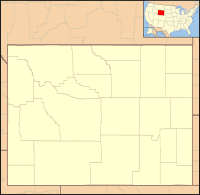
Park County, Wyoming, USAElevation 10,230 ft (3,118 m) [1] Location Range Absaroka Range Coordinates 44°24′06″N 110°09′34″W / 44.40167°N 110.15944°WCoordinates: 44°24′06″N 110°09′34″W / 44.40167°N 110.15944°W[1] Topo map Sylvan Lake Mount Stevenson el. 10,230 feet (3,120 m) is a mountain peak in the Absaroka Range of Yellowstone National Park. Mount Stevenson was named in 1871 by geologist Ferdinand Hayden during the Hayden Geological Survey of 1871 for his friend and chief assistant, James Stevenson (1840–1888)[2]. Stevenson, who had run away from home as a young boy, first met Hayden in 1853 during an exploration of the Dakota Badlands. In 1866, Stevenson began working for Hayden and did so until 1879. Hayden specifically cited Stevenson's loyalty to him in his 1872 report on the 1871 survey of the park. Stevenson Island on Yellowstone Lake is also named for James Stevenson.
My principal assistant, Mr. James Stevenson, labored with his usual efficiency and fidelity throughout the entire trip. In honor of his great services not only during the past season, but for over twelve years of unremitting toil as my assistant, oftentimes without pecuniary reward, and with little of the scientific recognition that uaually comes to the original explorer, I have desired that one of the principal islands of the lake and one of the noble peaks reflected in its clear waters should bear his name forever.
— F. V. Hayden, 1872[3]
See also
Notes
- ^ a b "Mount Stevenson". Geographic Names Information System, U.S. Geological Survey. http://geonames.usgs.gov/pls/gnispublic/f?p=gnispq:3:::NO::P3_FID:1603356. Retrieved Feb. 3, 2010.
- ^ Whittlesey, Lee (1996). Yellowstone Place Names. Gardiner, MT: Wonderland Publishing Company. pp. 181–82. ISBN 1599717166.
- ^ Hayden, F. V. (1872). Preliminary Report of the United States Geological Survey of Montana and Portions of Adjacent Territories being a Fifth Annual Report of Progess (Report). Washington, D.C.: U.S. Department of Interior. p. 5.
Historic structures and other attractions in the Yellowstone Lake, West Thumb, South and East Entrance areasStructures and History 
West Thumb Geyser Basin Geography and Geology Barlow Peak • Buffalo Bill Cody Scenic Byway • Cody, Wyoming • Colter Peak • Eagle Peak (Wyoming) • Factory Hill • Hayden Valley • Heart Lake • Heart River (Wyoming) • Jackson, Wyoming • Lewis Falls • Lewis Lake • Lewis River • Mount Chittenden • Mount Doane • Mount Hancock • Mount Schurz • Mount Sheridan • Mount Stevenson • Shoshone Lake • Snake River • Sulphur Spring • Sylvan Pass • Yellowstone Lake • Yellowstone RiverList of Yellowstone National Park related articles
 Media related to West Thumb Geyser Basin at Wikimedia Commons
 State of Wyoming
Topics - Governors
- Delegations
- Geography
- Government
- History
- People
- Visitor Attractions
- State Symbols
- Radio Stations
Society - Crime
- Demographics
- Economy
- Education
- Politics
Regions Cities Counties Categories:- Mountains of Wyoming
- Mountains of Yellowstone
Wikimedia Foundation. 2010.

