- McKittrick Canyon
-
McKittrick Canyon Protected Area 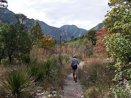 McKittrick Canyon Trail
Country  United States
State  Texas
TexasRegion Culberson County Nearest city Salt Flat, Texas Mountains Guadalupe Mountains Elevation 5,020 ft (1,530 m) Coordinates 31°58′37″N 104°45′07″W / 31.97694°N 104.75194°W Area 411 acres (166 ha) Geology Limestone Founded 30 September 1972 Management National Park Service 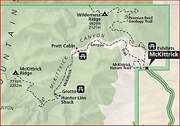 Map of McKittrick Canyon and its hiking trails
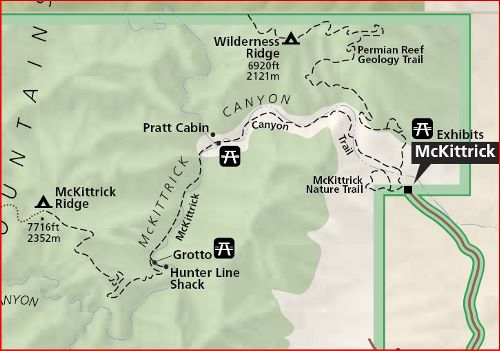
Website: McKittrick Canyon McKittrick Canyon Archeological District, Guadalupe Mountains National ParkNRHP Reference#: 91001381[1] Added to NRHP: September 26, 1991 McKittrick Canyon is a scenic canyon within the Guadalupe Mountains of West Texas. The steep towering walls of McKittrick Canyon protect a rich riparian oasis in the midst of the Chihuahuan Desert.
McKittrick Canyon is part of Guadalupe Mountains National Park but is separated from the main park area and managed as a "day-use only" area with limited visitation hours.[2] Access to McKittrick Canyon is via a 4.2-mile (6.8-km) gated side road that leads to the mouth of McKittrick Canyon from U.S. Route 62/180. Here the National Park Service maintains a parking area, restroom facilities, and visitor center, which is staffed most of the year by volunteers.
Contents
McKittrick Canyon Trail
McKittrick Canyon Trail begins at the visitor center and initially follows a dry stream, crossing the stream bed several times as it works its way up the canyon. At first the vegetation is more typical of the Chihuahuan Desert with various species of yucca, agave and cacti,[3] such as Spanish Dagger (Yucca faxoniana), Sotol (Dasylirion leiophyllum), Ocotillo (Fouquieria splendens), Lechuguilla (Agave lechuguilla), Century Plants (Agave americana), Prickly Pear (Opuntia spp.) and Claret Cup Cacti (Echinocereus triglochidiatus).[2] Scattered among these desert plants are a few hardy pines, juniper, and the occasional Texas Madrone (Arbutus xalapensis), an unusual tree with red-colored bark that tends to curl-up and peel off each year.
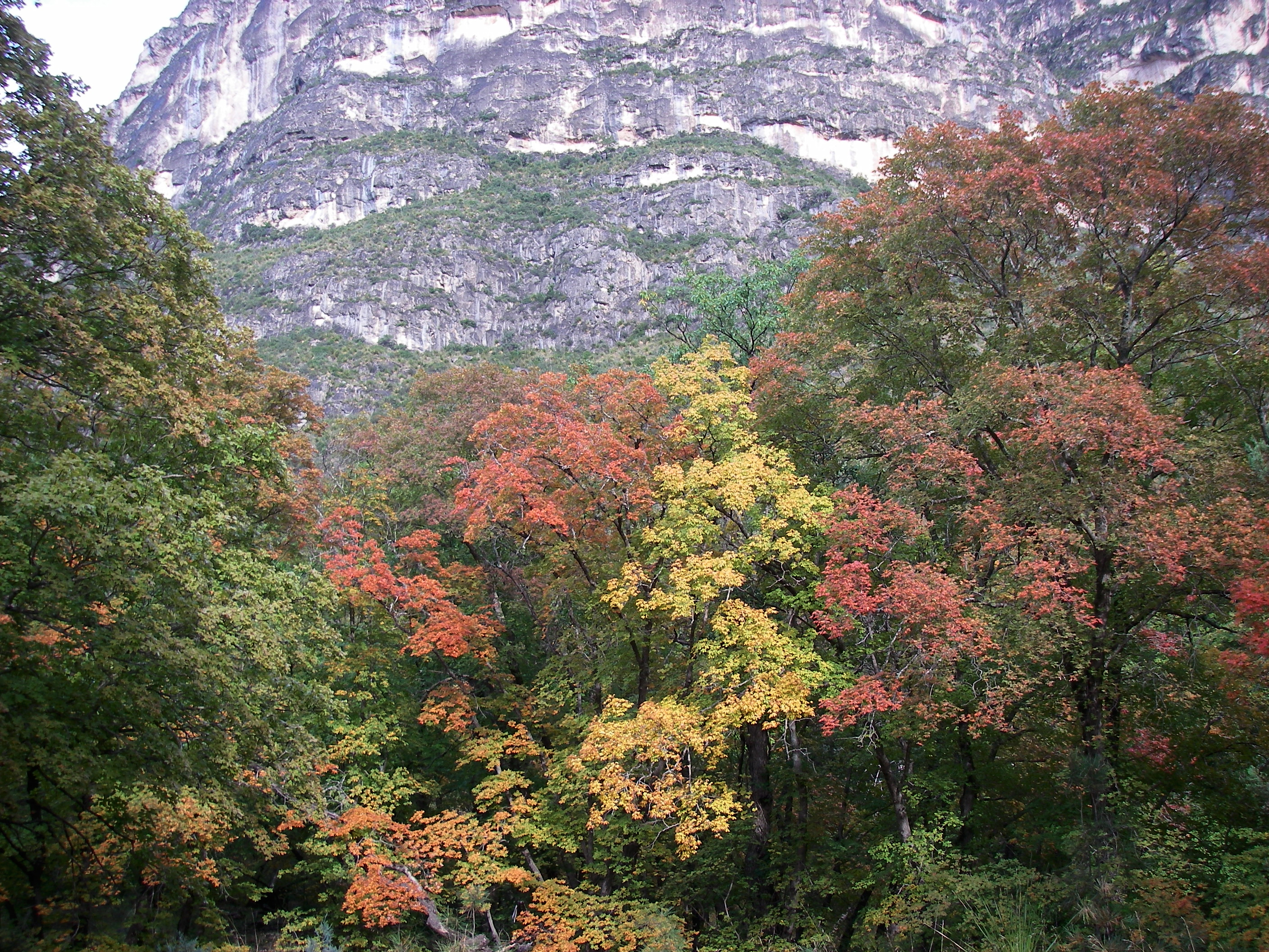
As one ascends into the relatively cool and more sheltered environment farther up the canyon, a flowing steam of clear water appears and riparian vegetation becomes more abundant, including deciduous trees such as oak, ash, and Bigtooth Maple (Acer grandidentatum). During the Fall, McKittrick Canyon comes alive with color from the turning foliage of maple and hardwood trees. The bright colors stand in stark contrast to the surrounding Chihuahuan Desert.
After a distance of 2.4 miles (3.9 km) the path reaches a cabin that was built by Wallace Everette Pratt (1885-1981), a petroleum geologist who once owned most of McKittrick Canyon. In 1959, Pratt donated 4,988 acres (2,019 ha) of his ranch to the National Park Service and seven years later, on 15 October 1966, President Lyndon B. Johnson signed the act establishing Guadalupe Mountains National Park.[4] On 30 September 1972, Guadalupe Mountains National Park was dedicated and formally opened to the public.[5]
Farther up the canyon, the path becomes quite steep as it begins to follow a series of switchbacks, climbing nearly 2,000 feet (610 m) over the next 2 miles (3.2 km), eventually reaching "The Notch" at an altitude of around 7,200 feet (2,200 m).[2][3] From this high point one can view McKittrick Canyon and the distant desert to the east and South McKittrick Canyon to the west.
A portion of the canyon was listed on the National Register of Historic Places for its archeological importance on September 26, 1991.[1]
-

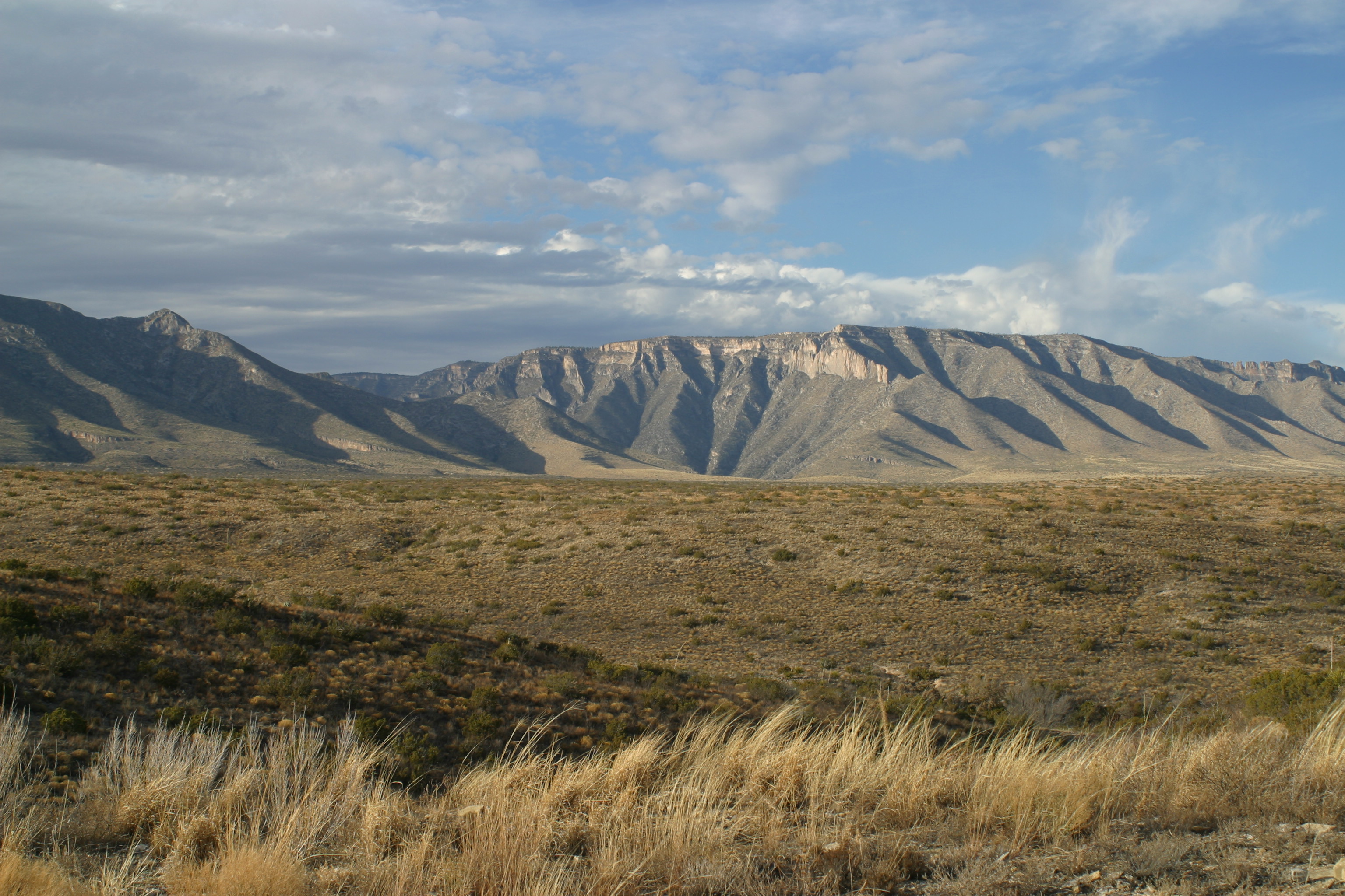
The mouth of McKittrick Canyon viewed from a distance
-

Fall colors of McKittrick Canyon with steep canyon walls in background
-
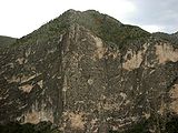
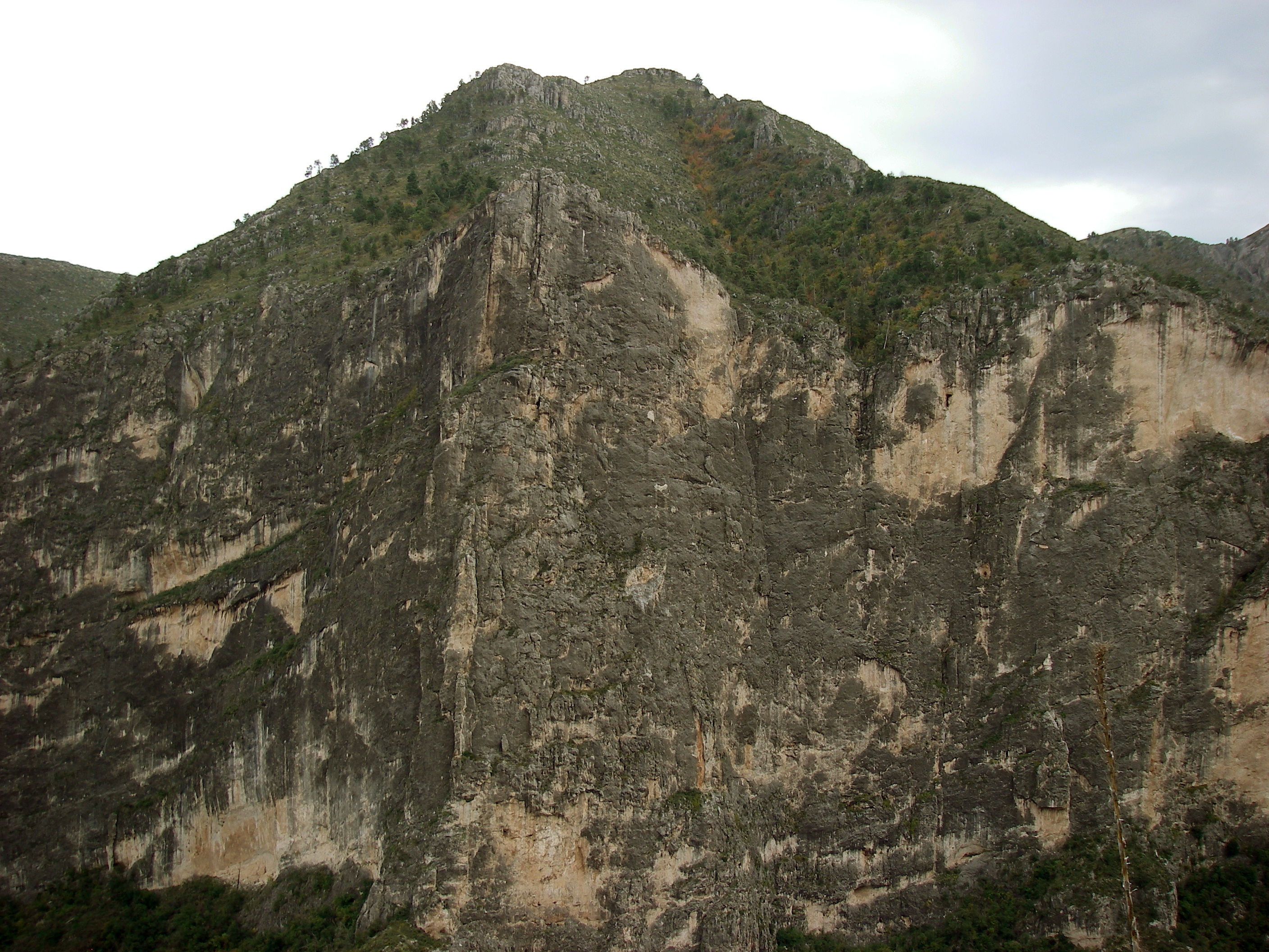
Steep valley wall in McKittrick Canyon
See also
- Carlsbad Caverns
- Delaware Basin
- El Capitan (Texas)
- Guadalupe Peak
- Pecos River
- Trans-Pecos
- Van Horn, Texas
- West Texas
References
- ^ a b "National Register Information System". National Register of Historic Places. National Park Service. 2009-03-13. http://nrhp.focus.nps.gov/natreg/docs/All_Data.html.
- ^ a b c National Park Service. "McKittrick Canyon". Guadalupe Mountains. http://www.nps.gov/archive/gumo/gumo/mckittrick.htm. Retrieved 26 September 2009.
- ^ a b Crossley, John. "McKittrick Canyon, Guadalupe Mountains National Park". The American Southwest. http://www.americansouthwest.net/texas/guadalupe_mountains/mckittrick_canyon.html. Retrieved 26 September 2009.
- ^ Kohout, Martin Donell. "Pratt, Wallace Everette". The Handbook of Texas Online. http://www.tshaonline.org/handbook/online/articles/PP/fpr21.html. Retrieved 26 September 2009.
- ^ National Park Service. "People". Guadalupe Mountains. http://www.nps.gov/gumo/historyculture/people.htm. Retrieved 26 September 2009.
External links
National Register of Historic Places in Guadalupe Mountains National Park Other historic districts McKittrick Canyon Archeological District
Other properties Guadalupe Ranch | Pinery Station | Wallace Pratt Lodge
See also: National Register of Historic Places listings in Guadalupe Mountains National Park U.S. National Register of Historic Places Topics Lists by states Alabama • Alaska • Arizona • Arkansas • California • Colorado • Connecticut • Delaware • Florida • Georgia • Hawaii • Idaho • Illinois • Indiana • Iowa • Kansas • Kentucky • Louisiana • Maine • Maryland • Massachusetts • Michigan • Minnesota • Mississippi • Missouri • Montana • Nebraska • Nevada • New Hampshire • New Jersey • New Mexico • New York • North Carolina • North Dakota • Ohio • Oklahoma • Oregon • Pennsylvania • Rhode Island • South Carolina • South Dakota • Tennessee • Texas • Utah • Vermont • Virginia • Washington • West Virginia • Wisconsin • WyomingLists by territories Lists by associated states Other  Category:National Register of Historic Places •
  Portal:National Register of Historic PlacesCategories:
- Historic districts in the United States
- Canyons and gorges of Texas
- Protected areas of Texas
- Guadalupe Mountains National Park
- National Register of Historic Places in Texas
- Protected areas of Culberson County, Texas
-

Wikimedia Foundation. 2010.