- Guadalupe Mountains
Geobox|Range
name=Guadalupe Mountains
image_caption=Guadalupe Mountains
country=United States
state=Texas|state1=New Mexico
parent=
border=Sacramento Mountains| border1=Brokeoff Mountains
length_imperial=65| length_orientation=|length_note=
width_imperial=20 | width_orientation=
geology=Limestone |orogeny=| period=
highest=Guadalupe Peak
highest_elevation_imperial=8749
highest_lat_d=31|highest_lat_m=53|highest_lat_s=28|highest_lat_NS=N
highest_long_d=104|highest_long_m=51|highest_long_s=36|highest_long_EW=W
map_caption=The Guadalupe Mountains are a
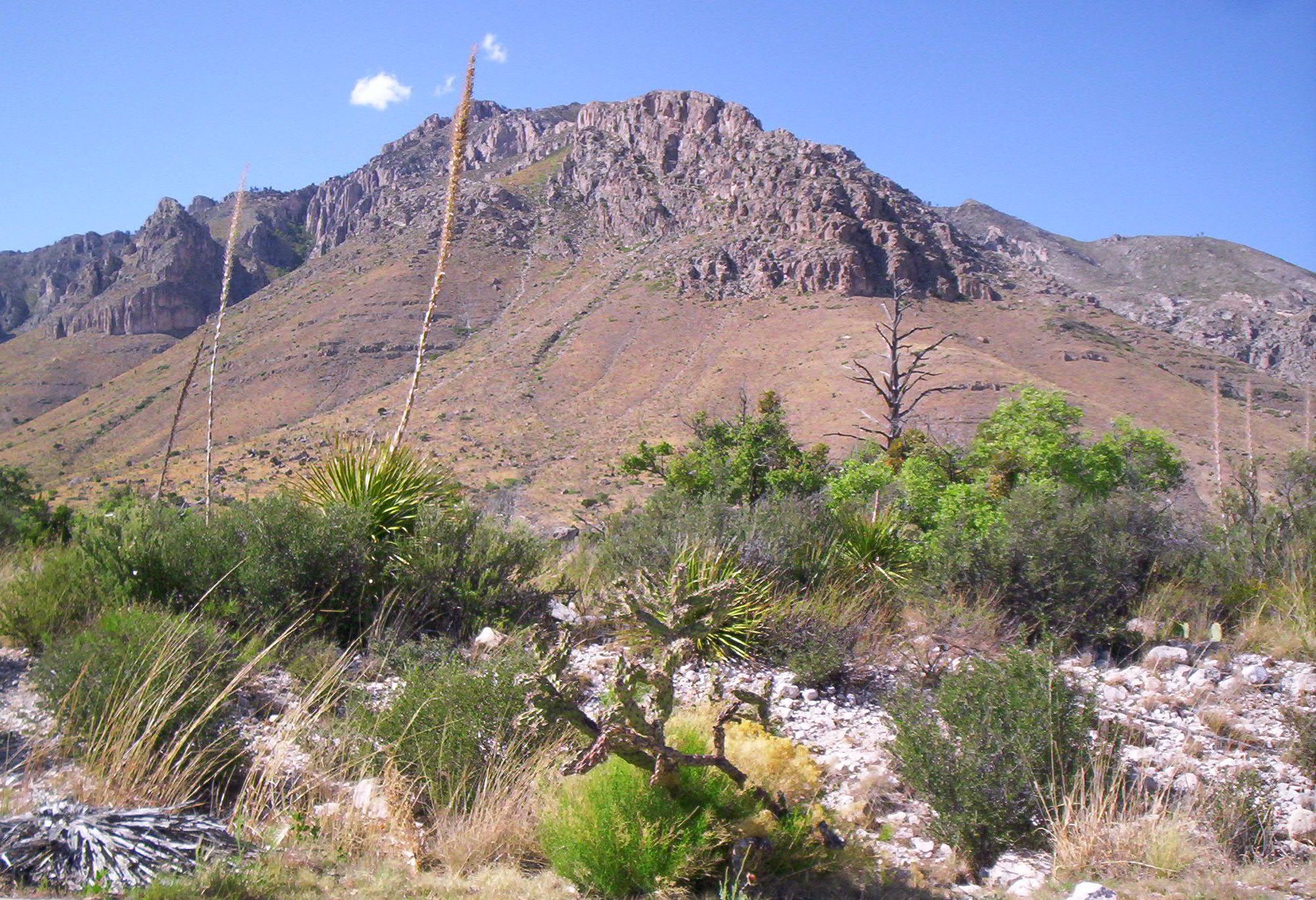
mountain range located in westernTexas and southeasternNew Mexico . The range includes the highest summit in Texas,Guadalupe Peak , Convert|8749|ft|m|0|abbr=on, and the "signature peak" of West Texas, El Capitan, both located withinGuadalupe Mountains National Park , as well asCarlsbad Caverns National Park .The range lies southeast of the
Sacramento Mountains and east of the Brokeoff Mountains. It extends north-northwest and northeast from Guadalupe Peak in Texas into New Mexico.gnis|id=912587] The northeastern extension ends about 10 miles (16 km) southwest ofCarlsbad , near White's City andCarlsbad Caverns National Park . The northwestern extension, bounded by a dramatic escarpment known as "The Rim", extends much further into New Mexico, to near the Sacramento Mountains. The range is bounded on the north by Four Mile Canyon; on the east by the valley of thePecos River ; and on the west by Piñon Creek, Big Dog Canyon, Valley Canyon, Middle Dog Canyon and West Dog Canyon.Much of the range is built from the ancient undersea Capitán Reef. For detail on the area's geology, see
Delaware Basin . As the range is built up almost entirely oflimestone , upland areas have little or no surface water. The only significant surface water is McKittrick Creek, in McKittrick Canyon, which emerges from the eastern side of the massif, just south of the New Mexico border. Elevations at the base of the range vary from Convert|4000|ft|m|-2 abovesea level on the western side to Convert|5000|ft|m|-2 on the east. Several peaks on the southern end exceed Convert|8000|ft|m|-2.Salt flat s on the western side of the National Park are marked bycreosote desert , with low elevations on the east covered withgrassland andjuniper .Canyon interiors such as McKittrick and Pine Springs Canyon on the southeast end exhibitmaple andpine , and uplands over Convert|7000|ft|m|-2|abbr=on|abbr=on|abbr=on|abbr=on are clothed with denser forests ofponderosa pine , with small stands ofoak andaspen .The range contains many world-class
cave s, includingCarlsbad Caverns (the best known) andLechuguilla Cave , discovered in 1986. The history of the range includes occupation by ancientPueblo and Mogollon peoples, and by theApache and variousAnglo outlaws in the 19th century.Butterfield, Mike, and Greene, Peter, "Mike Butterfield's Guide to the Mountains of New Mexico", New Mexico Magazine Press, 2006, ISBN 978-0-937206-88-1]_[) U.S. Geological Survey Photographic Library ( http://libraryphoto.cr.usgs.gov/ )]
U.S. Geological Survey Photographic Library ( http://libraryphoto.cr.usgs.gov/ )] )
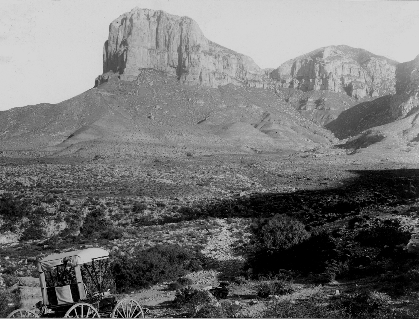
El_Capitan_(Hill,_1899)_[Darton, N.H. 1928. "Red Beds" and associated formations in New Mexico, with an outline of the geology of the state. United States Department of Interior, U.S. Geological Survey Bulletin 794, 356 pp. (Photo by R.T. Hill (1899), See Plate 8-A)])
References
ee also
*
Guadalupe Mountains National Park
*Carlsbad Caverns National Park
Wikimedia Foundation. 2010.