- Doubling Point Range Lights
-
Doubling Point Range Lights 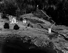
Front Light in foreground, Rear Light just visible, right of middle in the background Location Kennebec River , Maine Coordinates 43°52′58.219″N 69°47′44.346″W / 43.88283861°N 69.79565167°W Year first constructed 1898 Automated 1980 Tower shape Octagonal Wood Tower Markings / pattern White Focal height Front:18ft (5m)
Rear: 33ft (10m)Characteristic Front: Q W
Rear: Iso W 6sFog signal none, but see Fiddler's Reach Fog Signal USCG number Front: 1-6135
Rear: 1-6140Kennebec River Light Station

Nearest city: Bath, Maine Coordinates: 43°53′5.239″N 69°47′44.406″W / 43.88478861°N 69.79566833°WCoordinates: 43°53′5.239″N 69°47′44.406″W / 43.88478861°N 69.79566833°W Built: 1898 Architect: U.S. Army Corps of Engineers Governing body: U.S. Coast Guard MPS: Light Stations of Maine MPS NRHP Reference#: 87002263 Added to NRHP: January 21, 1988 The Doubling Point Range Lights are a pair of Range Lights on the Kennebec River, in Arrowsic, Maine. They were established in 1898, fifteen years after the founding of the Bath Iron Works, a major shipbuilder, one and a half miles upriver. They were part of a major upgrade of the river's lights — the Doubling Point Light and the separate Range Lights on the point, Perkins Island Light, and Squirrel Point Light were all built at the same time.
The Doubling Point Range Lights were listed on the National Register of Historic Places as Kennebec River Light Station on January 21, 1988, reference number 87002263.[3]
Gallery
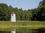 The two structures are more or less identical, but they show different characteristics at night.
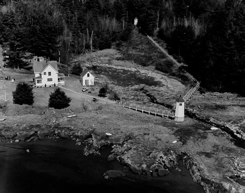
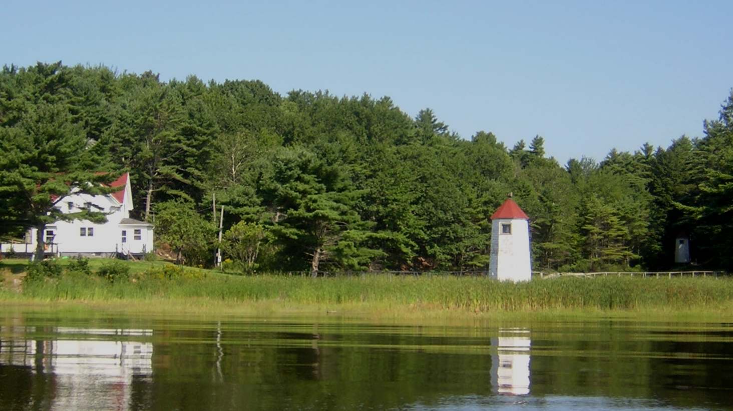
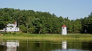 The keepers' quarters are to the left.
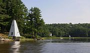 The Fiddler's Reach Fog Signal (left) was also tended by the Doubling Point Range Lights' keepers
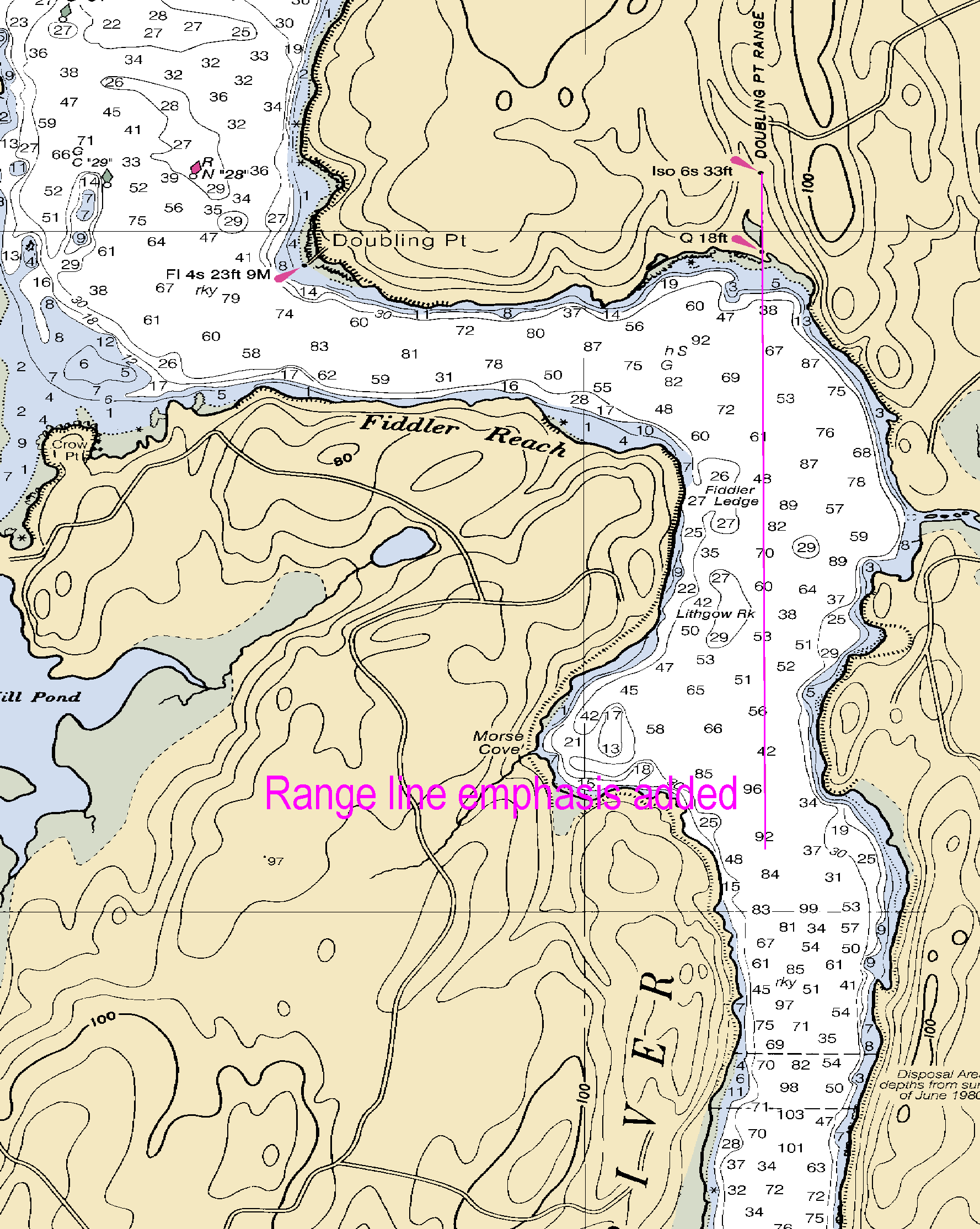
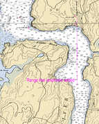 The range as it appears on NOAA Chart 13296
References
- ^ "Historic Light Station Information and Photography: Maine". United States Coast Guard Historian's Office. 2009-08-05. http://www.uscg.mil/history/weblighthouses/LHME.asp.
- ^ United States Coast Guard (2009). Light List, Volume I, Atlantic Coast, St. Croix River, Maine to Shrewsbury River, New Jersey. p. 53.
- ^ "National Register Information System". National Register of Historic Places. National Park Service. 2009-08-06. http://nrhp.focus.nps.gov/natreg/docs/All_Data.html.
Lighthouses of Maine Avery Rock Light · Baker Island Light · Bass Harbor Head Light · Bear Island Light · Blue Hill Bay Light · Boon Island Light · Browns Head Light · Burnt Coat Harbor Light · Burnt Island Light · Cape Elizabeth Lights · Cape Neddick Light · Crabtree Ledge Light · The Cuckolds Light · Curtis Island Light · Deer Island Thorofare Light · Dice Head Light · Doubling Point Light · Doubling Point Range Lights · Eagle Island Light · Egg Rock Light · Fiddler's Reach Fog Signal · Fort Point Light · Franklin Island Light · Goat Island Light · Goose Rocks Light · Great Duck Island Light · Grindel Point Light · Halfway Rock Light · Hendricks Head Light · Heron Neck Light · Indian Island Light · Isle Au Haut Light · Kennebunkport Breakwater Light · Ladies Delight Light · Libby Island Light · Little River Light · Lubec Channel Light · Manana Island Sound Signal Station · Marshall Point Light · Matinicus Rock Light · Monhegan Island Light · Moose Peak Light · Mount Desert Light · Narraguagus Light · Nash Island Light · Owls Head Light · Pemaquid Point Light · Perkins Island Light · Petit Manan Light · Pond Island Light · Portland Breakwater Light · Portland Head Light · Prospect Harbor Point Light · Pumpkin Island Light · Ram Island Light · Ram Island Ledge Light · Rockland Harbor Breakwater Light · Saddleback Ledge Light · Saint Croix River Light · Seguin Light · Spring Point Ledge Light · Squirrel Point Light · Tenants Harbor Light · Two Bush Island Light · West Quoddy Head Light · Whaleback Light · Whitehead Light · Whitlocks Mill Light · Winter Harbor Light · Wood Island Light Portland Head Light
U.S. National Register of Historic Places Topics Lists by states Alabama • Alaska • Arizona • Arkansas • California • Colorado • Connecticut • Delaware • Florida • Georgia • Hawaii • Idaho • Illinois • Indiana • Iowa • Kansas • Kentucky • Louisiana • Maine • Maryland • Massachusetts • Michigan • Minnesota • Mississippi • Missouri • Montana • Nebraska • Nevada • New Hampshire • New Jersey • New Mexico • New York • North Carolina • North Dakota • Ohio • Oklahoma • Oregon • Pennsylvania • Rhode Island • South Carolina • South Dakota • Tennessee • Texas • Utah • Vermont • Virginia • Washington • West Virginia • Wisconsin • WyomingLists by territories Lists by associated states Other  Category:National Register of Historic Places •
  Portal:National Register of Historic PlacesCategories:
- Historic districts in Maine
- Buildings and structures completed in 1898
- Lighthouses on the National Register of Historic Places in Maine
- Lighthouses in Sagadahoc County, Maine
- Bath, Maine
- United States lighthouse stubs
- Maine Registered Historic Place stubs


Wikimedia Foundation. 2010.