- National Register of Historic Places listings in Ozaukee County, Wisconsin
-
Buildings, sites, structures, districts, and objects in Ozaukee County listed on the National Register of Historic Places
-
- This National Park Service list is complete through NPS recent listings posted November 10, 2011.[1]
Current listings
[2] Landmark name Image Date listed Location City or town Summary 1 Bigelow School 
July 27, 2000 4228 W. Bonniwell Rd.
43°15′57″N 87°57′42″W / 43.265833°N 87.961667°WMequon 2 Harry W. Bolens House 
August 25, 1983 842 W. Grand Ave.
43°23′14″N 87°53′14″W / 43.387222°N 87.887222°WPort Washington Home of Port Washington mayor and 1930's state senator. 3 Cedarburg Mill 
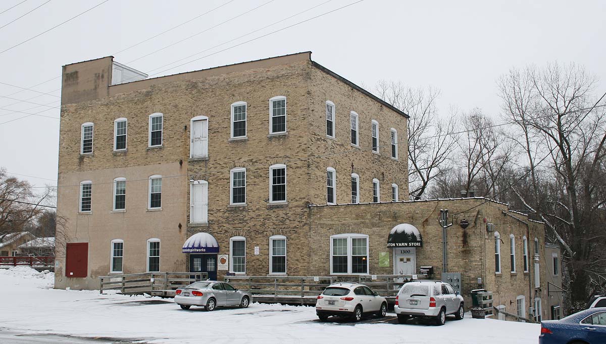
May 8, 1974 215 E. Columbia Ave.
43°17′48″N 87°59′10″W / 43.296667°N 87.986111°WCedarburg 1855 gristmill 4 Cedarburg Woolen Co. Worsted Mill 
June 30, 1983 1350 14th Ave.
43°19′03″N 87°56′57″W / 43.3175°N 87.949167°WGrafton 5 Jonathan Clark House 
June 2, 1982 13615 N. Cedarburg Rd.
43°15′57″N 87°59′23″W / 43.265833°N 87.989722°WMequon 6 Columbia Historic District 
January 22, 1992 Roughly bounded by Cedar Cr., Highland Dr. and Bridge Rd.
43°17′59″N 87°58′57″W / 43.299722°N 87.9825°WCedarburg Residential neighborhood anchored by Trinity Lutheran Church 7 Concordia Mill 
April 26, 1974 252 Green Bay Rd.
43°17′05″N 87°58′13″W / 43.284722°N 87.970278°WCedarburg 8 Covered Bridge 
March 14, 1973 1 Mi. N of Five Corners over Cedar Creek
43°20′16″N 88°00′16″W / 43.337778°N 88.004444°WCedarburg The last remaining original covered bridge in Wisconsin. Built 1876, retired 1962 9 Isham Day House 
December 28, 2000 11312 N. Cedarburg Rd.
43°13′25″N 87°59′00″W / 43.223611°N 87.983333°WMequon 1839 New England Yankee pioneer style home 10 Edward Dodge House 
July 24, 1975 126 E. Grand Ave.
43°23′16″N 87°52′10″W / 43.387778°N 87.869444°WPort Washington Greek Revival home with its faced covered in beach stones. Also known as Pebble House. 11 Grafton Flour Mill 
June 30, 1983 1300 14th Ave.
43°19′06″N 87°56′58″W / 43.318333°N 87.949444°WGrafton 12 Green Bay Road Historic District 
November 26, 2004 149-195 Green Bay Rd.
43°13′58″N 87°58′56″W / 43.232778°N 87.982222°WThiensville 13 Hamilton Historic District 
July 1, 1976 Hamilton and Green Bay Rds.
43°17′00″N 87°58′17″W / 43.283333°N 87.971389°WCedarburg 14 Hilgen and Wittenberg Woolen Mill 
December 22, 1978 N70 W6340 Bridge Rd.
43°18′05″N 87°59′18″W / 43.301389°N 87.988333°WCedarburg 15 Hoffman House Hotel 
March 1, 1984 200 W. Grand Ave.
43°23′16″N 87°52′22″W / 43.387778°N 87.872778°WPort Washington 16 William F. Jahn Farmstead 
August 10, 2000 12112-12116 N. Wauwatosa Rd.
43°14′07″N 88°00′11″W / 43.235278°N 88.003056°WMequon 17 Main Street Historic District 
November 26, 2004 101 N. Main St., 105-130 S. Main St., 101 Green Bay Rd. & 107 W. Buntrock Ave.
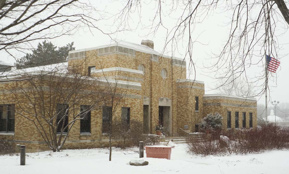
43°13′49″N 87°59′02″W / 43.230278°N 87.983889°WThiensville 18 Mequon Town Hall and Fire Station Complex 
July 18, 2000 11333 N. Cedarburg Rd.
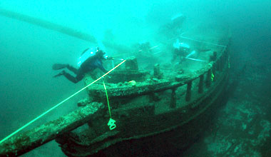
43°13′25″N 87°59′04″W / 43.223611°N 87.984444°WMequon 1937 Art Deco building complex 19 NIAGARA (steamer) 
December 16, 1996 one mile off shore
43°29′19″N 87°46′30″W / 43.488611°N 87.775°WBelgium The wreck of the Niagara. Sank in 1856, taking the lives of 60 of its 170 passengers 20 Edwin J. Nieman Sr. House April 12, 1996 13030 N. Cedarburg Rd.
43°15′19″N 87°59′25″W / 43.255278°N 87.990278°WMequon 21 NORTHERNER Shipwreck (Schooner) 
December 10, 2010 5 miles southeast of Port Washington Harbor in Lake Michigan Grafton 81-foot schooner, built in 1850, lost in 1868 off Port Ulao 22 O'Brien-Peuschel Farmstead 
October 24, 2000 12510 N. Wauwatosa Rd.
43°14′43″N 88°00′10″W / 43.245278°N 88.002778°WMequon 23 Old Ozaukee County Courthouse 
December 12, 1976 109 W. Main St.
43°23′18″N 87°52′16″W / 43.388333°N 87.871111°WPort Washington 24 Payne Hotel 
March 14, 1991 310 E. Green Bay Ave.
43°22′54″N 87°56′18″W / 43.381667°N 87.938333°WSaukville A stagecoach inn, on Green Bay Road and Highway 33 25 Port Washington Downtown Historic District 
September 8, 2000 Roughly along N. Franklin St., from E Jackson St. to E Grand Ave.
43°23′22″N 87°52′07″W / 43.389444°N 87.868611°WPort Washington 26 Port Washington Fire Engine House 
November 5, 2009 102 East Pier St.
43°23′24″N 87°52′15″W / 43.389892°N 87.870911°WPort Washington 27 Port Washington Light Station 
September 29, 1999 311 E. Johnson St.
43°23′28″N 87°52′03″W / 43.391111°N 87.8675°WPort Washington Lighthouse, established 1860 28 John Reichert Farmhouse 
July 1, 1982 14053 N. Wauwatosa Rd.
43°16′25″N 88°00′15″W / 43.273611°N 88.004167°WMequon 29 St. Mary's Roman Catholic Church 
December 12, 1977 430 N. Johnson St.
43°23′30″N 87°52′10″W / 43.391667°N 87.869444°WPort Washington Limestone Gothic Revival church 30 Stony Hill School 
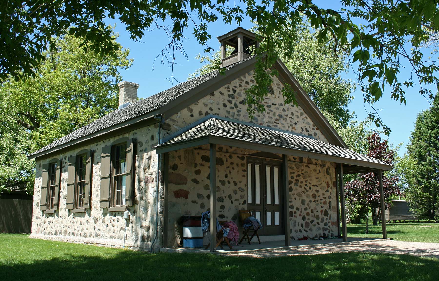
October 8, 1976 NE of Waubeka on SR 1
43°28′46″N 87°58′48″W / 43.479444°N 87.98°WWaubeka Location of the earliest formal observance of Flag Day, by schoolteacher Bernard Cigrand, in 1885. 31 TENNIE AND LAURA (Shipwreck) 
April 11, 2008 9 miles off shore from Port Washington Port Washington In 1903, the freighter Tennie & Laura sank in a storm while crossing Lake Michigan. 32 Jacob Voigt House 
September 22, 2000 11550 N. Wauwatosa Rd.
43°13′44″N 88°00′28″W / 43.228889°N 88.007778°WMequon 33 Washington Avenue Historic District 
January 17, 1986 Roughly bounded by Elm St., Cedar Creek, Hamilton Rd., and Washington Ave.
43°18′01″N 87°59′16″W / 43.300278°N 87.987778°WCedarburg Much of downtown Cedarburg, with buildings dating to the 1850's. 34 Wayside House 
March 17, 1982 W61 N439 Washington Ave.
43°17′31″N 87°59′11″W / 43.291944°N 87.986389°WCedarburg See also
References
- ^ "National Register of Historic Places: Weekly List Actions". National Park Service, United States Department of the Interior. Retrieved on November 10, 2011.
- ^ Numbers represent an ordering by significant words. Various colorings, defined here, differentiate National Historic Landmark sites and National Register of Historic Places Districts from other NRHP buildings, structures, sites or objects.
U.S. National Register of Historic Places Topics Lists by states Alabama • Alaska • Arizona • Arkansas • California • Colorado • Connecticut • Delaware • Florida • Georgia • Hawaii • Idaho • Illinois • Indiana • Iowa • Kansas • Kentucky • Louisiana • Maine • Maryland • Massachusetts • Michigan • Minnesota • Mississippi • Missouri • Montana • Nebraska • Nevada • New Hampshire • New Jersey • New Mexico • New York • North Carolina • North Dakota • Ohio • Oklahoma • Oregon • Pennsylvania • Rhode Island • South Carolina • South Dakota • Tennessee • Texas • Utah • Vermont • Virginia • Washington • West Virginia • Wisconsin • WyomingLists by territories Lists by associated states Other  Category:National Register of Historic Places •
  Portal:National Register of Historic Places
Municipalities and communities of Ozaukee County, Wisconsin County seat: Port Washington Cities 
Villages Towns CDP Waubeka
Unincorporated
communitiesFootnotes ‡This populated place also has portions in an adjacent county or counties
Categories:- Ozaukee County, Wisconsin
- Lists of historic places in Wisconsin
-


Wikimedia Foundation. 2010.